|

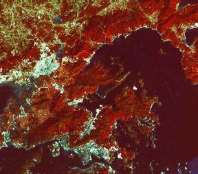
Image © 1990 CNES/SPOT
Image Corp. (Image provided by SPOT Image Corporation, Reston,
VA)
Larger Image (175k)
Labeled Image (175k)
|
Since WWII (during which the British colony was under
Japanese occupation for nearly 4 years), Hong Kong has built a thriving
free-market economy. Over 6 million people live in Hong Kong, in a land
area roughly 6 times the size of Washington, DC. In 1984, the British
and Chinese governments signed an agreement to revert control of Hong
Kong back to China on July 1, 1997. This image shows the New
Territories at lower left. Two large cities, Shenzhen (China) and Kowloon,
are easily discernable as grey/white areas at upper left and bottom
middle respectively. Victoria, on the north side of Hong Kong Island
is visible at bottom center.

|


