
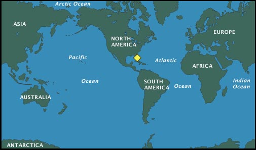
| Cape Canaveral is located on the eastern shore of Florida, U.S.A between Jacksonville and Miami. Known as "the Cape", it sits on an elbow of land extending into the Atlantic Ocean. Originally a missile launch and testing range operated by the Air Force in the 1950s, the site was strategically chosen due to its location away from populated areas and the ability to launch rockets and spacecraft over the water. NASA was formed in 1958. Launch operations for NASA were conducted at the Cape and by the early 1960s, as preparations were underway for the Apollo program, the facility that we know today as the John F. Kennedy Space Center (NASA/KSC) was established. |
|
|
|
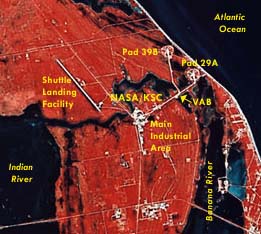
This image shows the northern portion of Merritt Island east of Titusville, Florida. North is at top. The island lies between the Atlantic Ocean (right) and the Indian River (left). NASA's John F. Kennedy Space Center (KSC) is visible at center. The main industrial area of KSC is centered in the image with two launch pad complexes (39B at top, 29A below) visible along the coast to the east. The Vehicle Assembly Building (VAB) and the Shuttle Landing Facility runway are clearly visible to the west. The east-west waterway running through the KSC complex is Banana Creek which connects to the Banana River (north-south). Much of the area in and around KSC is also protected as a National Wildlife Refuge. The marshes and estuaries are home to hundreds of species of wildlife including alligators, birds, and the endangered Florida manatee. |
