
|
Ecuador is located on the western coast of South America bordering the Pacific Ocean and the countries of Colombia and Peru. Located in the Andean mountains just south of Ecuador's capitol of Quito is Cotopaxi, the highest active volcano in the world with a summit elevation of 5,911 meters (19,388 feet). The last confirmed eruption ended in 1904 and recent smaller scale activity was recorded in the 1970s. |
|
| Ecuador lays claim to the Galápagos Islands located about 1000 kilometers (600 miles) to the west. The Galápagos Islands were first discovered in 1535 by Fray Tomás de Berlanga, the Bishop of Panama. Nominally owned by Spain until 1832, the islands were claimed by the Republic of Ecuador in 1832 and in 1892 given the name of "Archipelago de Colon". The Islands are perhaps best known as a research setting for famed naturalist Charles Darwin who visited the Galápagos aboard the H.M.S. Beagle in 1835. Darwin later used his study of the organisms inhabiting these islands in formulating his theories regarding evolution and natural selection. | |
|
|
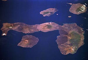
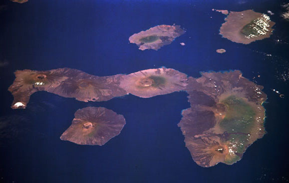
This image shows part of the Galápagos Island chain which consists of 19 islands totaling 7882 square kilometers in land area. In this image, four large major islands (Fernandina, Isabela, Santiago, Santa Cruz) and 4 small islands (Pinzon, Rabida, N.Seymour, Baltra) can be seen. The islands are of volcanic origin. Numerous shield volcanoes dot the islands and the 6 volcanoes on Isabela can be seen in this image. The major islands of Fernandina and Isabela experience frequent volcanic activity.
|

|
Geography From Space '98 ©1998 National Air and Space Museum |