 |
 |
|---|---|
| Mosaic | Map |
|
|
|---|---|
| Mosaic | Map |
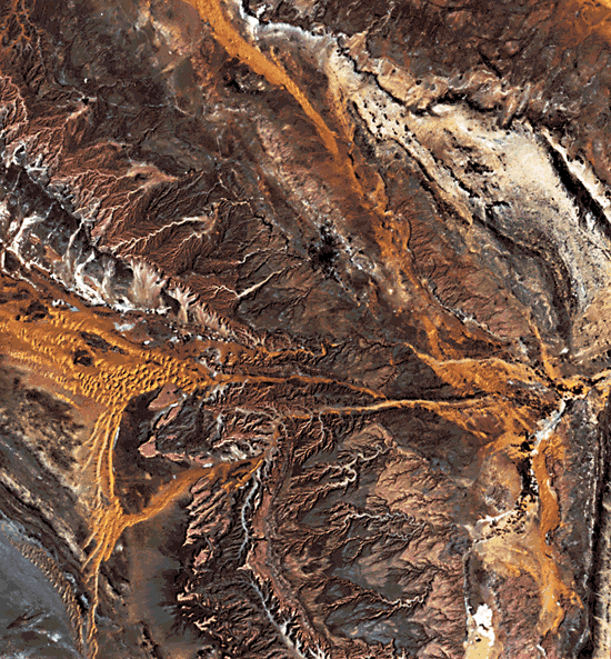
This striking example of image processing illustrates the lithologic control of a cuesta landscape in east-central Saudi Arabia. Riyadh is situated at an elevation of 600 m in a zone of uplands characterized by a northwest to southeast trending series of ridges developed on Jurassic and Cretaceous carbonate units. The western boundary of the uplands is marked by a prominent west-facing escarpment, the Jabal Tuwayq. Lowlands to the west of the escarpment are filled with eolian sand, including the Nafũd- Qunayfidhah dunefield. To the northeast of the Upland is the Ad Dahna sand sea, a small portion of which is visible at the top right corner of the image. Prevailing wind directions can be inferred from the dune development along a northwest-to southeast pattern of sand drift (McKee, 1979).
The cuesta landscape is developed on an eastward-dipping sequence of Mesozoic shelf-platform sediments that overlie the Precambrian crystalline rocks of the west-central Arabian Peninsula. Limestone units comprise resistant ridges with west-facing escarpments. Sandstone units comprise the intervening valleys. The lowest troughs are occupied by sandy desert.
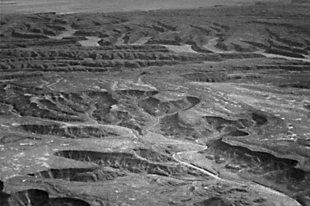
The resistant rock units are dissected in a striking erosion pattern that leaves relatively flat sloping surfaces on the gently dipping bedding planes (Figure I-2.1). Valleys have relatively flat floors, and steep slopes separate the upland surfaces from the valley floors. Such slopes, with a faceted appearance, characterize resistant rock types in arid and semiarid regions.
| Figure I-2.1 |
 |
|---|
The climate of north-central Saudi Arabia is extremely arid. Average annual rainfall at Riyadh is 75 mm. The aridity explains the resistance of various limestone units, which in a humid climate might be less resistant because of solution processes. Granular disintegration of sandstone maybe facilitated by salt-weathering processes in an arid climate, whereas a sandstone of similar composition may be more resistant in a humid climate. Whatever the details of differential resistance to erosion, the resulting landscapes produce an excellent response of geologic units on remote sensing imagery. The simple index map prepared from the image conveys nearly as much geologic information as a detailed geologic map based on considerable ground-based field mapping. Landsat 10171-06530, January 10, 1973.
Continue to Plate I-3| Chapter 1 Table of Contents.| Return to Home Page| Complete Table of Contents