 |
|---|
| Plate P-8 |
 |
|---|
| Plate P-8 |
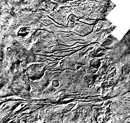
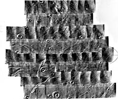
The Plate scene, showing an area of "outflow channels" (Carr, 1981; Baker, 1984) between Lunae Planum and Chryse Planitia, was chosen because it includes many features common to Martian channels in general. This Viking Orbiter mosaic covers an area about 300 km wide just west of the Viking 1 Lander site on Chryse Planitia (Figure P-8.1).
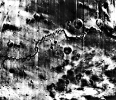
Martian channels have been grouped by Sharp and Malin (1975) into three main classes: runoff, outflow, and fretted. Runoff channels are both the most common and the most Earth-like fluvial erosion features on Mars, and are shown in Plate P-8 and Figure P-8.2, the latter covering the Nirgal Vallis. As described by Carr (1981), they "start small, increase in size downstream, and have tributaries." Those shown in Plate P-8 could be described as dendritic. Some runoff channels have only one valley, as in Figure P-8.2, except for a few small tributaries. Given enough time, these would presumably evolve into larger features like the main valley by headward erosion.
| Figure P-8.1 | Figure P-8.2 |
|---|---|
 |
 |
Despite their Earth-like appearance, the origin of runoff channels is debated. Various authors have proposed erosion by wind, lava, and even liquid hydrocarbons, but most evidence points firmly to water as the eroding agent. The exact mechanism is uncertain, the chief possibilities being direct erosion by rainfall or by ground-water seepage as discussed in Plate P-7 for the Valles Marineris tributaries. The two mechanisms are not necessarily mutually exclusive because infiltration of rain water could have occurred as it does on Earth (Carr, 1981).
An extremely important aspect of the runoff channels is their nearly complete restriction to the oldest part of the Martian landscape-the cratered terrain. Furthermore, as shown in this Plate, some craters are channeled and some channels are cratered, suggesting that formation of the early Martian atmosphere overlapped the later stages of crust formation and heavy cratering. A fascinating possibility is that the terrain shown in this Plate is what the primordial landscape of the Earth looked like more than 4 billion years ago.
.| Figure P-8.3 | Figure P-8.4 |
|---|---|
 |
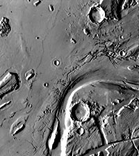 |
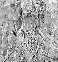
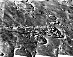
The outflow channels, shown in Figure P-8.3, were one of the most surprising discoveries made on Mars. Their resemblance to the Channeled Scablands of Washington (Plate F-27) suggests that catastrophic floods had once scoured the Martian surface. Since the surface pressure on Mars is now only a few millibars, even ponds could not last long before freezing or evaporating, much less floods. However, the existence of many other fluvial landforms now makes it clear that Mars once had a much denser atmosphere, since lost by one means or another, and flooding is now generally agreed upon. Some landforms, such as the segment of Kasei Vallis shown in Figure P-8.4 (a Viking Orbiter image), are so evocative that one can almost see the rushing water. However, the source of this water is, as for the runoff channels, unknown, although sudden massive release seems to be required. An outflow channel just north of Capri Chasma (Figure P-8.5) suggests a possible source. The channel originates in a canyon filled by chaotic terrain and grades into a scoured valley to the left, away from the cratered highlands. This relationship between chaotic terrains, canyons, and outflow channels is common and suggests that the release of subsurface water first formed chaotic terrain by slumping and then formed channels by erosion. Mechanisms proposed for this release include geothermal melting of ice and "breakout" of high-pressure water from confined aquifers (Carr, 1981), possibilities that are not necessarily exclusive.
| Figure P-8.5 |
|---|
 |
Unlike the runoff channels, which are essentially confined to old cratered terrain, the outflow channels cut the younger mare-like plains as well. Therefore, they occurred in a substantially later period of Martian geologic history. 76-H-697.
Continue to Plate P-9| Chapter 10 Table of Contents.| Return to Home Page| Complete Table of Contents|