 |
 |
|---|---|
| Plate T-47 | Map |
|
|
|---|---|
| Plate T-47 | Map |
India is a large continental mass that drifted northward after breaking off Antarctica (Gondwana) to ultimately collide with southern Asia in the Mid-Tertiary. This shield, known as the Peninsula, is an ancient plateau comprising Archean belts that contain intrusions mixed with high-grade metamorphic, Proterozoic platform belts, Late Paleozoic/Mesozoic sedimentary rocks (Gondwana System) in rifts, and Cretaceous/Tertiary Deccan basalt flows.
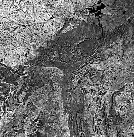
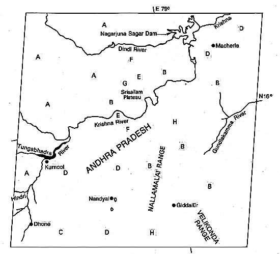
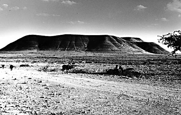
The Plate shows the central part of the state of Andhra Pradesh in the southern peninsular shield. The scene (left index map) includes most of the Cuddapah Basin, containing Upper Proterozoic sedimentary rocks deposited on a surface (Eparchean unconformity) carved from much older Archean rocks, the entire assemblage then being considerably deformed. Archean rocks surrounding the basin form low hills and plateaus (A) that are part of the eastern Ghats (Figure T-47.1). At the eastern edge are metavolcanics and schists of the Dharwar Super Group, found mainly in the Velikonda Range.
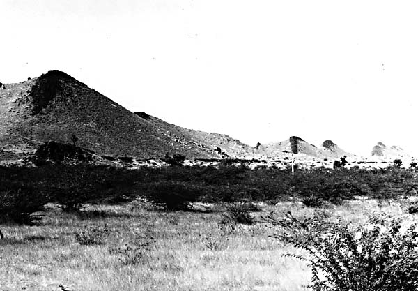
The Cuddapah System (exposed at B) is composed of 6000 m of shales, sandstones-grits, and limestones grouped in four Series. Proterozoic orogenic activity folded these rocks into a broad synclinorium with greater deformation and mild metamorphism along the eastern basin margin. Dolerite sills (Figure T-47.2) are evident at C. The Kurnool System of less deformed sedimentary rocks lies unconformably on the Cuddapah sequence at D.
Bedi (1982) recognizes four major geomorphic subprovinces in this semiarid (620 to 890 mm of rainfall) region. The exposed Archean rocks underlie a vast, intricately dissected pediplain, in which fractures control the numerous short ephemeral to semiperennial streams with narrow floodplains. The path of the Dindi River is fault-influenced. Pediment surfaces occur on the low interfluves. Red soils derived from the gneisses are developed north of the Krishna River; black soils exist around the Tungabhadra River drainage basin. Small fans and baradas (bajadas) are scattered throughout.
| Figure T-47.1 | Figure T-47.2 |
|---|---|
 |
 |
The Srisailam Plateau is topped by quartzites and sandstones. Lineaments (as at E and along the Dindi River) break the plateaus into several structural blocks. Steep scarps (F) bound much of the plateau, and cuestas occur in places (G). The Krishna River has cut through resistant cover units to produce a highwalled gorge. The plateau supports both mixed forest and scrub cover.
Cuestas mixed with broad floodplain piedmont surfaces form the black soil-covered areas between Kurnool and Nandyal (Figure T-47.3). These gently sloped landforms are associated with the Cuddapah rocks, whereas the flatter piedmont terrain is developed from the Kurnool rocks. The Nallamalai Range is characterized by a valley and ridge topography in which the hogbacks are held up by harder quartzites and the valleys are eroded on weaker phyllites and schists.
The state of Orissa, in east-central India along the Bay of Bengal, is another part of the Peninsular Shield., The section of Orissa seen from Landsat in Figure T-47.4 (index map to its right) consists of two physiographic areas-the Utkal Plain and the Garhjat Hills. The latter, mostly 1000 to 1200 m above sealevel, contains the Simlipal Massif, the Baitarani Uplands, and the Keonjhar Plateau.
The Eastern Ghats Group (Archean granulite rocks) serves as the basement for the Iron Ore Group of sediments (western third of image) deposited in a basin bordering the Ghats stable mass. That Group was folded and metamorphosed during the Iron Ore orogeny, about 2700 Ma ago, after which the Singhbhum granite was emplaced. The Keonjhar Plateau includes remnants of older erosion surfaces on the Iron Ore Group (schists/ quartzites to the north; volcanics in the south). A spectacular pattern of orthogonal fractures crisscross the Baitarani Uplands. Dolerite (diorite) dikes appear to fill some of the fractures. Erosion and vegetation cause others to stand out boldly.
| Figure T-47.3 | Figure T-47.4 |
|---|---|
 |
 |
The forest-covered Simlipal Massif is a Mid-Proterozoic rift basin containing banded iron formation. The mass if formed as a broad basinal structure later folded into open concentric folds.
The Baitarani Uplands (lighter toned) are composed mainly of Singhbhum granites. The Uplands comprise an old surface of flat-topped hills. Numerous dolerite dikes (up to 700 m wide) pervade the Uplands, standing out as low ridges (visible as dark lines).
Late Paleozoic block-faulting influences the courses of the present Brahmani and Mahanadi River valleys. Cross-folding accompanying the faulting imposed a northwest topographic grain (the Mahanadi trend) that interrupts the regional northeast Eastern Ghats trend.
Marine transgressions in the Early Tertiary led to formation of the Utkal coastal plain. Alluvial and deltaic deposits from the braided Brahmani and Baitarani Rivers added to the thickness of this marine wedge, which increases toward the Bay of Bengal (just off the image). (NMS) Additional References: Chowdhury, (1974) Drury and Holt (1980), Drury et al. (1984). Landsat 2719-04125-6, January 10, 1977.
Continue to Plate T-48| Chapter 2 table of Contents| Return to Home Page| Complete Table of Contents