 |
 |
|---|---|
| Plate T-49 | Map |
|
|
|---|---|
| Plate T-49 | Map |
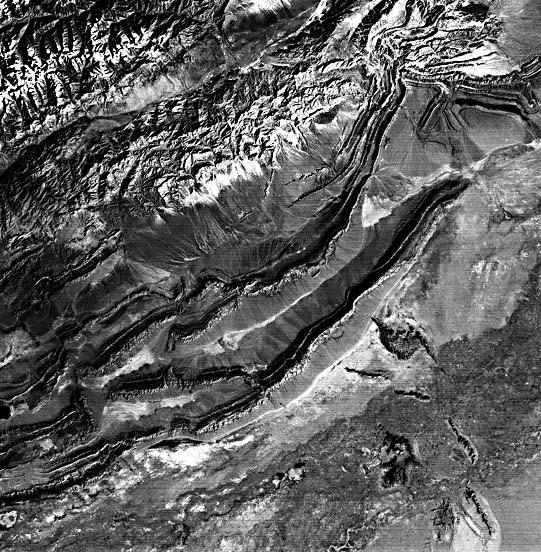
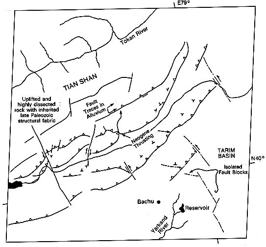
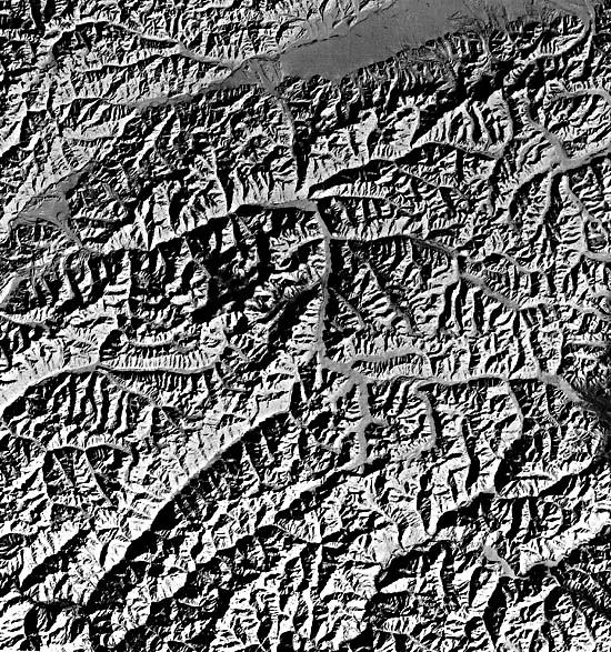
The Tian Shan is the major mountain belt of central Asia, extending approximately 2500 km from the Kyzyl Kum Desert of western China to the Gobi Desert in Mongolia. It separates the Tarim basin to the south from the Kazakhstan shield and the Dzungarian basin to the north. Arc collisions during the Silurian, Devonian, and Mississippian and, finally, suturing along the Tian Shan in the Late Paleozoic produced most of the structural and metamorphic fabric of the mountain interiors in the northwest part of the Plate scene (Bally et al., 1980; Dewey and Burke, 1973; Gansser, 1974; and Zhang and Liou, 1984). Following a period of quiescence in the Mesozoic and Early Tertiary, tectonic activity resumed in the Eocene in response to the collision of India with Eurasia (Molnar and Tapponnier, 1975; and Tapponnier and Molnar, 1977).
The Kashgar Ku-Che fold belt is an area of conspicuous thrust faulting associated with box folds involving many Silurian and Devonian formations. Linear ridges oriented northeast-southwest, with multiple southeast-facing scarps, denote a series of northwest-dipping strata. These ridges are broken and offset by faulting. The repetition of the sequence of northwest-dipping sedimentary units, coupled with the absence of apparent dip reversal or overturned beds, indicates that the stratigraphic section is being repeated across thrust faults. Fault traces parallel to the interpreted thrust direction can be observed in the alluvium separating the older core of Tian Shan from the thrust belt. This, in conjunction with the juvenile erosional patterns associated with the thrusts and fault blocks south of the new thrust fault, demonstrate recent and continuing deformation.
| Figure T-49.1 | Figure T-49.2 |
|---|---|
 |
 |
Two prominent strike-slip faults abruptly offset the thrust belt in the western part of the scene. The westernmost of these north-trending faults transects the entire thrust belt (~75 km) and has an apparent 10-km left-lateral offset. The presence of similarly oriented left-lateral strike-slip faulting can be inferred from outcrop patterns and bedding orientation in the northeastern part of the scene and along the margins of the isolated fault blocks in front of the main thrust fronts. The outcropping of older rocks and the apparent continuation of thrust-belt tectonic direction in front of the main thrust front indicate that active compression deformation is occurring to the south within the Yarkand Darya floodplain.
| Figure T-49.3 | Figure T-49.4 |
|---|---|
 |
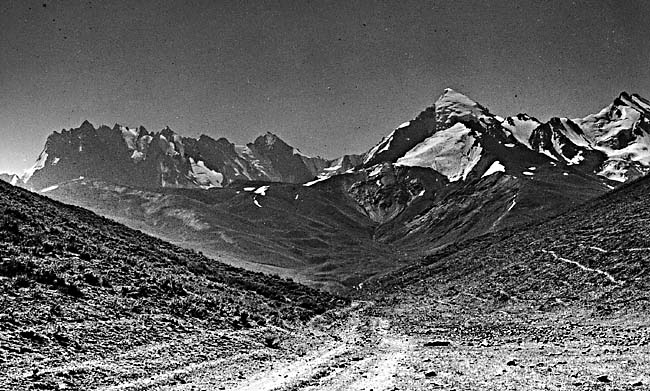 |
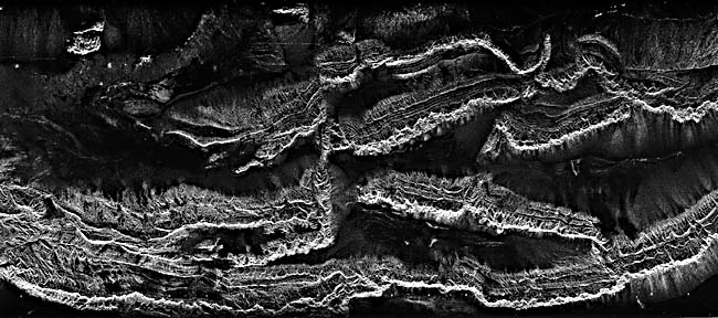
Figure T-49.1 is a SIR-A image of complex folds and thrusts in the southwestern portion of the Landsat MSS image. The folds, which lie on the north edge of the Tarim basin, are overturned to the south and thrust on the south side. The intensity of deformation decreases from north to south across the zone. Radar does a much better job here of highlighting fine details of the fracture pattern edges of the eroded beds that make up the cuestas than the MSS. The radar is actually "seeing through" some of the sand and alluvium that cover the low areas in this arid region. These details of the stratigraphy and fracturing are visible farther down the dip slopes on the radar than on the MSS image. The higher-resolution of the radar brings out many details that are not visible in the MSS image.
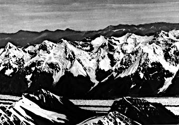
This scene falls within the southwestern Tian Shan where it straddles the border between westernmost Sinkiang Province of China, north of the Taklimakan Desert (Plate E-27), and the Kirghiz S.S.R. Several mountain peaks in the scene reach above 6000 m and approach 8000 m both to the west and to the east. The mountains (Figure T-49.2) have been extensively glaciated (see Plate G-26) and in places rival the Himalayan chain to the south in ruggedness and grandeur. Farther west, the Tian Shan chain extends into the Pamirs in the Tadzhik S. S. R., north of the Hindu Kush. Russia's highest mountain, Pikkommunizma (7495 m), is located within the Landsat image seen as Figure T-49.3. The Peter the Great Ridge (Figure T-49.4) is typical of the spectacular scenery of this region. (GCW: R. C. Michael) Landsat 1206-05000, February 14, 1973.
Continue to Plate T-50| Chapter 2 table of Contents| Return to Home Page| Complete Table of Contents