 |
|---|
| Plate T-51 |
|
|---|
| Plate T-51 |
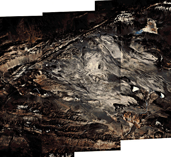
The Qaidam basin is a large intermontane basin in west-central China, covering approximately 100000 km2 between 36° N and 39° N latitude and 91° E and 98° E longitude. The Qaidam basin and adjacent physiographic features owe their present configuration to Neogene Himalayan tectonism. The interior of the basin comprises a vast middle-latitude desert that receives only 35 mm of precipitation per year and is subjected to very high winds and long severe winters. As a result, vegetation is extremely sparse and much of the surface is covered by thin eolian deposits and encrusted saline soils. Average surface elevation within the basin is 3000 m. The clear air, lack of vegetation, and abundance of exposed bed rock make the Qaidam an almost ideal subject for study from space.
Viewed synoptically in the six-image mosaic of the Plate, the Qaidam region exhibits coherent structural patterns that result from northeast-oriented principal stress associated with Himalayan tectonism (Bailey and Anderson, 1982). This stress is largely accommodated by movement along major east-to east-northeast-trending left-lateral strike-slip faults, such as the Altyn Tagh and Kunlun fault zones that extend for thousands of kilometers across China. In western China, where movement along these faults is transpressional, marginal uplifts are intensely and complexly deformed. Large intermontane basins, such as the Qaidam basin, form as compressional features between major uplifts that were produced by movement on strike-slip faults (Tapponnier and Molnar, 1977). In the Qaidam basin, the compressional origin of the basin is attested to by the large complex folds that dominate the basin interior.
| Figure T-51.1 | Figure T-51.2 |
|---|---|
 |
 |
The western Qaidam basin lies between the Altyn Mountain to the north and the Kunlun Mountains to the south. These ranges comprise Paleozoic and older rocks deformed during Late Paleozoic and Mesozoic times. However, the elongate en echelon, and many places discontinuous, aspect of these ranges strongly suggests that movement of adjacent through-going strike-slip faults of large displacement controls their present configuration. The Altyn Tagh left-lateral fault zone is particularly conspicuous on the mosaic. Evidence on the Landsat imagery for recent predominantly strike-slip movement along this fault includes: (1) the straight, narrow trace of the fault, (2) the sharp trace of the fault within recent alluvium, (3) left-lateral offset of streams crossing the fault and the orientation and, in any instances, truncation of minor related structures along the fault.
The older, repeatedly deformed rocks of the Altyn and Kunlun Mountains also exhibits a superimposed structural fabric that appears to be related to left-lateral strike-slip faulting. Much of the structural fabric in the northwest Kunlun Mountains parallels the left-lateral east-trending Kunlun fault zone. The structure of the Altyn Mountains, although complex and partially inherited from older orogenies, includes locally prominent features that appear to be related to left-lateral movement along the Altyn fault zone (Tapponnier and Molnar, 1977).
The Qaidam basin proper is filled mainly with Tertiary, and locally Cretaceous, continental sediments. The interior of the basin is pervasively folded, with folding affecting sediments as young as Quaternary age. This suggests that deformation of the basin interior and strike-slip faulting of the surrounding uplands are contemporaneous. Most large folds, trending northwest to west-northwest, that structurally comprise the interior of the basin are asymmetrical. The absence of discernible intervening synclines between anticlines, the local and in many places highly oblique truncation of beds, and the general disharmonic appearance of these folds indicate that many are thrust-displaced. A major thrust-bounded intrabasinal uplift, the Youshashan, is present in the western part of the basin, interior to the apex where the two mountain systems converge (Bailey and Anderson, 1982). The Youshashan uplift exhibits a juvenile erosional texture and is oriented parallel to the major folds and thrust faults.
Much of the basin's surface appears to be wind-scoured. Large surficial evaporitic deposits are also widespread. Most of the area, because of sparsity of precipitation, supports little or no vegetation, except in areas of seasonal lakes.
| Figure T-51.3 | Figure T-51.4 |
|---|---|
 |
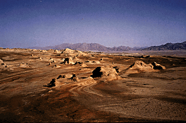 |
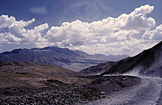
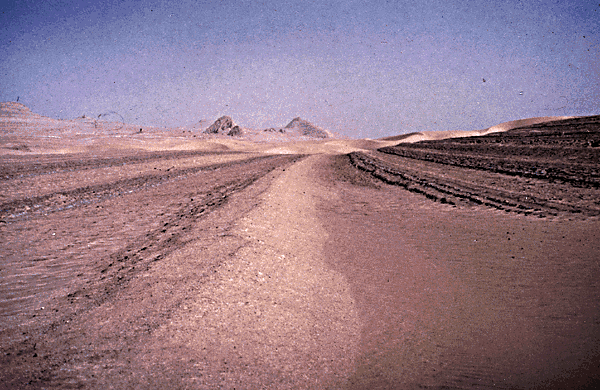
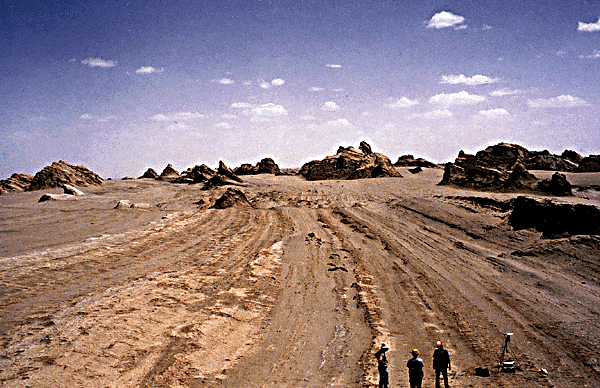
Figure T-51.1 is an east-northeast view along a fault valley of the major left-lateral strike-slip Altyn fault zone. Rock berms in the foreground are used for road construction by the workers in the distance. Figure T-51.2 shows the subdued topography typical of the Qaidam Basin. More resistant remnants of generally nonresistant clastic sedimentary rocks dip to the right in this photograph. Figure T-51.3, from the western part of the Qaidam Basin, shows typical exposures of folded nonmarine clastic sedimentary rocks and illustrates the low topographic relief commonly exhibited by folded rocks in the basin interior.
| Figure T-51.5 |
|---|
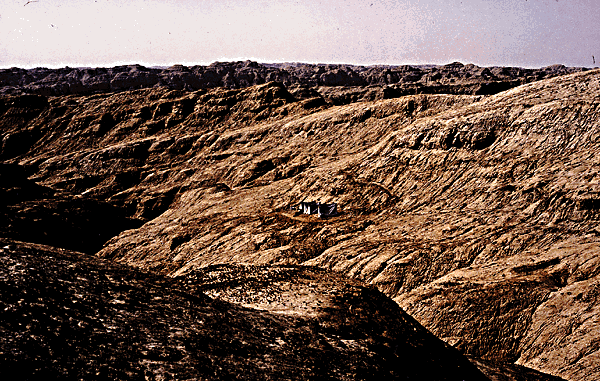 |
In the rugged, desolate terrain of the fault bounded Youshashan uplift (Figure T-51.4), the soft silty rocks weather rapidly in the harsh climate, leaving extensive surficial clay residues. The region is devoid of vegetation. In Figure T-51.5, the camp of a Chinese geological field party is seen in the middle ground. (GCW: R. C. Michael) Additional References: Bally et al. (1980), Zhang and Liou (1984). Landsat Mosaic.
Continue to Plate T-52| Chapter 2 table of Contents| Return to Home Page| Complete Table of Contents