 |
 |
|---|---|
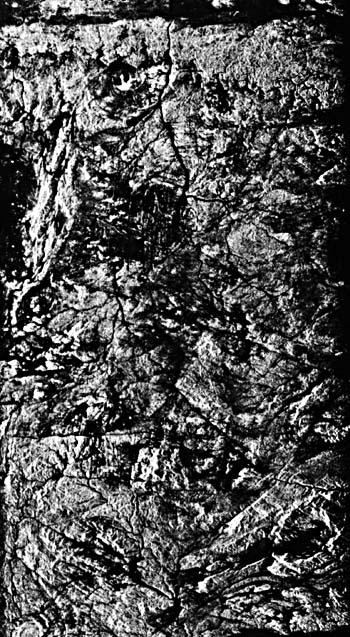
| Plate T-60.a | Plate T-60.b |
|
|
|---|---|
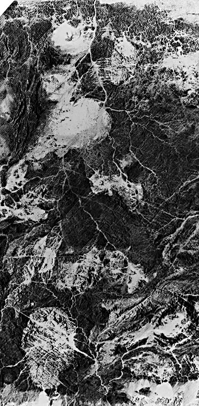
| Plate T-60.a | Plate T-60.b |
 |
 |
|---|---|
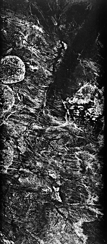
| Plate T-60.c | Plate T-60.d |
One of the most eye-catching structural features of shield areas in widely separated parts of the world are circular or near circular plutons that seem to float in the contorted and fractured shield rocks like plums in a pudding (see the Southern Arabian Shield mosaic, Plate T-40). The ages of these plutons span a wide range of time. They are patently younger than the shields which they intrude, and they appear to be less structurally complex than the country rock, which likewise suggests that the age difference between country rock and pluton maybe substantial. The strikingly smooth circular to elliptical outlines of many of these features suggest that emplacement took place in a horizontally isotropic stress field after the last major deformational event that contorted the shield rocks.
During the emplacement, the magmas that form the intrusions rose buoyantly in the crust to a near-neutral buoyancy equilibrium level. However, the depth of emplacement, as well as depth of subsequent erosion, also seem to vary widely from region-to-region. For instance, the Air Mountain (Niger) plutons (see below) clearly display evidence of having domed the surrounding rocks and appear to be in an early stage of unroofing. In contrast, plutons in Egypt and Sudan (see below) show little or no evidence of having domed the surrounding rock, suggesting a deep level of erosion and, perhaps, emplacement.
| Figure T-60.1 | Figure T-60.2 |
|---|---|
 |
 |
The Plate montage on the facing page depicts plutons from opposite sides of the African continent (Egypt above and Mali below) as recorded by two sensors (Shuttle Imaging Radar (left) and Landsat Multispectral Scanner (right) for each pair). Each instrument gathers unique information. In general, the synthetic aperture radar records far more textural information so that fractures and foliation stand out strongly. Conversely, the MSS emphasizes tonal variations so that the strongest contrasts are between sand and bedrock. The radar conveys considerable structural information, and in some areas, actually reveals bedrock features beneath a thin dry sand cover that obscures the underlying rock from the MSS (see Plate I-3). But, distribution of the sand in MSS imagery sometimes assists in recognizing the outline of the plutons, which tends to become lost in the structural detail revealed by radar.
Figure T-60.1 shows the Air Mountains of Niger (18.5°N, 9°E). These Precambrian to Devonian plutons intrude and dome lighter toned Precambrian (2750 to 1750 Ma) rocks. Several of the plutons clearly display radial and concentric fracture sets.
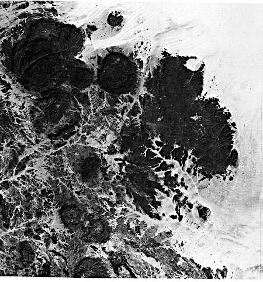
| Figure T-60.3 |
|---|
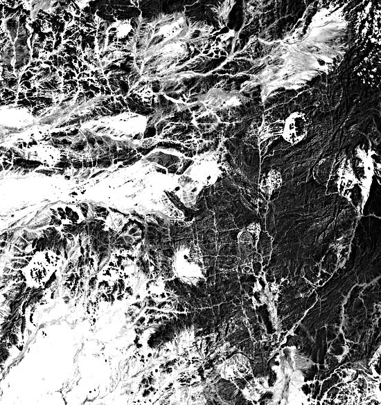 |
Figure T-60.2 records a carbonatite intrusion in the complexly deformed rocks of the Brazilian shield (21.5°S, 46.5°W) near Pocos de Caldas. Most of the area is forested. However, the richer soils developed on the carbonatites are intensively farmed.
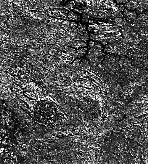
Figure T-60.3 near Tokar, Sudan (17.9°N, 36.3°E), covers a complexly deformed, highly eroded shield area sprinkled with more than a dozen plutons. Different compositions probably account for the different tones of the various plutons. In fact, the plutons range in composition from sodic syenite to riebeckite granite, with a few being as basic as gabbros. These so-called younger plutons have ages that group at 700, 500, and 100 Ma (Neary et al., 1976). (JRE) (See Appendix B for image ID's,) SIR-A and MSS Mosaics.
Continue to Plate T-61| Chapter 2 table of Contents| Return to Home Page| Complete Table of Contents