 |
 |
|---|---|
| Plate V-1 | Map |
|
|
|---|---|
| Plate V-1 | Map |
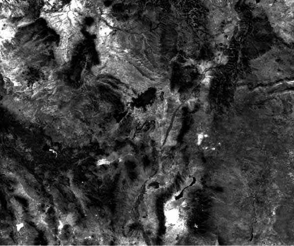
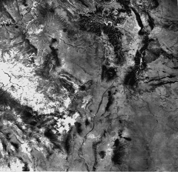
This large-area (490 000 km2) HCMM scene provides a synoptic overview of volcanic activity in the last 60 Ma dispersed over the southern Rocky Mountains, Colorado Plateau, Great Plains, and Basin and Range Provinces from Utah/Colorado southward into New Mexico and Arizona. Figure V-1.1 shows the same scene as imaged by the Day IR (thermal) sensor on HCMM. The Jemez Mountains (Valles Caldera) and Mt. Taylor field and the Hopi Buttes and San Francisco volcanic field are described in some detail in the next two plates. Other important fields are considered here.
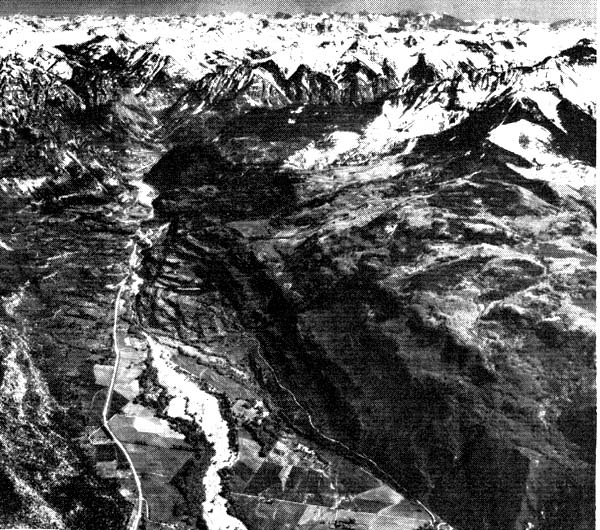
The most continuous volcanic deposits in the scene are the San Juan Mountains of southwest Colorado (Lipman et al., 1972). There, a great pile (up to 2300 m thick) of lavas and ashflows emitted from various centers from Eocene into Quaternary has been carved by stream and glacial erosion into rugged mountains (elevations to 4361 m) that rival any in the Rocky Mountains in relief (Figure V-1.2). Especially evident in both visible and thermal images are three resurgent calderas- Silverton, Lake City, and Creede-resulting from expulsion of huge volumes of welded ashflows. All three are nested within the San Juan, Uncompaghré, and LaGaita calderas, whose larger collapse structures and outlines are difficult to perceive in the imagery. All told, 17 calderas have been identified in the San Juan field (P. Lipman, private communication).
| Figure V-1.1 | Figure V-1.2 |
|---|---|
 |
 |
Even more widespread but scattered volcanism occurs within the Mogollon-Datil field that extends through various mountain ranges in southwestern New Mexico into eastern Arizona. This Mid- Tertiary activity involves calc-alkalic intrusives and outpourings of andesites and rhyolites emplaced during three cyclic spasms, the last of which shows bimodal basaltic and rhyolitic affinities. The location of the volcanic deposits is difficult to discern in the Day VIS HCMM image; the darker patterns, which embrace some nonigneous rocks as well, are governed in part by distribution of vegetation. The thermal image better distinguishes the mountain uplifts, including the Gila and Blue Mountains, owing to cooler temperatures at their higher elevations.
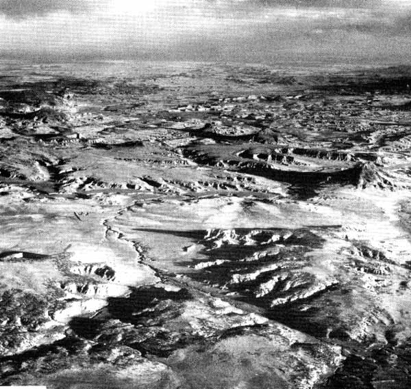
North of these mountains is the Datil Mountains physiographic section of the southeastern Colorado Plateau. Numerous lava- capped plateaus and mesas are common south of the Zuni uplift, where lava fields abound. The Day VIS image depicts one young-looking series of dark flows (Suwanee and McCartys flows) that, however, occupy much less of the mapped Quaternary extent of the field; even these are scarcely recognizable in the thermal image. The Mt. Taylor field (Figure V-1.3) is conspicuous in the Day VIS scene, and Mt. Taylor itself stands apart in the Day IR thermal image.
Exposed Tertiary intrusive make up the Navajo Mountains near the Four Corners area. The nearby famed Shiprock diatreme neck, with its radiating dikes, can be clearly seen in the Day VIS image because of the light-toned background, but shows only as a dark spot in the Day IR.
| Figure V-1.3 | Figure V-1.4 |
|---|---|
 |
 |
Volcanism is associated with the Rio Grande Rift, in some respects analogous to the East African Rift System. At the scene bottom (best noted in the thermal image) are the Quaternary cones and pipes of the Potrillo Mountains. Near the Rio Grande is the Socorro field, an older Quaternary basalt flow that stands out in lighter (warmer) tones. In the Tularosa Basin east of the rift zone, the Carrizozo basalt flow, a narrow Quaternary flow more than 60 km in length, is sharply contrasted in the Day VIS scene, but shows in only slightly darker tones in the Day IR. The Tertiary intrusive in the Carrizozo complex to the east appear as isolated darker blotches in both images. The Taos Plateau volcanics-a Tertiary field with calc-alkaline affinities-occupies the Rio Grande trench in northern New Mexico/southern Colorado, where a number of large hills carved from andesites and tholeiitic cones and plugs are major features of the landscape. To the east are the older (Eocene) Spanish Peaks (granitic stocks intruded into Tertiary and subjacent Mesozoic units), around which are many radiating dikes that are sharply visible in the enlargement of a Landsat TM band 5 scene (Figure V-1.4). To its southeast are the dissected basalt-capped mesas and plugs of Miocene/ Pliocene age in the Raton section of the Great Plains.
This entire region thus offers well-preserved to remnant indicators of intermittent volcanism from Late Cretaceous onward. Volcanic rocks older than about 26 to 28 Ma are usually differentiated from calc-alkaline parent magmas. Christensen and Lipman (1972) and Lipman et al. (1972) have defined a significant shift thereafter to basaltic parents that dominate extrusives to the present. Their model for Cenozoic volcanism as related to plate tectonics is introduced in the next Plate caption. HCMM 171-20240-1 Day VIS, October 14, 1978.
Continue to Plate V-2| Chapter 3 Table of Contents.| Return to Home Page| Complete Table of Contents