 |
 |
|---|---|
| Plate V-15 | Map |
|
|
|---|---|
| Plate V-15 | Map |
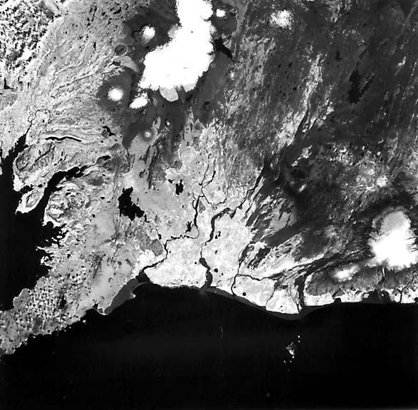
Iceland is one of two places on the Earth's face (the other is the Afar, Plate V-21) where geologists can take a close subaerial look at the morphology of a large part of an active oceanic spreading ridge. This volcanic island lies astride the Mid-Atlantic Ridge at the intersection between its Reykjanes and Kolbeinsey segments and the Iceland Transverse Ridge. This latter structure, seismically inactive, extends east-southeast from the Greenland shelf through the Iceland Block, thence southeast, along the Iceland/Faeroe Ridge. Iceland itself is the highest topographic section of the Mid Atlantic Ridge. Here the oceanic crust is anomalously thick (8 to 18 km), giving rise to a strong gravity high. Icelandic-type crust, made up of oceanic tholeiitic basalts typical of the MORB (Mid- Ocean Ridge Basalts) suites, displays thicker counterparts of normal oceanic layers 2 and 3 observed at submarine ridges, whereas layer 1 is replaced by igneous units. Seismically, anomalously low sub-Moho velocities exist beneath Iceland. High heat-flow values on Iceland suggest that the island sits atop a mantle plume or an expression of upwelling convection currents along the crossing ridges.
| Figure V-15.1 | Figure V-15.2 |
|---|---|
 |
 |
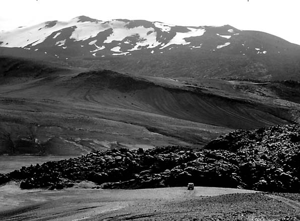
The island developed well after the opening of the North Atlantic; the oldest rocks emplaced in Iceland data 16 Ma. In the Late Tertiary, rifting increased, accompanied by intermittent volcanism that persisted through maximum glacial activity during the Pleistocene into the present stage of reduced icecap cover. In the last 11000 years, the 400 km3 of volcanic effluents, including 55 km3 of tephra, now cover 11000 km2 of the island (Thorarinsson, 1959). Since the 1500s, Iceland's volcanoes, 3 percent of the active ones on Earth, have produced 24 percent by volume of the extruded lavas worldwide (Macdonald, 1972). The sequence of units in Iceland (Preusser, 1976) begins with the Tertiary Basalt Fm, covered by the Gray Stage Basalts, then the Old Gray Basalts (Pliocene/Pleistocene), the Young Gray Basalts (Pleistocene interglacial), and the most recent Móberg or Palagonite Fm, consisting of tuff breccias, pillow lavas, and basalt glass altered from sideromelane glass. Sediments interspersed with these units are mostly tillites and glaciofluvial deposits.
As expected for a spreading ridge, halves of Iceland are diverging at a rate of 0.6 to 2.0 cm/year from the Central Axial Graben. In this scene, two arms of the graben (Western and Eastern Volcanic Zones) extend northeast-southwest before joining in a single north-south branch just above the image. Here the plateau basalts are broken into a series of tilted blocks (horsts/grabens) of shallow depth and moderate vertical displacements. Mainly within the rift zones are numerous en echelon fissures (gjár) (A) from a few meters to 1 km in width; sheet basalts with innumerable vertical dikes are common within and beyond the faults.
| Figure V-15.3 | Figure V-15.4 |
|---|---|
 |
 |
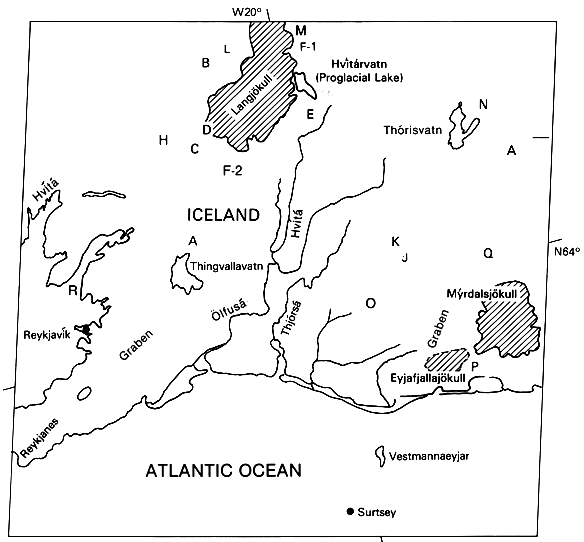
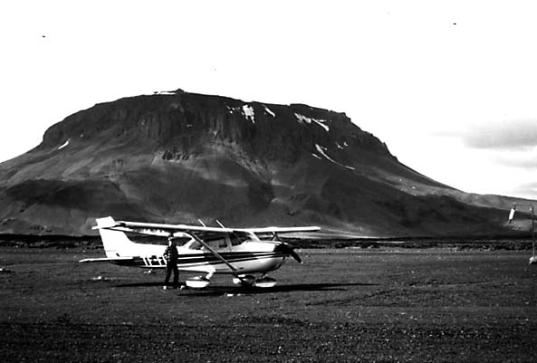
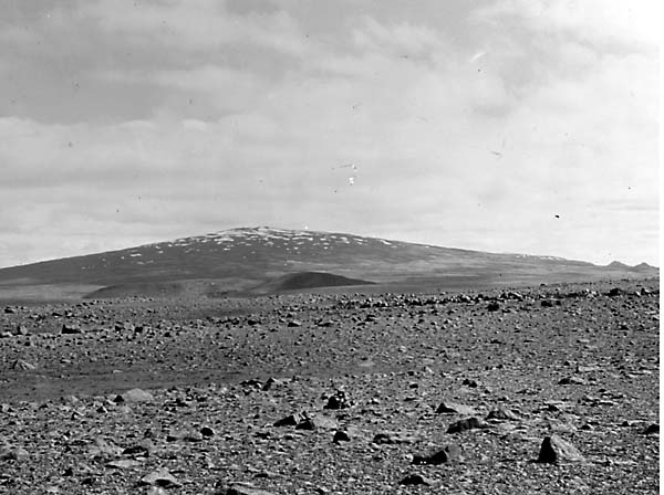
Iceland hosts a variety of unique landforms developed by extrusion under the ice caps (Preusser, 1976; Williams et al., 1983). A dominant form is the serrated ridge produced by subglacial eruptions where lava enters long fissures under the ice, Another is the stapi or table mountain, of which those at Eiríksjökull (Figure V-15.1 (B)), Thórisjökull (C), Geitlandsjökull (D), Bláfell (E), and Hrútafell (F) are outstanding examples that cluster about the icecap, Langjökull. A stapi results from "intrusion" of lava into glacial ice cover which, on melting, helps to mold the volcanic materials against the ice-wall void. Stapis have steep slopes and flat tops built from palagonite breccias capped by subaerial basalt. Another landform, the shield volcano, is represented by Skjaldbreidur (G) (Figure V-15.2) and by the even larger Ok (H). These structures form primarily during interglacial times, with several having smooth undissected profiles originating in the last interglacial period. Typical of Iceland are crater row volcanoes (Figure V-15.3) that align along linear fractures, as at the Lakagigar row of some 100 cones along a 25 km zone (I). Larger linear composite volcanoes, such as Hekla (J) with its elongate (8 km) crestal fissure (Figure V-15.4), are another distinctive form. Hekla erupts frequently, including several times in the 20th century, sending tephra long distances from Iceland. Hekla is the site of many small lava flows, or hraun (K); others in the scene include the Hallmundarhraun (L), the Lambahraun (M), and the Veidivatnahraun (N) in the northwestern lava fields west of the Laki fissure that expelled 12 km3 of lava and ash in 1783, with accompanying poisonous gases, killing much livestock and causing a devastating famine. An older flow, the Thjórsá field, extends up to 70 km wide for 130 km before reaching the sea in the south west lowlands (O).
Other geomorphic features of interest are: (1) the southern highlands (palagonites and Young Gray Basalts) (P), rising to 1000 m against the Myrdalsjökull/ Eyjafjallajökull icecaps; (2) the Torfajökull Highlands (Q), with cone-shaped mountains, obsidian lava fields, and 30 solfataras; and (3) Hvalfjördur (R), a 35-km long fjord. Landsat 1392-12191-7, August 19, 1973.
Continue to Plate V-16| Chapter 3 Table of Contents.| Return to Home Page| Complete Table of Contents