 |
 |
|---|---|
| Plate V-24 | Map |
|
|
|---|---|
| Plate V-24 | Map |
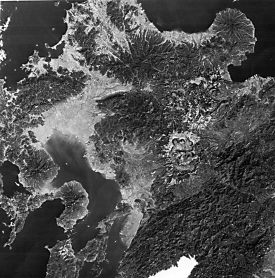
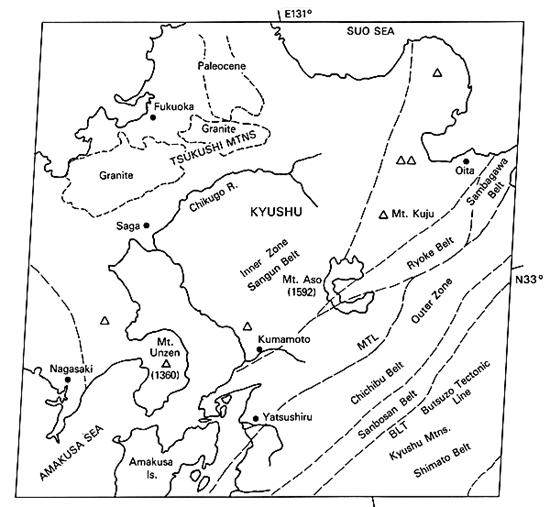
The reader is referred to Plate T-54 for a background synopsis of the geology of the Japanese Islands (see also Tanaka and Nozawa, 1977; Yoshida, 1975). The southwestern island of Kyushu contains many of the same petrologic, structural, and age units described earlier for the Inland Seto Sea scene. Kyushu is part of the Ryukyu Arc system, which meets the Southwest Japan Arc north of Oita. The southwestern extension of the Median Tectonic Line (MTL) once again divides this island into the older Inner Zone (metamorphic terrane) and the younger Outer Zone (sedimentary terrane). Various belts within these two zones cross the island. Their approximate positions as deduced from published maps are shown in the index map but, except for the MTL, neither the actual boundaries nor the different terranes are well expressed in the image.
The contact between the Sangun and the Ryoke metamorphic belts appears to run through the giant Aso caldera (see below). Cretaceous granites intrude into the Sangun belt. The western termination of the Sambagawa belt lies just below Oita. In the Outer Zone, the Chichibu belt is characterized by linear ridge crests. Patches and inliers of Silurian/Devonian, Carboniferous, Permian, and Triassic units occur mainly in this belt. The narrow Sambosan belt and its southern boundary fault, the Butsuzo Tectonic Line (BTL), seem to have a faint expression. To the southeast are Cretaceous sedimentary units of the Shimanto Belt. Paleocene rocks make up the surface at the lower right corner; an inlier of this age occurs to the north, and Paleocene units cover most of Amakusa Island. High-pressure crystalline schists comprise the north-south- trending Nishisonogi belt around Nagasaki, which may be a continuation of the Sambagawa belt.
| Figure V-24.1 | Figure V-24.2 |
|---|---|
 |
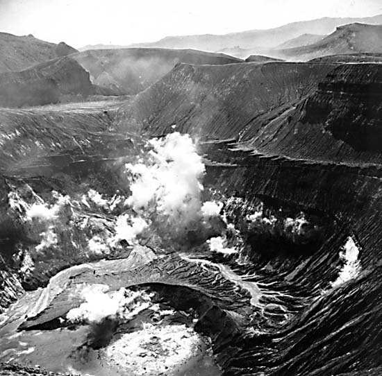 |
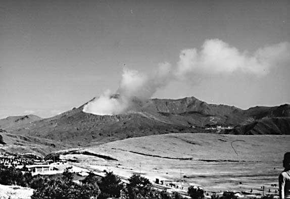
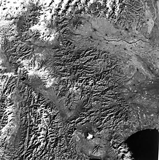
The volcanoes of Kyushu (Matumoto, 1963) lie along the West Japan Volcano Belt that extends southwestward through the Nansei (Ryukyu) Islands. The Aso Volcano is a Valles-type caldera (20 km maximum dimension) formed by multiple collapses as pyroxene andesites ashflows were ejected during Late Tertiary through Pleistocene times. Ignimbritic ashflows, pumice, and other pyroclastics (some water-saturated, producing so-called "mud lavas") filled river valleys and extend almost across the island (light tones near caldera walls are ashbeds) (Yoshikawa et al., 1981). Views of Mount Aso, a post-collapse crater within the caldera, are presented in Figure V-24.1 and Figure V-24.2. Mt. Unzen, Mt. Kuju, and others in the Landsat scene, marked by V's, are dissected Quaternary stratocones that erupted lavas and ash of hornblende andesite composition.
| Figure V-24.3 | Figure V-24.4 |
|---|---|
 |
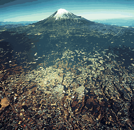 |
Figure V-24.3 is a Landsat scene taken on December 15, 1972. The three prominent rivers (from left to right) are: Tenyru, Fuji, and Tone Rivers. This is a critical section in the Japanese Arc geologic framework because it marks where the Island of Honshu is separated into two geologic regions (Southwest and Northeast Japan Arcs). In this area is a rupture zone known as the Fossa Magna, whose western border is denoted by the Itoigawa/Shizuoku Tectonic Line (upper left to lower center). To its east are the Kanto Mountains and Kanto Plain. (Part of western metropolitan Tokyo appears here.) The Akaishi and Kiso ranges to the southwest are on either side of the north-south Ina tectonic valley. Parts of the Sambagawa, Chichibu, Sambosan, and Shimanto belts lie to the south of the Tone River. The Median and Butsuzo Tectonic Lines continue through the scene but are deflected northward around the Fossa Magna (a folded zone containing Neogene sediments and Neogene/ Quaternary volcanics) before turning east again. North of these lines (near the top of the scene) are three Inner Zone terranes-the Joetsu, Ashio, and Tsukubawa belts. A province of the Green Tuff region, an assemblage of altered volcanic rocks and clastic sediments laid over older rocks in the Miocene, then folded, metamorphosed, and intruded by granites, occupies much of the western half of the scene.
In the Fossa Magna scene, the famed Mt. Fuji (Figure V-24.4), a composite cone, has erupted lavas, ash, and tephra of basaltic to mafic andesitic composition. To its southeast, the Hakone volcano is a caldera formed from collapses of an old and a young cone after numerous pumice and lava eruptions. The older Ashitaka volcano falls at the third (south) apex of the triangle of volcanoes that stand at the head of the Izu Peninsula. Older dissected stratocones are visible in the image north of the Fuji River and west of the towns of Takasaki/Maebashi on the Tone River. Still farther west is frequently active Asama-yama, site of a disastrous eruption in 1783 that produced two nuées ardentes and a lava flow. Landsat 30277-01130-5, December 7, 1978.
Continue to Plate V-25| Chapter 3 Table of Contents.| Return to Home Page| Complete Table of Contents