 |
 |
|---|---|
| Plate F-16 | Map |
|
|
|---|---|
| Plate F-16 | Map |
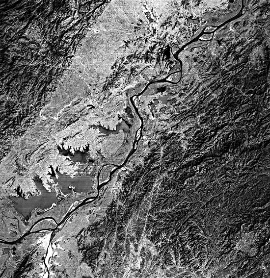
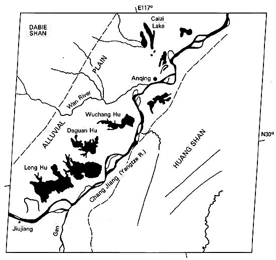
The lower Yangtze River (Chang Jiang) valley of east- central China consists of a broad alluvial plain flanked by uplands of crystalline rocks, the Dabie Shan to the northwest, and the Huang Shan to the southeast. Relatively recent subsidence in the sedimentary basin is indicated by numerous large lakes on the alluvial plain, including Wuchang Hu, Daguan Hu, and Long Hu.
This Landsat scene shows an area 400 km west of the Yangtze delta at Shanghai. The river is navigable for 2900 km from its mouth, and oceangoing vessels of 10000 tons can reach major inland ports such as Anqing (north center of scene), Nanjing (260 km downstream of Anqing), and Wuhan (300 km west of Anqing). The river's watershed includes one-fifth of the land area and two-fifths of the population of China. Boat traffic operates through a magnificent network of lakes and rivers in central China.
The Yangtze headwaters in southwestern China receive peak flows in the rainy season of July and August. Floods of the lower Yangtze are augmented by typhoons in July through September. The result is the world's fifth largest fluvial discharge averaged from an annual basis. The Yangtze transports 1.5 times as much water and 2.3 times as much sediment per year as the Mississippi/Missouri Rivers (Millman and Meade, 1983). Its total length is 5500 km.
| Figure F-16.1 | Figure F-16.2 |
|---|---|
 |
 |
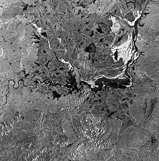
As with many large rivers, the Yangtze near Anqing has an anastomosed pattern. Large alluvial islands of relatively stable floodplain are common. One theory for the formation of such patterns in large rivers holds that large discharges of water and suspended sediment are best accommodated in relatively narrow, deep channels. Although width can easily increase as river size scales upward, depth cannot. The depth of scour is limited by the nature of the alluvial valley fill. Therefore, very large rivers with high suspended sediment loads must split their channels, maintaining several channels of optimum width-depth ratio. Anastomosed rivers have relatively fine sediment loads and gentle gradients.
Note that anastomosed rivers of this type are very different from braided rivers, despite similar sinuosity and the presence of islands. Braided rivers possess wide, shallow channels that are optimum for transporting relatively coarse sediment as bedload. The "islands" in braided rivers, such as the Brahmaputra or the Yukon, form initially as bars during periods of floodflow. As the stage drops during recession of the flood hydrograph, the bars become obstructions, splitting the flow into narrower, more efficient secondary channels. The former bars may eventually stabilize to become temporary islands. However, these can be easily reworked during a subsequent major flood.
Although the islands of anastomosed rivers are more stable than those of braided rivers, they experience continual modification. The scroll patterns on the Yangtze River islands show that progressive channel migration occurs in a similar manner to that in meandering rivers.
| Figure F-16.3 | Figure F-16.4 |
|---|---|
 |
 |
Upstream of Anqing, the Yangtze and its tributaries flow in great inland basins that are intensively cultivated for rice. Largest of these is the Dongting Swamp (Figure F-16.1). The swamp was probably once occupied by the Yangtze, which has now migrated to the north. Rivers entering from the south flood this basin with water. The basin also acts as a flow regulator for the great Yangtze floods. The largest city in the area is Changsha (pop. 850000), visible as a dark spot on the right bank of the Xiang River at the lower right of Figure F-16.1.
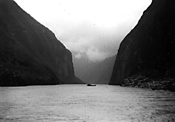
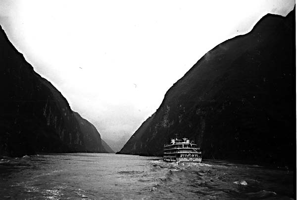
Upstream of the Dongting Swamp, the Yangtze flows through three spectacular gorges: Qutang Gorge, Wu Gorge, and Xiling Gorge. The river narrows abruptly in these gorges. Because the great discharge must be conveyed through narrow cross sections, the flow depths become enormous. At one point, the depth reaches 150 m, making the Yangtze the deepest river in the world.
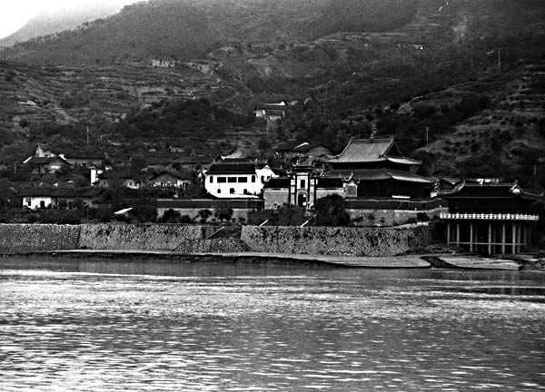
Figure F-16.2 shows Huangling Temple in Xiling Gorge. Floods have entered this building three times in the last 400 years, in 1788, 1860, and 1870. The 1970 flood was 110000 m3/s (3880000 cfs). During such floods, the Yangtze has been known to rise as much as 30 m, stranding river streamers on rock bars in the gorges. Figure F-16.3 and Figure F-16.4 show two views of the Yangtze gorges during moderate discharge conditions in October 1985. Landsat E-1519- 02131-6, December 24, 1973.
Continue to Plate F-17| Chapter 4 Table of Contents.| Return to Home Page| Compelte Table of Contents|