 |
 |
|---|---|
| Plate D-15 | Map |
|
|
|---|---|
| Plate D-15 | Map |
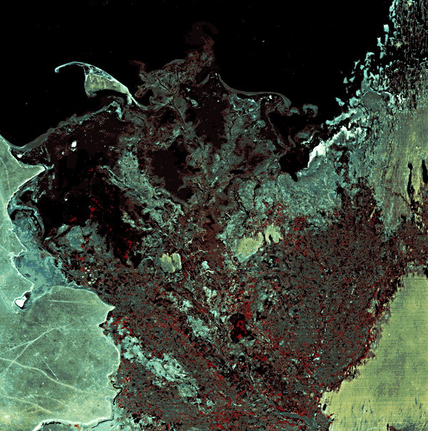
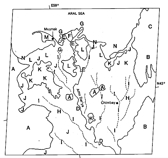
The Amu Darya River, known in ancient times as the Oxus, is the largest river in central Asia. It extends some 2550 km from its headwaters in the high mountains of Afghanistan and Soviet Tadzhikistan to the end of the delta (Samajlov, 1956). In ancient times, at approximately 500 B.C., it is believed that the river flowed into the Caspian Sea and later changed to its present course into the Aral Sea. The receiving basin, the Aral Sea, is some 64 000 km2 in area and experiences less than 1100 mm of annual precipitation. Evaporation is dominant, with approximately 1 m of water stripped from the surface annually. This water is replaced by inflow from the two major rivers that drain into the Aral, the Amu Darya and Syr Darya. Because water from both of these rivers is used for irrigation, the water level has decreased and the salinity is increasing.
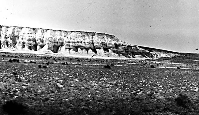
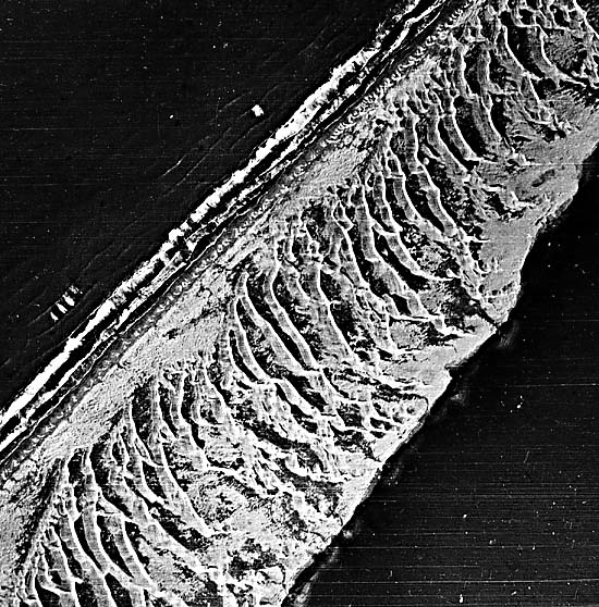
In its alluvial valley, the river flows through the extremely arid Turan lowlands, where evaporation removes a high percentage of the total flow, resulting in extremely high sediment concentrations. The delta, illustrated in the Landsat image, is bordered by the Kara Kum desert on the west and the Kyzyl Kum desert on the east. The Kara Kum consists of a denuded desert plain (A) with abundant salt flats, soft sediment bluffs (Figure D-15.1), and karst topography. The initial flow of the river was into a low depression of this desert referred to as the Sarykamysh Depression. Some of the former river courses that fed into this depression can still be discerned on aerial photographs. To the east lie the eolian sand fields of the Kyzyl Kum desert. Quaternary linear dune fields, some of them presently active, are shown in the image (B). Note that many of these linear dune fields have been inundated by the Aral Sea, giving a striking example of the linearity of the dune fields (C).
| Figure D-15.1 | Figure D-15.2 |
|---|---|
 |
 |
The modern channel displays active meandering (D) within the upper delta plain; in the lower delta plain, the channel bifurcates, and many distributaries feed water and sediment to the Aral Sea (E). The presently active part of the delta (F) is characterized by relatively small bifurcated channels that deliver a high volume of sediment to the Aral Sea annually. The turbid river plumes are dramatically shown in the image (G). The river has an average discharge of 1500 m3/sec, with a peak flow of 3380 m3/sec during flood. The image was obtained near the end of May, a period of spring flooding just before the major floods that occur in June and July as a result of glacial melt. Sediment load is extremely high in the active channel; in excess of 100 million metric tons of suspended sediment and 5 million metric tons of bedload is delivered to the delta annually.
The relatively inactive abandoned delta plain (H) dominates much of the scene in the image. The various abandoned channel courses (I) are well defined and consist of abandoned meander scars. In many instances, land reclamation in this arid delta follows these courses, and irrigation schemes are abundant along their courses. Modifications by man are not as prominent on the Plate scene as on low-level photographs. However, the general trend of the former courses can be easily discerned and mapped from the satellite imagery. The eastern part of the delta was active until the 10th century, when the major courses shifted to the west. The modern course began to form in the late 17th and early 18th centuries.
| Figure D-15.3 |
|---|
 |
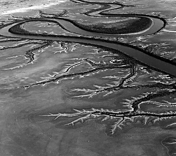
A large percentage of the delta plain is composed of evaporation flats and salt playas (J). Figure D-15.2 examines similar tidal flats of the Ord River delta, Australia, which is comparable in many respects to the Amu Darya. In most instances, these flats are present in the interdistributary regions. Some of the lower lying depressions, formed during the prior delta progradation, have not been totally infilled and now exist as high- salinity algal flats and saline lakes (K). Other partially filled depressions are barren of higher vegetation and consist of algal flats and salt marshes (L). Along the coast, waves and currents have reworked parts of the older delta plains into a series of beach-barrier complexes (M), often covered with small coastal dunes and backed by salt and algal flats. Figure D-15.3 pictures a typical reworked barrier sand spit on the fringes of the Ord River delta, Australia, that acts as an analog to those around the Amu Darya delta. Along the fringes of the older abandoned delta are coastal sand and mud flats (N). Landsat 1310-06192, May 29, 1973.
Chapter 5 References| Chapter 5 Table of Contents| Return to Home Page| Complete Table of Contents|