 |
 |
|---|---|
| Plate D-9 | Map |
|
|
|---|---|
| Plate D-9 | Map |
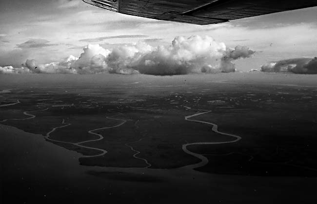
The Yukon River, the fifth longest river system (3185 km) in North America, has its headwaters in a group of lakes on the border between the Yukon Territory and British Columbia in Canada. After flowing across central Alaska, it empties into Norton Sound in the Bering Sea. Within its alluvial valley, the river is a complex meandering and braided river system that transports a large volume of extremely coarse sedimentary debris. The valley is flanked on both sides by bluffs composed either of mainly Pleistocene unconsolidated sediment or of Precambrian schists, Cretaceous sandstones and shales, or extrusive rocks. The river system drains an area of approximately 855 000 km2 and has a discharge of 6220 m3/sec during breakup. Suspended sediment discharge has been estimated to range from 30 to 90 million tons per year. This river delivers approximately 90 percent of the sediment entering the northeastern Bering Sea (Eardley, 1937).
The source area extends across a region of continuous to discontinuous permafrost in which the effects of mechanical weathering prevail. The sediment is dominated by silts and fine sands containing an abundant percentage of feldspars. The channels and offshore delta region are ice-bound from late October through late May. During breakup, much of the sediment bypasses the delta fringe and is deposited offshore by a combination of over-ice flow and sub-ice flow through a series of channels that extend up to 25 km offshore. Tides in Norton Sound range from 1 to 1.5 m, and tidally induced currents are active throughout the year. In the late summer and early fall, frequent southwesterly winds and waves associated with major storms control the transport of sediment. High wave energy and decreasing sediment discharge from the river result in significant coastal erosion and reworking of the deltaic sediments (Williams, 1952).
| Figure D-9.1 | Figure D-9.2 |
|---|---|
 |
 |
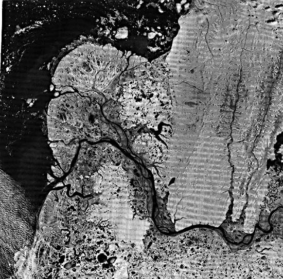
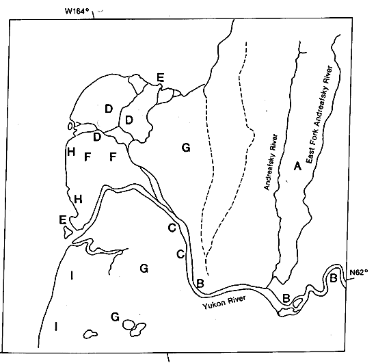
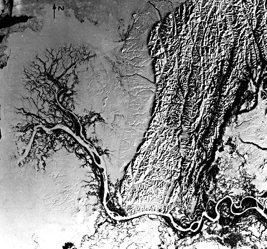
The delta of the Yukon River is a relatively young geologic feature, having begun to form not earlier than 2500 years ago when the river shifted its course to where it presently enters Norton Sound. East of the Yukon delta is a series of Cretaceous highlands that attain elevations ranging from 300 to 600 m. A well-developed trellis drainage network has developed in these sandstones and shales. The fluvial channel (B) of the river is a highly complex meandering river with numerous stretches of intense braiding. Just before entering the delta, the channel displays an extremely complex braiding pattern with numerous midchannel islands and braid bars. Farther down the delta, the distributary pattern displays a highly complex anastomosing pattern (D). This is highlighted in Figure D-9.1, a winter (February 7, 1979) Landsat scene in which snow cover contrasts with the still-flowing distributary channels. In the summer, numerous overbank splays break the channel margin and flow into the adjacent interdistributary lows. Near the distributary mouths, the channels bifurcate to form numerous small channels (E) that prograde out onto the delta front that previously served as the subice platform or the shorefast ice zone. The delta plain is fringed by prograding tidal flats and slightly coarser zones associated with the distributary mouth bars.
| Figure D-9.3 |
|---|
 |
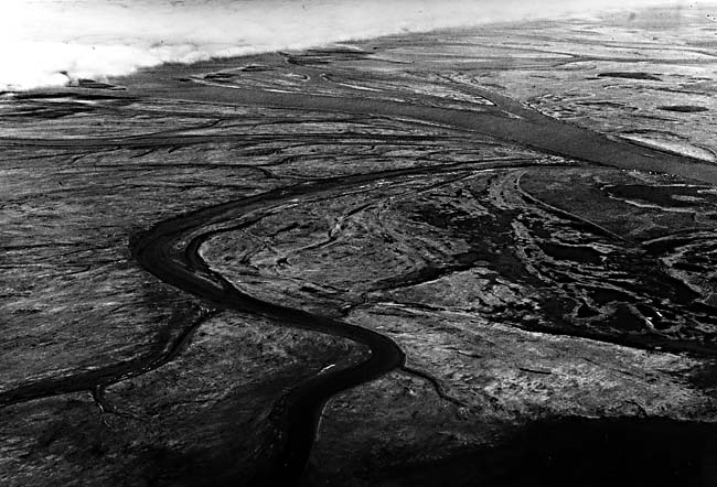
The subaerial delta plain (F) contains a complex assemblage of active and abandoned distributary channels, natural levees (which are extremely small), interdistributary marshes, and numerous small freshwater lakes (Figure D-9.2, showing the similar Colville River delta, Alaska (see also Plate F-1l)). The active distributaries display relatively high sinuosity, and channel migration is rather common as a result of the abundant coarse material in the delta plain. Interdistributary marshes are characterized by poorly sorted peaty silt and mud. Older parts of the delta (G) are often capped by freshwater peats up to 1 m thick. Numerous small freshwater lakes are present on this surface. Incipient permafrost development has resulted in the formation of peat mounds at the sites of former lakes. Many small shallow lakes are present in the delta plain, with most now in the process of being infilled with vegetation.
The delta-front platform consists of prograding tidal flats, distributary mouth bars, and sandy low-relief beach ridges resulting from reworking by major storms (Figure D-9.3). Tidal flats are typically 100 to 1000 m wide and consist of poorly sorted sandy silt. Poorly sorted silty sand forms the progradation linear beach ridges (H) present on the southwestern side of the modern delta. South of the delta area series of well-developed linear beach ridges (I); between the ridges, small linear lakes have developed in the swales. Landsat 2505-21303-7, June 10, 1976.
Continue to Plate D-10| Chapter 5 Table of Contents| Return to Home Page| Complete Table of Contents|