 |
 |
|---|---|
| Plate C-13 | Map |
|
|
|---|---|
| Plate C-13 | Map |
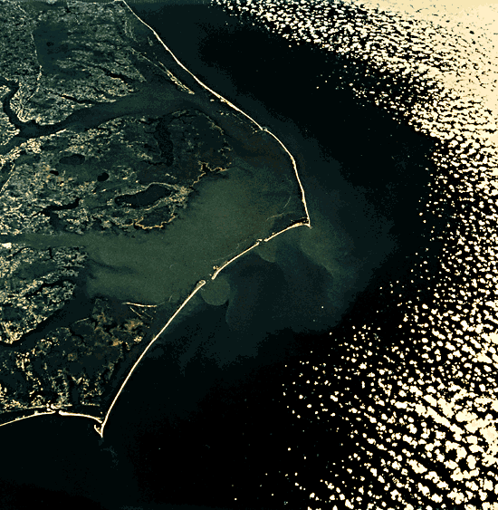
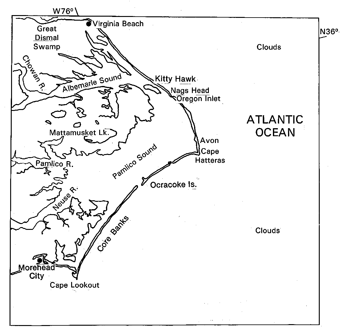
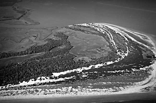
Plates C-13 through C-17 all show landforms at the edge of a broad continental shelf that has been repeatedly exposed and drowned during multiple glacially controlled sea-level fluctuations. This scene illustrates a gigantic cuspate foreland on a trailing continental margin. This and the next two Plates are from the southeastern United States, and their sequence from Cape Hatteras southward to the Florida Everglades illustrates the progressive change from polycyclic clastic sand deposits in the north to biogenic carbonate sediment in the south. This northward oblique view was taken with a hand-held camera by Apollo 9 astronauts. It shows the North Carolina and Virginia coast from west of Morehead City, North Carolina, and Cape Lookout northward to Cape Henry and Norfolk, Virginia. The view is considerably foreshortened by the oblique angle.
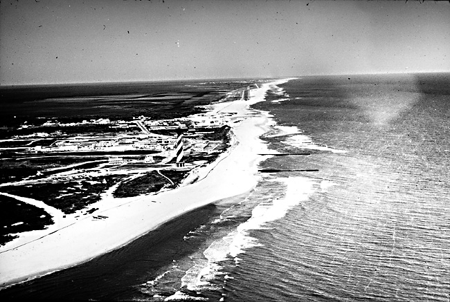
Cape Hatteras (Figure C-13.1) is one of the several cuspate forelands that project seaward from the nearly continuous chain of barrier islands and spits that extends from Long Island, New York, to Florida. The barrier spit that encloses Currituck and Albemarle Sounds southward from Cape Henry to Oregon Inlet is about 100 km long. It includes the high dunes at Kitty Hawk, from which the Wright brothers made their pioneering flights. In the 65-km distance from Oregon Inlet to Cape Hatteras, the barrier system projects even farther seaward to enclose Pamlico Sound, which is almost entirely less than 10 m deep (Pierce and Colquhoun, 1970, p. 3699). Seaward of Cape Hatteras, the submerged Diamond Shoals extend seaward almost to the edge of the continental shelf. The shoal may represent the retreat path of Cape Hatteras as sea level rose in the Holocene Epoch, at the end of the last ice age (Swift, 1969). The great swirl of turbid water southeast of Cape Hatteras in the image is a clue to the dangerous submerged sandbars and confused currents that have caused so many shipwrecks there. South of Cape Lookout to Myrtle Beach in South Carolina, the Barrier Islands lie close to the cuspate mainland coast, as is sharply portrayed in the second Apollo 9 oblique view looking to the north (Figure C-13.2).
| Figure C-13.1 | Figure C-13.2 |
|---|---|
 |
 |
The segment of barrier that extends 120 km southwest from Cape Hatteras to Cape Lookout includes Ocracoke Island and the Core Banks, with several inlets and other locations of ephemeral washovers across the barrier system. This barrier segment seems less well nourished than the barriers north of Cape Hatteras. Another ridge of dangerous shoals and shifting currents extends southeastward from Cape Lookout.
The prominent eastward projection of the U.S. Atlantic coast at Cape Hatteras suggests an ancient tectonic or sedimentologic foundation for the barrier system. It is noteworthy that emerged marine terraces of Late Tertiary age, far inland and as much as 60 m above present sea level, show a similar cuspate shape. One of the numerous emerged Pleistocene barriers of the southeast Atlantic coast can be traced as a beach ridge through the lowlands inland from Albemarle and Pamlico Sounds, evident in the upper left corner of the Plate as a narrow light-toned line fringing the Dismal Swamp and other forest belts.
In southern South Carolina and Georgia, relatively young emerged fossil barrier islands converge within 20 to 30 km of the present shoreline and are separated by shallow lagoons or "sounds" that are mostly shallow and filled with the salt marsh grass, Spartina alterniflora. The barrier segments are dissected by estuarine rivers into short wide islands that look like sausage links. These are the Sea Islands (Figure C-13.3), where cotton and tobacco growing were introduced to the United States. Now many of them are developed as winter resorts or exclusive holiday communities (e.g., Hilton Head Island). The cores of the Sea Islands were barrier islands of the last interglacial age, when sea level was a few meters higher than now. Certainly, more than one episode of barrier building preceded the last full- glacial drop of sea level, when the coastal plain rivers extended across the exposed continental shelf and dissected these barriers into segments that became the Sea Islands when sea level rose again (Winkler and Howard, 1977). The general southward direction of sand transport is illustrated by the recurved spits (Figure C-13.4) on islands such as Ossabaw and St. Catherines.
| Figure C-13.3 | Figure C-13.4 |
|---|---|
 |
 |
The modern barrier system is partly underlain by an older but similar system (Pierce and Colquhoun, 1970). Perhaps during the last interglacial high sea level about 125 000 years ago, which in most parts of the world was a few meters above present sea level, the former barrier system was built. It was deeply weathered during the last ice age when it was exposed by lower sea level, but as the sea rose to its present level in Holocene time, the modern barrier was built against and partly on top of the older eroded system. As on so many other coasts, the present dynamic barrier system, which responds so subtly and quickly to storms and waves, is actually only the youngest in a long history of similar forms built on the coast.
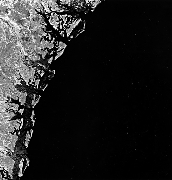
The mainline coast inland from the sounds is obviously drowned by the postglacial rise of sea level, but was not cut back or straightened by wave erosion, so that the barriers must have been in place during the submergence. Barriers such as these are not evidence of coastal emergence or uplift, but of inheritance from previous forms with constant reworking by modern processes. Apollo 9 Photo AS-9-20- 3128.
Continue to Plate C-14| Chapter 6 Table of Contents.| Return to Home Page| Complete Table of Contents|