 |
 |
|---|---|
| Plate KL-3 | Map |
|
|
|---|---|
| Plate KL-3 | Map |
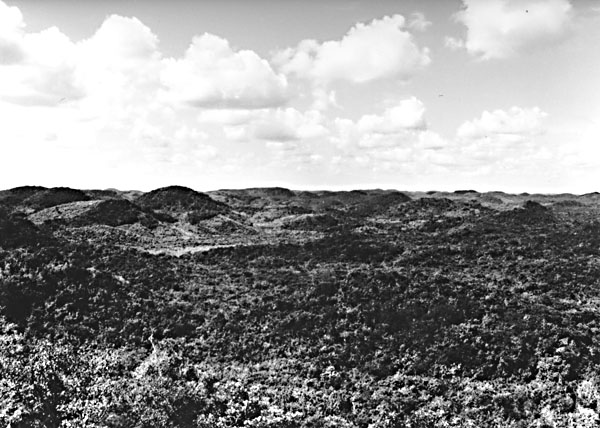
This image includes part of the Yucatan Platform within the Yucatan Peninsula in the states of Campeche, Quintana Roo, and Yucatan. Although no coastline is exposed in the image area, it is surrounded on three sides by the sea. This part of Mexico receives between 1000 mm of rainfall near Merida and 1500 mm toward the south edge of the image. Nearly all of this rain falls between May and September. Of the total precipitation, approximately 85 percent returns to the atmosphere via evapotranspiration, while the remaining 15 percent infiltrates to the ground-water table (Hanshaw and Back, 1980). As can be seen from the image, no drainage network has developed over the region; thus, runoff is insignificant.
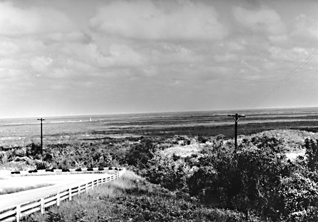
The Yucatan Peninsula and adjoining continental shelf (Campeche Bank) consist of relatively flat-lying Tertiary carbonates (Figure KL-3.1) covering some 350 000 km2 of area (Weidie et al., 1978). The Campeche Bank extends about 200 km into the Gulf of Mexico both north and west of the peninsula. The narrow Caribbean shelf borders the peninsula to the east and rarely exceeds a few tens of km in width. The exposed Tertiary rocks attain thicknesses up to 1000 m in northwestern Yucatan and consist primarily of dolomites, limestones, and marls. Most of the surface rocks exposed in the image area are Eocene and Paleocene in age. Other ground scenes typical of karst terrain in the Yucatan are shown in Figure KL-3.2 and Figure KL-3.3.
| Figure KL-3.1 | Figure KL-3.2 |
|---|---|
 |
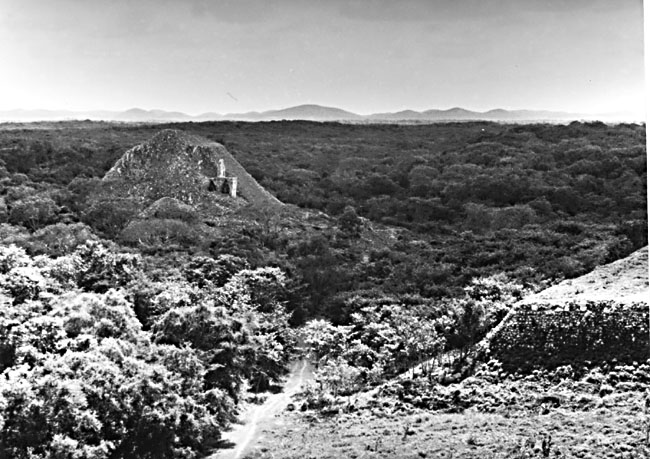 |
The most prominent structure in the region is the Ticul Fault and associated Sierrita de Ticul escarpment, which trends N60W for about 200 km (see index map and image). Movement on the fault has probably been sporadic since the Late Cretaceous (Weidie et al., 1978). Sierrita de Ticul is a series of hills, forming an arcuate ridge with a relief of nearly 50 m (West, 1967). The Sierrita marks the boundary between the flattish Yucatan Plain to the north and the hilly Campeche region to the south. Most of the Yucatan Peninsula is dominated by karst topography (Figure KL-3.3) consisting of cenotes (steep-walled sinks that usually penetrate the water table), bare limestone platforms, aquadas (broad shallow solution basins), and resumideros (funnel-shaped conical depressions). The cenotes and aquadas are the two most important sources of water in the region, and as a consequence, most of the Mayan cultural development and population centers are found to be closely associated with these karst features. Where the limestone is not bare, it is covered with a thin terra rossa soil, usually less than 20 cm thick, developed on weathered limestone (Hanshaw and Back, 1980). Where bare limestone is exposed, it often exhibits deep solution channels or karren that can pose a problem for vehicular travel (West, 1967).
| Figure KL-3.3 |
|---|
 |
It is because of the karst that no surface drainage exists in the northern and central parts of the peninsula. The high porosity and permeability of the limestones provide for an efficient internal drainage (Southworth, 1984). The Yucatan Peninsula is similar to Florida because both have thick sequences of relatively flat-lying Tertiary limestones; however, in Yucatan, the lack of Upper Tertiary clays and marls overlying the limestone results in rapid infiltration or rainfall. The presence of an extensive interconnected subsurface drainage network is suggested by: (1) a gentle piezometric surface gradient that has been measured as 1.2 to 1.5 m above sea level in areas 80 km inland from the coast at an elevation of 30 m above sea level, (2) the lack of notable drawdown observed in heavily used wells, and (3) the young age of water dated from its C14 content (Hanshaw and Back, 1980).
Hanshaw and Back (1980) believe that chemical mass wasting in the zone of dispersion is perhaps the most important geomorphic process in the region. From their measurements on the concentration of dissolved solids, the surface in places could be lowered by as much as 340 mm/1000 yr. This figure is misleading, however, because much of the dissolution occurs along subterranean passageways.
The karst nature of the image area can be recognized by the lack of any developed drainage network and by the presence of residual karst knobs found south of Sierrita de Ticul. Lago de Chichancanal (see index map) may be fracture-controlled like some of the lakes east of the image area that are influenced by the Holbox fracture system. Alignment of cenotes due to fracture control has also been documented in the eastern part of the peninsula (Southworth, 1984). Landsat 21089-15115, January 15, 1978.
Continue to Plate KL-4| Chapter 7 Table of Contents.| Return to Home Page| Complete Table of Contents