 |
 |
|---|---|
| Plate KL-6 | Map |
|
|
|---|---|
| Plate KL-6 | Map |
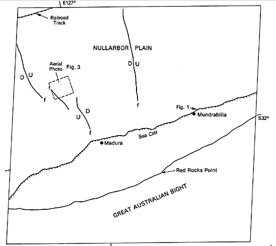
The Nullarbor karst makes up an area encompassing about 200 000 km2 of southern Australia, which makes it one of the larger karst regions in the world. The Landsat image views only a portion of the south-central Bunda Plateau, which is treeless and is called the Nullarbor Plain. The Bunda Plateau is the positive surface expression of the Eucla structural basin, which is filled with over 600 m of Cretaceous and Tertiary marine sediments. The planar surface of the Bunda Plateau and associated Nullarbor Plain represent an emergent stable continental margin mantled with a uniform sheet of shelf sediments. The uppermost formation, the Nullarbor Limestone, is of Middle Miocene age and ranges in thickness from 15 to 60 m (Twidale, 1973). It is in this limestone that the Nullarbor karst is expressed.
The emerged sea cliff (Figure KL-6.1) of the Hampton Range exposes both the Nullarbor Limestone and the underlying older Abrakurrie Limestone. South of the sea cliff, the coastal plain is mantled with Late Tertiary and Quaternary marine sediments and shelly conglomerates.
| Figure KL-6.1 | Figure KL-6.2 |
|---|---|
 |
 |
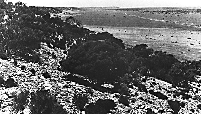
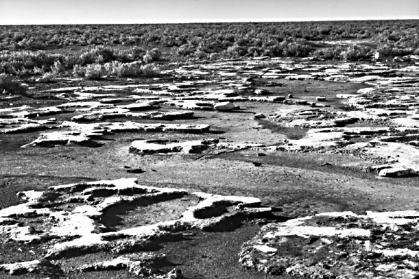
The Nullarbor karst is unusual in that it represents an arid karst. The precipitation averages about 250 mm per year near the coast and decreases northward to about 150 mm, where the flat to gently rolling surface of the Nullarbor Limestone is sparsely vegetated with shrubs and grasses, particularly saltbushes and blue bushes. As might be suspected, this arid karst supports no surface streams (Figure KL-6.2). Any rainfall quickly disappears underground through joints and depressions exposed on the surface. The aridity is also responsible for the observed paucity of caves and dolines and the absence of larger karst features like uvalas and poljes.
Denudation, primarily due to solution and minor wind deflation, averages 5 mm per 1000 years over the last 14 Ma since the landscape began to evolve (Lowry and Jennings, 1974). In the image area, Lowry and Jennings estimate that between 60 and 180 m of subaerial solution has taken place.
| Figure KL-6.3 | Figure KL-6.4 |
|---|---|
 |
 |
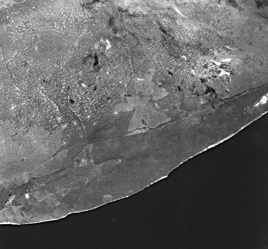
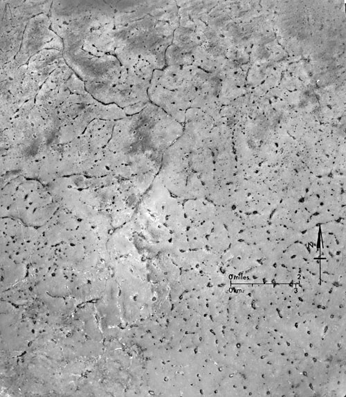
Several striking morphological features show clearly on the Landsat image, including one that is probably related to solution denudation. Besides the emerged and prominent sea cliff making up the Hampton Range, several fault traces, possibly Early Pleistocene, can be discriminated. These faults (see index map) exhibit scarps with a relief of 5 to 25 m on the surface. The ground view (Figure KL-6.2) and vertical aerial photos (Figure KL-6.3 and Figure KL-6.4) show large-scale views of this topography. Karst and solution features show up as a distinctive ridge-and-corridor pattern (Figure KL-6.2), which imparts a rippled texture to the Nullarbor Plain in the image area. The low relief of 1.5 to 6 m stands out surprisingly well on the Landsat image. The corridors are flat-floored basins up to 1 km wide and several km long that show up as light tones because of a concentration of clays in the residual soil. The ridges of the same dimensions show darker tones because of a greater concentration of vegetation and associated darker soils. Lowry and Jennings (1974) regard differential solution of the limestone surface as the prime factor in the development of relief across this ridge-and-corridor topography. The distinct east-west trend of the corridors is apparently controlled by jointing; however, the exact nature of the cause and effect relationship remains unclear. The white areas near the coastline are coastal sand dunes.
Twidale (1973) summarizes the Nullarbor Plain as being:
Landsat 2083-00391-6, April 15, 1975.
Continue to Plate KL-7| Chapter 7 Table of Contents.| Return to Home Page| Complete Table of Contents