 |
 |
|---|---|
| Plate E-1 | Map |
|
|
|---|---|
| Plate E-1 | Map |
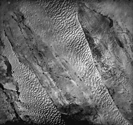
Dome dunes up to 150 m high (Holm, 1960) dominate this area of Saudi Arabia. As maybe seen in the Plate and the figures, dome dunes are mounds of sand that lack external slipfaces.
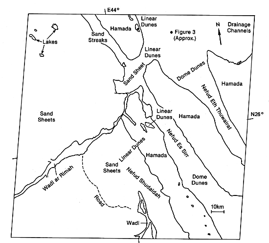
The sand seas in the northern part of the Arabian Desert are divided into the Great Nafud, the Jafurah, and Dahna sand seas (Anton, 1983). Holm (1960) considers the primary sources of sand to be crystalline rocks exposed in the uplands. Sandstone outcrops and gravel plains are a secondary source. Holm suggests that the sands in the Arabian Peninsula accumulate in two large basins, the Great Nafud and the Rab´al Khali, the Empty Quarter. A 120-km long Dahna sand field connects the two basins.
Small elongate sand seas, called nefuds, subparallel to and west of the Dahna, are in this scene. The sand fields are about 20 km wide and are separated by 25-km wide hamadas that rise about 50 m above the dunes. As seen in the Plate, the western contacts between the sand fields and the hamadas are sharp, while the eastern contacts are generally gradational.
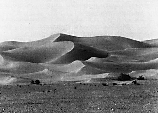
The hamadas and the gravel plains in the lower left of the Plate are vegetated sparsely along the wadis. Figure E-1.1 illustrates the dune/gravel contact near Al Hawtah. The ripples on the dunes are roughly perpendicular to the slipface that faces left in this photograph. Holm (1960) notes that the gravel plains are either alluvial or residual and are created from weathering and deflation of conglomerates. He believes that the Wadi ar Rimah was once continuous with Wadi al Batin, which is northeast of the scene. The wadis now are separated by the sand seas in the upper right of this Plate. Holm suggests that during the Pleistocene this river system reached the sea from the Tigris/Euphrates Valley. Eolian deflation has smoothed hamadas into flat, gently undulating surfaces.
| Figure E-1.1 | Figure E-1.2 |
|---|---|
 |
 |
Wilson (1973) reports that travelers find that hamadas are no more free from sand storms than are the surrounding sand seas. He mentions that hamada sand is only a thin veneer between pebbles of the desert pavement, or is found as drifts in low-elevation areas. The hamada in the upper right is composed predominantly of limestone, while the hamada between Thuwairat and Sirr nefuds is composed of sandstones. The hamada continues past the alluvium of the Wadi. Lakes in this area tend to be in the western sections of the hamadas.
The westernmost rocks in the scene are granite. Sandstone lies between the granites and the Nefud Shudaidah. The contact between these rocks cannot be seen on the Plate. Dome dunes are common in these sand fields. North of the Wadi ar Rimah and Wadi al Batin dome dunes grade into linear dunes, as may be seen in the upper center of the Plate.
The dunes enlarge toward the east in each of the sand fields in this Plate. The domes decrease in size toward the south. As seen in the Plate, some of the domes are coalescing into composite dunes up to 5 km long and 1.5 km wide (Holm, 1953). Breed et al. (1979a) conclude that, with a mean diameter of 1.2 km, these are the largest dome dunes observed in their study. Holm (1953) notes that the dome dunes are elongated because of the prevalence of particular wind directions over other wind directions.
| Figure E-1.3 |
|---|
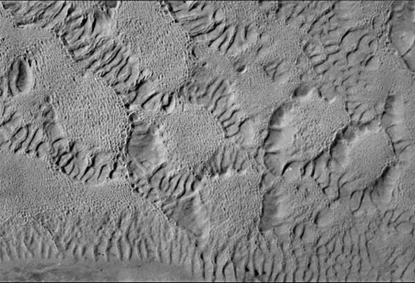 |
According to Anton (1983), the Dahna sand fields occupy a low topographic position and approximately follow the geological structure. Anton believes that this suggests a nearby sand source. He notes two paleosoils 1 and 2 m below the surface of the sand ridge in this area. This implies two humid periods in the environment.
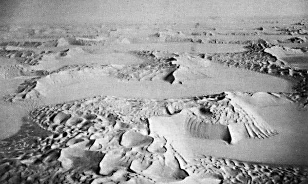
Figure E-1.2 illustrates large dome dunes in the Empty Quarter of Saudi Arabia. Figure E-1.3 shows dome dunes present in the upper right of this Plate. The domes are about 1 km in diameter. As the figure illustrates, these dunes are complex with small crescentic dunes, showing the present dominant wind direction, on the rounded crests of the dome dunes. Adjacent dunes are separated by low ridges and deflation hollows. Breed and Grow (1979) interpret the dark gray spots on the ridges as oases. They point out that large dome-shaped dunes such as these are located at the far upwind margins of sand seas. Landsat 1137- 07043-7, December 7, 1972.
Continue to Plate E-2| Chapter 8 Table of Contents.| Return to Home Page| Complete Table of Contents