 |
 |
|---|---|
| Plate E-20 | Map |
|
|
|---|---|
| Plate E-20 | Map |
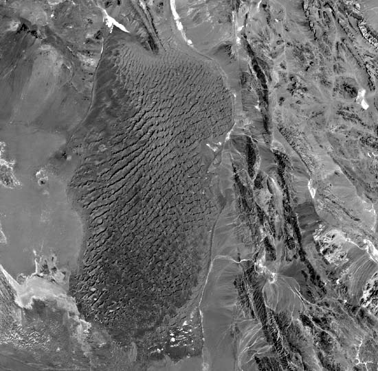
This 10 000-km2 sand sea in the southea stern Lut Desert is directly east of the yardangs described in Plate E-19. The eastern and southern edges of the yardang field are on the left in this Landsat image. The field has an elevation of less than 300 m above sea level; the elevation of the sand sea is about 600 m on the west, 900 m in the center, and 1200 m on the east.
The Lut Desert consists of several expansive basins separated by low ridges and residual mountains. The desert is on the Lut Block, a stable elongated fault-bounded structure about 900 km wide north-south and 200 to 250 km east-west. The block exhibits a simple tectonic structure with faulting, tilting, and gentle folding. Strong disturbances occur only near the junction of the block with the flysch zone in the east (Stocklin et al., 1972). The eastern border with the flysch zone is in the right of this image, and the western border is to the left of the yardangs in Plate E-19.
The youngest deposits in the basin are recent unconsolidated gravels that cover vast portions of the desert (Stocklin et al., 1972). The stony desert is locally called a dasht, and the Lut Desert is sometimes referred to as the Dasht-E-Lut. The gravel surfaces seen in the upper left and lower right are dissected by intermittent light-colored stream channels flowing into the basin. Krinsley (1970) states that the sand ridges between the dune field and the southeastern portion of the yardang area are derived from the excavation of the furrows between the yardangs.
| Figure E-20.1 | Figure E-20.2 |
|---|---|
 |
 |
A volcano with a small caldera is on the western edge of the sand sea. Dunes and a sand sheet are encroaching its lava field. A few small star dunes on the northeastern edge of the lava field and a large, simple three-armed star dune northwest of the volcano imply an older age for the volcano. The northeast and southwest arms of the star dune close to the volcano are in an orientation close to the star dune arms near the yardangs 40 km to the southwest. The third arms of the latter are northwest, while the third arm of the former is southeast. For the dune near the volcano, the arm is southeast. This may be because the volcano's topography creates a change in the orientation of the wind pattern around it.
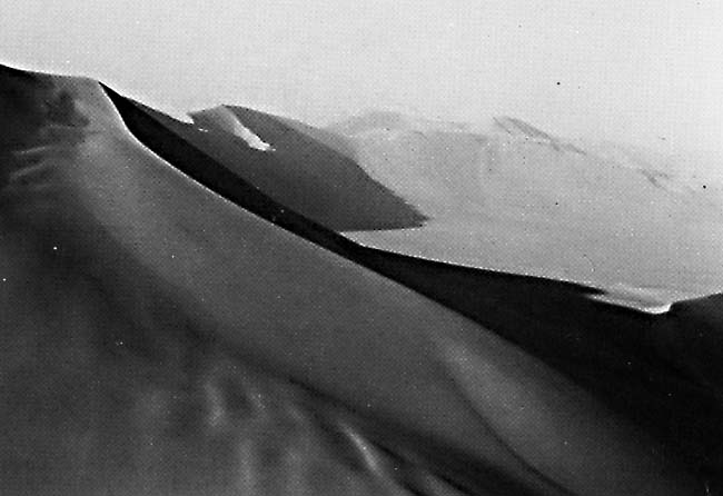
Alfons Gabriel, one of the first explorers in this area, describes this sand sea as a "confused mass of impassable tangled dunes" (1938, pg. 148). He notes that the sands of this dune field, with dunes up to 150 m tall, are of uniform size, are almost perfectly round, and have an admixture of volcanic material.
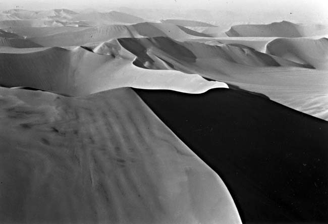
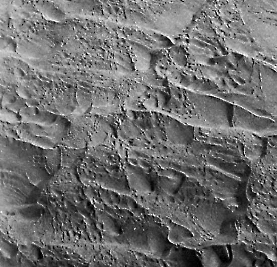
Figure E-20.1 and Figure E-20.2 are photographs taken near the center of the dune field. They show- crested complex star dunes with arms greatly elongated in two directions. A crescentic dune extends onto the arm of the left center star dune in Figure E-20.2. Figure E-20.3 is an aerial photograph of the northern portion of the dune field.
| Figure E-20.3 | Figure E-20.4 |
|---|---|
 |
 |
The dunes in this sand area are predominantly sharp- crested simple, compound, and complex star dunes. The northeast and southwest arms of the dunes dominate and are connected to give a linear orientation to the dunes. The wavelengths between the linear dune pattern increases toward the west as the elevation decreases. The edge of the sand sea is marked by individual small dunes and sand streaks. The dunes in the north grade into dome dunes and sand sheets. It appears that sand is encroaching on the dune field in the north. Although dunes in the north have the same orientation as the other dunes in the field, they appear subdued as if they are being covered by a sand sheet.
Subtle changes in the linear pattern of the dune field may reflect topographic differences in the basin. The linear pattern of the sand sea is subperpendicular to the pattern of the yardangs.
The slightly darker gray tone in the left-center of the sand sea and a difference in the sharpness of the arms suggest a change in composition of the dunes. Selivanov (1982) suggests that the sands of the Lut consist of deposits of different ages. Using aerial photographs, he observes that younger, more readily transported loose sands have covered older coarse sand now anchored by grasses.
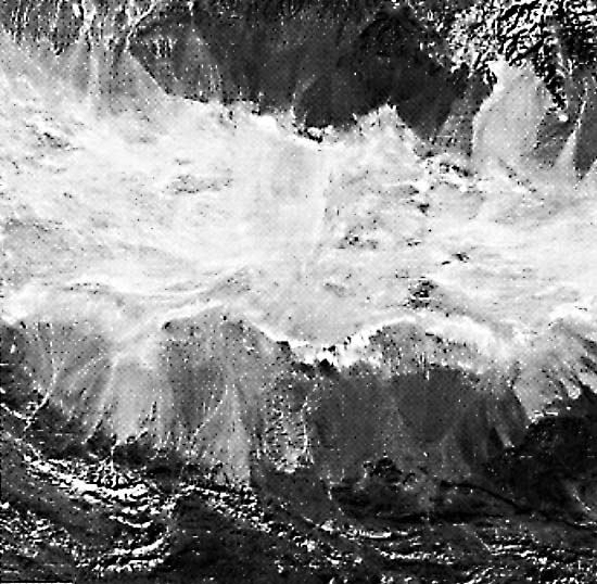
Salt flats scattered throughout the image attest to the presence of playas and extensive coalescing fans that border them. Krinsley (1970) notes that the salty clay flats, with drainage patterns, and the waterlines at the base of some of the dunes of the sand sea indicate that a local shallow perched water table may reach the surface seasonally. One of the largest continuous salt flats and bolsans (Figure E-20.4) in Iran occurs some 300 km to the south around the Haman- e-Jaz Murian in the intermontane basin between the Kerman Mountains (north) and the western end of the Baluchistan belt. Landsat 2663-05425-7, November 15, 1976.
Continue to Plate E-21| Chapter 8 Table of Contents.| Return to Home Page| Complete Table of Contents