 |
 |
|---|---|
| Plate E-5 | Map |
|
|
|---|---|
| Plate E-5 | Map |
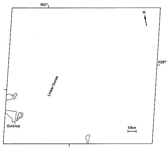
Erg Chech, east of Yetti Eglab Massif in the central Sahara, is imaged in this Plate, and in Plate E-3 (HCMM Day-VIS), and in Plate E-4 (HCMM Night-IR). On an ancient alluvial plain (Petrov, 1976), it is separated from Grand Erg Occidental by sand sheets and low hills such as the Ougarta Range, and from Grand Erg Oriental by the Tademait Plateau. Wilson (1973) suggests that this erg and the Simpson Desert, Australia, ergs are probably interdigitated with their source areas to a large extent. For most ergs, however, he holds that the center of mass must be downwind from the main mass of the source area.
Erg Chech consists of very widely spaced parallel compound and complex linear dunes. These southwest-trending dunes are asymmetrical, with the east side of the crest broader than the west side. Bedrock or gravel cover is visible in the dark interdune areas in the lower left. The black areas in the lower left of the Plate are water.
| Figure E-5.1 | Figure E-5.2 |
|---|---|
 |
 |
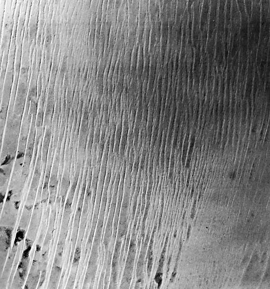
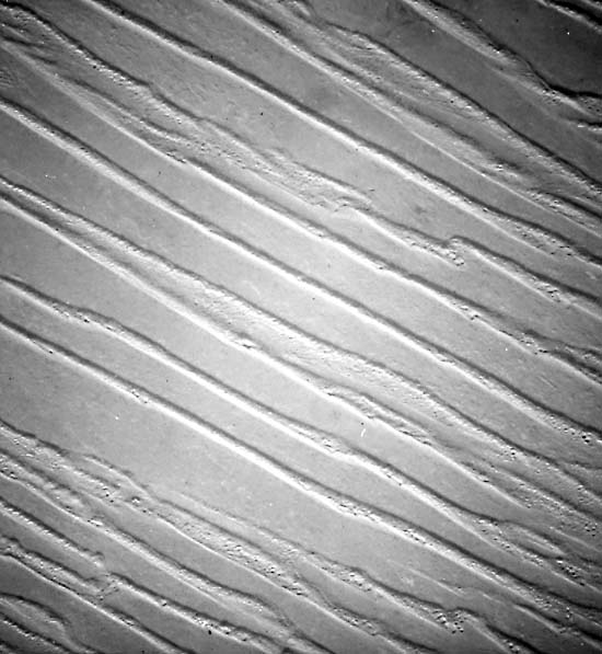
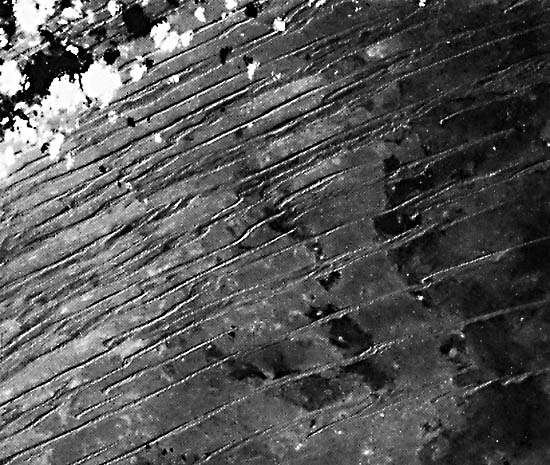
Compare the Plate with Figure E-5.1, a space photograph. It is more difficult to see any interdunal features on the photograph. In the field, this erg is quite red. The dunes in this figure are much wider than the linear dunes shown in Figure E-5.2 and Figure E-5.3. Figure E-5.2 is an aerial photograph of the linear dunes in the erg. The dunes in this figure and Figure E-5.3, a Skylab photograph, show complex linear dunes with crescentic dunes on their crests.
Using Landsat, Breed et al. (1979a) measured the spatial parameters of dunes in the Erg Chech. They found the dunes to have a mean width of 1.0 km and an average spacing of 5.7 km. They consider the wide spacing unusual when compared with the linear dunes of other deserts. These investigators traced the linear dunes southwest onto sand seas of northwestern Mali and northeastern Mauritania.
| Figure E-5.3 | Figure E-5.4 |
|---|---|
 |
 |
Mainguet and Chemin (1983) suggest that the large interdune areas in Erg Chech indicate a very negative sand budget. They conclude that a negative sand budget occurs when the output of sand is greater than the input, and the sand sea thins. They contend that a large part of the exported sand is trapped in the Sahel, although some is blown into the Atlantic.
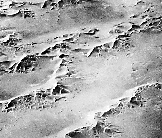
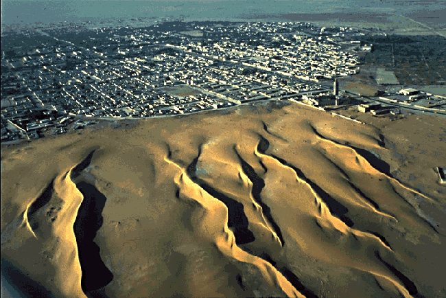
Figure E-5.4 shows linear dunes encroaching Nouakchott, capital of Mauritania. The area is southeast of the Plate. The mosque and farms at the edge of the photograph are becoming inundated by the sand sea. Landsat 1565-10032-6 February 8, 1974.
Continue to Plate E-6| Chapter 8 Table of Contents.| Return to Home Page| Complete Table of Contents