 |
 |
|---|---|
| Plate E-4 | Map |
|
|
|---|---|
| Plate E-4 | Map |
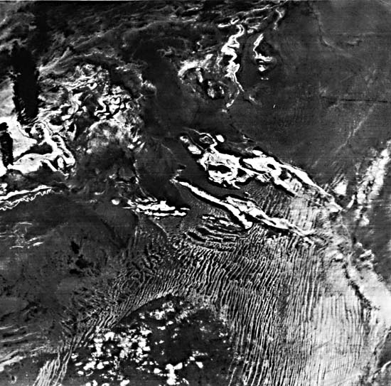
The central point of this HCMM Night-IR image of the Sahara Desert is northeast of that of the HCMM Day-VIS image of Plate E-3. The overlap is considerable, and it is interesting to compare them. A locale near the northeast edge of Yetti Eglab Massif is marked as point A on both images. Except for the black (cool) clouds on the upper left of this Plate, atmospheric effects are negligible in both images. The Landsat image on Plate E-5 of Erg Chech, is outlined on the lower right.
HCMM day data were collected when the spacecraft was in the ascending node (passing from south to north) at about 2 p.m. local time. For the night data, however, the spacecraft was in the descending node (passing from north to south) at about 2 a.m. local time. Because of the track coverage, a north-south line in the Day-VIS image trends toward the right in the image, while on a Night-IR image, the line trends left.
Few rock types of Yetti Eglab Massif can be discriminated because their thermal contrasts at night are not great. Several rock types in the massif may be discriminated by their gray tones on the Day-VIS image. Standing bodies of water are warm at night and extremely bright on HCMM Night-IR images. The sharp bright areas on the massif are small lakes, and they correspond with the sharp black lakes on the Day-VIS image. The diffuse light-gray areas near the lakes are probably marshes and are not seen on the Day-VIS image. The areas of these swamps are different on Night-IR images of other dates, indicating the response of moisture to the surface environment in the desert.
| Figure E-4.1 | Figure E-4.2 |
|---|---|
 |
 |
Compare the signatures of the rocks on the massif with those of the rocks of the Ougarta Range. Although the range rocks are relatively cool (dark) on Day-IR Images of this area, they are very warm (light) on this Night-IR image. Through comparing Day-VIS (Plate E-3), Day-IR (not included), and Night-IR images, more rock types are discriminated than can be discriminated on one type of image alone. However, field investigators are necessary to identify the rock types.
Most of the dunes south of 30°N in this image are much warmer (lighter) than the more sheltered interdunal areas. Because resolution on the thermal IR image is 600 m, as compared with 500 m on the VIS images, the dunes are not as sharp. The diffusive appearance of the dunes of eastern Erg Er Raoui and eastern Erg Chech is probably an atmospheric phenomenon. A topographic low may have created a warm air pocket. Some of the dunes directly southwest of the Ougarta Range are distinguishable in this image because of the contrast between the dune and the sheltered interdunal area, but in the Day-VIS image, they are indistinguishable.
The northern ends of many of the linear dunes in Erg Chech bend sharply to the west. A different rock type maybe seen on the Day-VIS image where this occurs, and the turn may reflect a change in the wind direction resulting from an abrupt change in topography. The variations in rock types beneath these turning dunes are not apparent on the Night-IR image.
| Figure E-4.3 |
|---|
 |
It is interesting to compare the Day-VIS and Night-IR appearance of the dunes of Erg Iguidi west of the massif. The westernmost dunes discernible on the Day-VIS image have a deeper gray signature than the other dunes. On the night image, the signatures are identical. Many dunes in the eastern part of Erg Iguidi are visible at night and are difficult to distinguish in the Day-VIS image. In the VIS image, the dunes appear to be similar in gray tone to the rocks in the massif and therefore indistinguishable from the massif. In contrast, the dunes are much warmer at night than the surrounding interdunal areas and are visible.
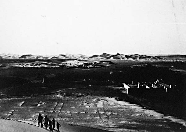
The southwest corner of Grand Erg Occidental (Great Western Sand Sea) is in the upper right of this image. Although the edge of the erg can be recognized by a subtle change in gray scale, the dunes mapped by Breed et al. (1979a) as star dunes cannot be distinguished on this HCMM image because of the poor resolution.
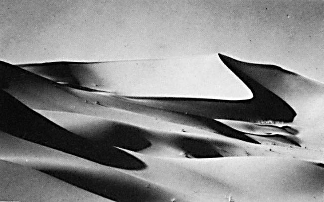
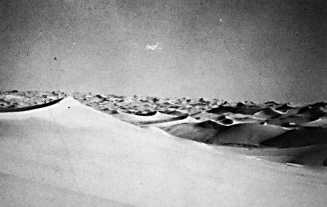
Examination of this area on Landsat indicates that the interdunal areas do not contrast in signature with the dunes, as they do in the ergs south of this erg. This also maybe seen in Figure E-4.1 and Figure E-4.2, ground photographs of the erg. The southwestern border of this erg, Wadi Daorua, is represented on the Plate image by a thin light-gray line. Outcrops on Hamada du Guir are seen in the light-colored areas west of the erg. Figure E-4.3, near Beni- Abbes, shows that hamada with the erg in the background. HCMM 0141-02090-3 Night-IR, September 14, 1978.
Continue to Plate E-5| Chapter 8 Table of Contents.| Return to Home Page| Complete Table of Contents