
Other Remote Sensing Systems - IRS-1 and JERS Series
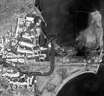
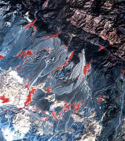
India successfully operates several Earth-resources satellites that gather data in the Visible and Near IR bands, beginning with IRS-1A in March of 1988. The latest in the series, IRS-1D, launched on September 29, 1997. Its LISS sensor captures radiation in the blue-green, green, red, and near IR bands at 23 m spatial resolution. The spacecraft also produces 5.8 m panchromatic images, as well as 188 m resolution wide-field (large area) multispectral imagery. Below are two recent images from this system, the one on the top, a 5.8 meter panchromatic view of part of the harbor at Tamil Nadu in India and on the bottom (or right) a three-band color composite, showing mountainous terrain and pediments with alluvium fans in southern Iran.
More information on the Indian remote sensing program is available from its U.S. distributor, SpaceImaging-Eosat Corp (http://www.spaceimaging.com).
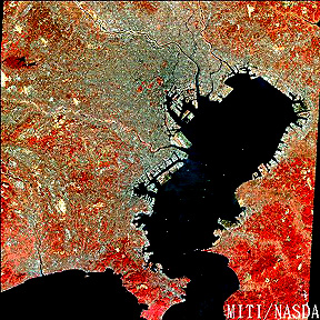
The Japanese, beginning in 1990, have flown JERS-1 and JERS-2 which include optical and radar sensors. The optical system is a seven band scanner similar in coverage to the TM. Here is a false color image of Tokyo and Tokyo Bay:

Collaborators: Code 935 NASA GSFC, GST, USAF Academy Webmaster: Bill Dickinson Jr.
Primary Author: Nicholas M. Short, Sr. email: nmshort@epix.net
Contributor Information
Last Updated: September '99
Site Curator: Nannette Fekete
Please direct any comments to rstweb@gst.com.