Other Remote Sensing Systems - Radar Systems
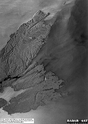
Another class of satellite remote sensors now in space are radar systems (these are treated in detail in Section 8). Among systems now operational are the Canadian Radarsat, ERS-1 and ERS-2 managed by the European Space Agency, and JERS-1 and JERS-2 under the aegis of the National Space Development Agency of Japan, NASDA. As an example, here is the first image acquired by Radarsat, showing part of Cape Breton in Nova Scotia, and the surrounding waters.
The European Space Agency, ESA, also has flown radar on its ERS-1 and ERS-2 satellites. Here is an image in black and white showing the San Francisco, California, metropolitan area and the peninsula to its south, as well as Oakland, California, the East Bay, and beyond.
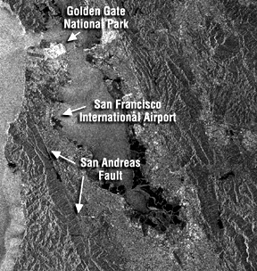
I-26: Look at the above two radar images, especially the one showing San Francisco. State two characteristics of the radar images that seem to differ from those of Landsat. ANSWER

Collaborators: Code 935 NASA GSFC, GST, USAF Academy Webmaster: Bill Dickinson Jr.
Primary Author: Nicholas M. Short, Sr. email: nmshort@epix.net
Contributor Information
Last Updated: September '99
Site Curator: Nannette Fekete
Please direct any comments to rstweb@gst.com.