
A plethora of spectacular surface images have accrued from the Mariner 9 and
Viking missions. Below, we show only a few, to whet your intellectual appetite,
but for the curious, consult these two references for many more pictures: The
Geology of Mars, T.A. Mutch et al., 1976, Princeton University Press and
Viking Orbiter Views of Mars, C. R. Spitzer, Ed., 1980, NASA SP-441.
We start with the greatest hole in the ground ever discovered in the solar system. Look at this Viking color mosaic, extracted from the near hemisphere view we showed earlier, here centered on the most conspicuous feature on Mars: the Valles Marineris which extends nearly 4,000 km (2,486 mi) (close to the width of the 48 contiguous United States) and attains depths between
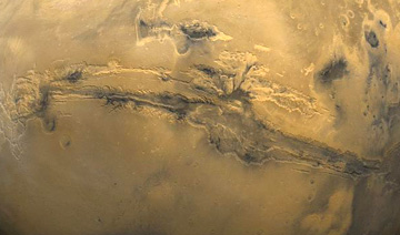
2 and 7 km (1.25-4.35 mi). The canyon is actually a series of structural troughs, produced by faulting, radial to the Tharsis bulge to the northwest, which rises some 11 km (6.8 mi) above the surrounding plains, on which are the three dark-shield volcanoes , named on the preceding page. These volcanoes reach about 10 km (6.2 mi) above the bulge. A look inside the canyon wall, along a segment called South Candor Chasma, conveys the sense of steep slopes, perhaps furrowed by water erosion, and basal landslide deposits.
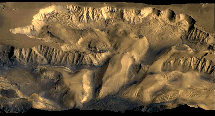
A close-up of a slide in Valles Marineris gives details of the massive debris pile-up, as material pulled away from the steep canyon wall.
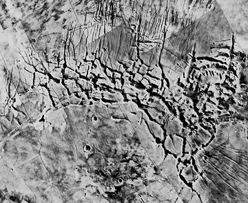
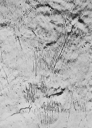
Other tensional grabens are found in various parts of Mars, especially in the newer terrains. These can occur in intersecting networks, such as below which portrays Noctis Labyrinthus in the northern Tharsis region. This tecto-morphological feature is also called fractured terrain.
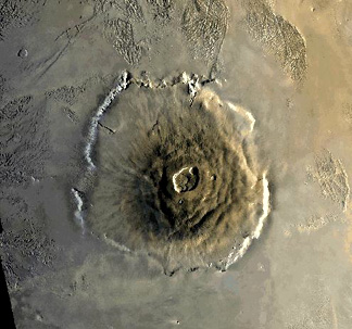
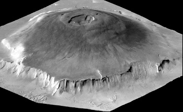
Next, we show (left), from Mariner 9, and later from Viking, the large structure known as Olympus Mons in the Tharsis region, which is a huge shield volcano (now dormant)¾ many times the area and volume of the big island of Hawaii, which consists of basaltic outflows from several major vents. Olympus has a median diameter of 625 km (388 mi) and a height of 25 km (16 mi). Its elliptical central caldera is 80 km (50 mi) in major axis. A cliff 7 km (4.3 miles) high surrounds it, and stands out in the perspective view (right), derived by combining an image with topographic data. Scientists still debate the origin of this cliff, but some of them cite it as evidence of an escarpment resulting from wave erosion by an ancient (now vanished) ocean that may have covered at least part of Mars. Note the distinctive grooved terrain (volcanic origin?) beyond the volcano's edge.
The largest volcanic structure on Mars, and so far, in the Solar System, is the great bulge in the northern Tharsis region known as Alba Patera, only a few kilometers high but 1600 km (1000 miles) in longest dimension. It is broken by a series of concentric and a set of elongate, subparallel fracture grabens, as seen in this Mariner mosaic.
At its top are an older summit caldera (left) and a smaller, more recent one. Note the lava flows descending its gentle slopes.
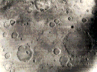
Extensive impact cratering was observed by Mariner 4, which sent back the first ever images (21 all told) taken of another planet's surface (one seen in the top photo below) by a space probe that approached to within 9800 km (6086 miles). As imaged the next year by Mariner 6, the Sinus Sabeus region of the southern highlands (bottom) preserves typical impact craters in the ancient terrain that apparently has not been extensively resurfaced by lavas. Note that none of the larger craters in this view have central peaks.
Mariner 9 and the Vikings confirmed that a large fraction of the (older) martian surface mainly in the southern hemisphere remains heavily cratered. This is evident in this sketch drawing from Mutch et al., The Geology of Mars, 1976 in which all craters larger than 15 km are positioned.

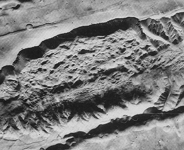
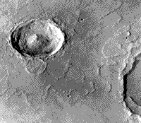
One can argue that this landscape has many similarities to the still cratered Earth in its early stages before extensive water had collected into major oceans. Some of the martian impact structures retain well-preserved ejecta blankets that display prominent lobes, such as seen here around the crater Yuty. The ejecta was probably fluidized by vaporization of carbon dioxide-rich ice lying just beneath the surface.
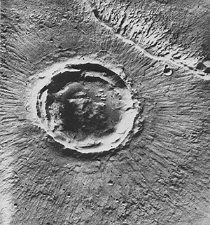
Still another large impact crater, Poona, has a remarkable uniform set of rays, equispaced over the full 360° around the rim:
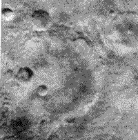
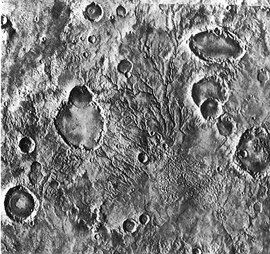
This next Viking scene, in the southern Highlands, seems to have both impact and volcanic craters. Some without ejecta beyond their rims, especially the elliptical one, are calderas. Several others have aspects more characteristic of degraded impact structures. This was an active region, with channels (either volcanic or stream) and other types of terrain.
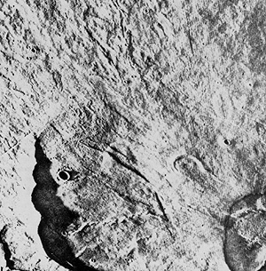
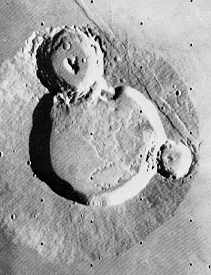
Now look at these three craters (Ulysses Patera):

Primary Author: Nicholas M.
Short, Sr. email: nmshort@epix.net
Contributor Information
Last Updated: September '99
Site Curator: Nannette Fekete