
Exploring the planets with spacecraft
began with the first trip to the Moon, two years after the former Soviet Union
set the space program into full motion with the launch of Sputnik I, in October
1957. In September 1959, Lunik (Luna) 2 impacted onto the lunar equator. The
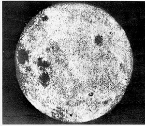
next month Luna 3 completed the first flyby of a planetary body, returning a
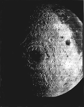
series of pictures of the lunar limb and a few views of the Moon's farside (left
image, below). Russia's Zond 3 sent back much better quality images of the farside
in their next mission, during July 1965 (right image).
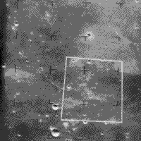
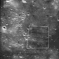
The first U.S. missions to the Moon were literally a crash program! Between 1961 and 1965, NASA launched three Ranger spacecraft like bullets to land (impact) onto the surface, destroying themselves in the process. Each Ranger had a television camera mounted in its nose that looked forward at the surface as it approached. They instantly telemetered progressively higher resolution images, until the moment of collision. The last images had resolutions of just a few meters. Here is a typical example, captured by the Ranger 7 camera. Each trapezoid frames the next scene in the succession:
One of the hallmarks of pre-Apollo lunar exploration was the Lunar Orbiter
program, in which five "photolab" spacecraft orbited the Moon between
August 1966 and August 1967. The former Soviet Union was actually the first
to orbit the Moon, in April of 1966, but its image returns were minimal. The
first three Lunar Orbiters used orbits inclined to the equator, and the last
two were in near-polar orbits. Each had a payload consisting of two cameras
holding 70 mm black and white film. One camera, with a wide angle lens, produced
photos whose resolutions ranged from 8 m to 150 m (26 ft to 492 ft) depending
on varying orbital altitudes. The second High Resolution camera improved these
values by a factor of eight but covered much smaller areas. The photos, developed
onboard as negatives, consisted of continuous strips, electronically scanned
by a "flying spot" passed into a photomultiplier tube that generated
an analog signal transmitted to Earth. On Earth, the signal drove an imaging
device which produced 35 mm positive strips that photointerpreters joined
into mosaics. The 2,000, or so, photos from these missions covered almost
the entire lunar surface, leading to detailed geological maps that have been
interpreted mainly through superposition and cross-cutting relationships (see
page 19-5). Here are four typical scenes:
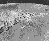
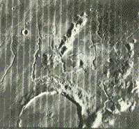
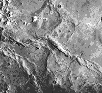
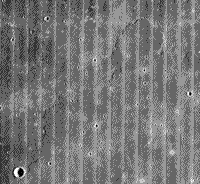
In the top left is an oblique view of the Apennine Mountains, with an uplifted crust that is similar to highlands in terrain characteristics, lapped by mare lavas from younger basalts that filled Oceanus Procellarum. The right photo above shows lava plains with sinuous rilles (flow trenches) in Oceanus Procellarum and part of crater Prinz. Each strip in the mosaic is 4 km (2.5 mi) wide.
The bottom left photo shows mare ridges (squeeze-ups) and another rille. The photo at the bottom (the fourth one) seemingly is a bland view of a flat mare surface, except that a close look discloses an upper flow unit that is marked by a distinct front that creates a lobe marking the advance. These structures clearly signify basin-filling by multiple extrusions.
19-9:
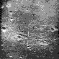
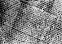
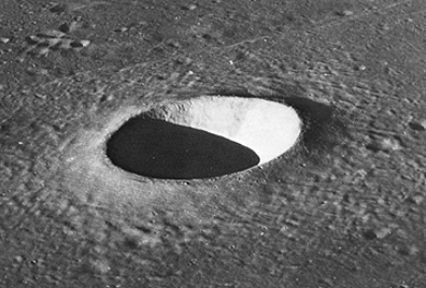
A primary goal for the Orbiters was high resolution photos of candidate landing sites. The scene below (5 km by 8 km, 3 mi by 5 mi) documents an elliptical site in Oceanus Procellarum, near the Apollo 12 touchdown point, considered acceptable despite a seemingly high crater density.
19-10:
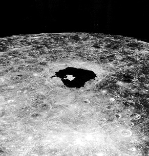
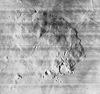
Constructed from photo strips acquired by Lunar Orbiter IV, at an average altitude of 2,700 km (1,678 mi), the next classic image shows the great lunar "bullseye," known as the Orientale Basin, a multiringed (perhaps four; the outermost with a diameter of 900 km [559 mi]) impact structure invaded by lavas (Mare Orientale). This feature lies just beyond the visible western limb of the Moon; the western Oceanus Procellarum is at the upper right.
19-11:
The Orbiters confirmed that cratering is a dominant process. But, signs of volcanism were ubiquitous: photointerpreters indentified some volcanic calderas, lunar rilles were either flow channels or collapsed lava tubes, domes were evident, and the floors of many large impact craters contained clear indications of volcanism, as shown in this Orbiter V view of the interior of Tycho. This view shows, on a larger scale, many features similar to those on terrestrial caldera floors:
One classic crater is the conspicuous Tycho (85 km rim-to-rim diameter) whose rays are visible to the naked eye; this implies that it is recent enough (in the last billion years) so that the ray material has not been obliterated. This is how it looks as seen by the Lunar Orbiter.
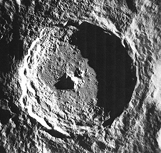
But, signs of volcanism were ubiquitous: some volcanic calderas were identified, lunar rilles were widespread, and the floors of many large impact craters contain clear indications of volcanism. The last is seen in this Orbiter V view of the interior of Tycho, which shows on a larger scale many features similar to those on terrestrial caldera floors (the lavas form in the lunar subcrust after the impact unloads rock from above causing hot rock below to melt and migrate to the new crater floor [much like blood flows to a surface wound]) :
19-12:
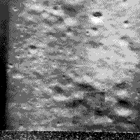
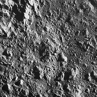
Constructive volcanic features are rare. Stratocones have not been found. A few domes, such as the individuals found in the Marius Hills or the domes atop a single larger dome at the Rumker Hills (shown below), are characteristic of upwellings of basaltic lavas.

Primary Author: Nicholas M.
Short, Sr. email: nmshort@epix.net
Contributor Information
Last Updated: September '99
Site Curator: Nannette Fekete