 |
 |
|---|---|
| Plate T-56 | Map |
|
|
|---|---|
| Plate T-56 | Map |
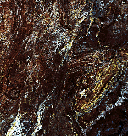
This Plate image is graphic proof of the ability of the Landsat MSS to capture geologic details where exposed bedrock is not masked by heavy soil or vegetative cover. The correspondence between different outcrop patterns visible in the image and their counterparts as geologic units is immediately evident when they are compared with a part of the 1:2500000 map of this region of northeastern Western Australia, reproduced below the Plate. Even better than the map, the image shows the effects of abrupt termination of certain units by several large faults.
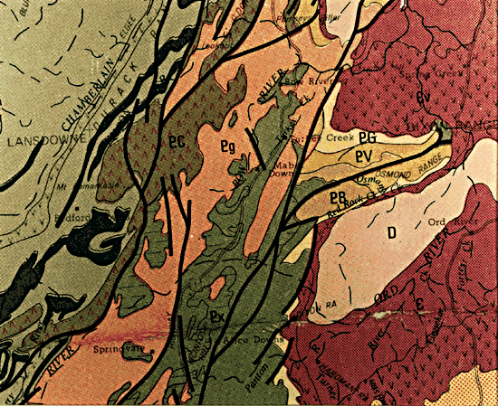
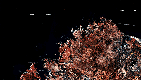
The Plate is centered about 700 km to the northeast of the eastern edge of the Pilbara Block shown in the previous Plate. The Kimberley Plateau contains parts of three major depositional basins, each of which also evolved into a distinct tectonic unit. Oldest is the Halls Creek Province. This strongly deformed Proterozoic unit wraps around the somewhat younger, less deformed Kimberley basin to the north. Some workers subdivide the Halls Creek Province into the Halls Creek Trough, trending northwest, and, farther east, the Sturt Platform, trending north-northeast. The youngest tectonism affected the Ord basin of Devonian age to the east. These basins are shown in wider perspective in a mosaic (Figure T-56.1) that includes almost all of the Kimberley basin, the upper parts of both arms of the Halls Creek Province, and the northern tip of the Canning basin (left). The upper half of the Plate scene occupies a portion of the mosaic near its lower right corner. This part, shown in the Plate, displays the Halls Creek Group, of "Nullaginian age," that includes basic volcanics, graywackes, shales, and limestones/dolomites. These are intruded by ultrabasic rocks, gabbros, and granites of the Lamboo complex. Accompanying metamorphism ranges from the greenschist to the granulite facies. The oldest units (Px) are felsic volcanic rock dated at 2050 Ga.
| Figure T-56.1 | Figure T-56.2 |
|---|---|
 |
 |
Rocks of the Carpentarian System (1.8 to 1.4 Ga), deposited in the Kimberley basin, seem to have equivalent sequences in the mobile belts comprising the Halls Creek Province but show fewer unconformities. Rocks of Nullaginian age are buried in the Kimberley basin. The basal units in the Kimberley basin consist of about 2000 m of silicic volcanic and tuffs that lie unconformably over the Halls Creek Group. Younger Carpentarian units, the Speewah, Kimberley, and Bastion Groups that reach an aggregate thickness of about 5700 m of sandstones, arkoses, shales, and stromatolitic dolomites, lie mainly to the northeast of the scene. The entire sequence has been intruded by sills of the Hart dolerite, several of which are strongly expressed in this scene. Members of the Adelaidean System occur in scattered outliers in both the Sturt Platform and the Kimberley basin. In this scene, the unit marked PV (~1100 Ma) lies against a wedge of an older unit (PB, 1600 Ma); a still younger unit (PG, 700 Ma), containing tillites, outcrops just to the north.
Cambrian units, consisting of basal basalts flows (Ev) and sandstones and dolomites (E), rest unconformably along the eastern flank of the Sturt Platform. In the lower right corner of the scene, these dip gently to the southeast. Between the two outcrop areas of this Cambrian sequence is a central area of Devonian (D) sandstones, conglomerates, and reef limestones. The false-color yellow tones of many of these units suggest that they are actually reddish (containing iron oxides).
Three major orogenies affected Precambrian rocks in this scene: one of epi- "Nullaginian" age (~1800 Ma), the second during the Carpentarian time interval, and the last near the close of the Adelaidean event. Additional deformation took place in the Paleozoic.
| Figure T-56.3 |
|---|
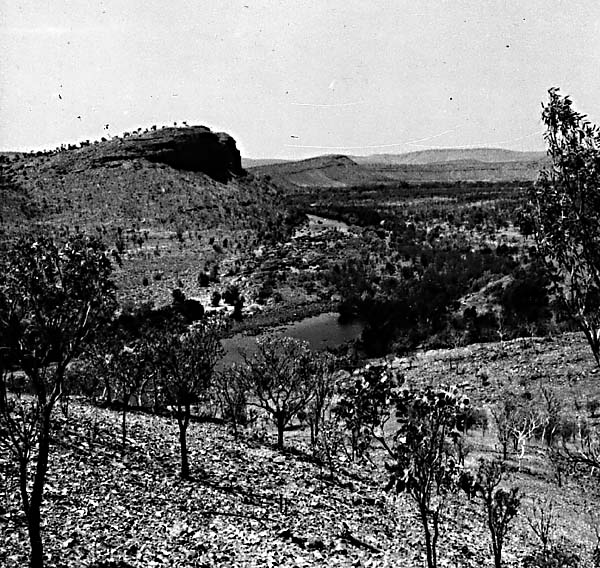 |
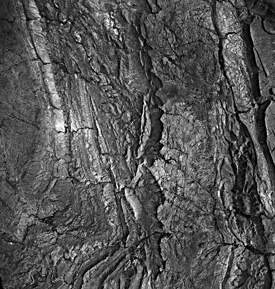
A high-altitude aerial photograph (scale = 1:86000) provides a closer look at some of the structural landforms. In Figure T-56.2, deformed units, composed of Mid- to Late-Proterozoic and Early Paleozoic sedimentary rocks, stand out as bench-like landforms. These rocks include jointed sandstones, siltstones, shales, dolomites, and tillites. Some units form impressive scarps. Resistant beds clearly show an eastward (to the right) dip through most of the view, except along the western edge where they dip west off the domal structure. Many of the ridges are really escarpments, or cuesta-like. A prominent erosional escarpment can be seen along the right (east) side of the photograph. Drainage channels are discordant in part, where they cut across the structure. Figure T-56.3 shows the terrain along the Ord River from the ground. (NMS) Reference: David (1950). Landsat 1377-00573, August 4, 1973.
Continue to Plate T-57| Chapter 2 table of Contents| Return to Home Page| Complete Table of Contents