 |
 |
|---|---|
| Plate T-59 | Map |
|
|
|---|---|
| Plate T-59 | Map |
Shields, exposed parts of thick sections of crystalline rocks that comprise the core of continents, contain some of the most complex and interesting geology on Earth. Many of these areas are spectacular when viewed from space. Most of these regions have been geologically stable for a long time with the last major tectonic or metamorphic event having occurred before the beginning of the Paleozoic. Because of this great antiquity, "Precambrian" is almost automatically associated with shields.
Crystalline rocks comprise the bulk of the rocks exposed in shields. Most of these rocks have experienced repeated cycles of deformation, intrusion, and metamorphism in which these processes acted while the rocks were buried at considerable depth. This implies that flow folding and other low-viscosity types of deformation dominated during much of a cycle. Repeated metamorphism and intrusion have affected a substantial degree of welding and integration (and even homogenization) of rocks that were initially quite different in composition and competence. Cratonic shields have served as nuclei for continuing continental accretion as other shields, island arcs, fold belts, etc. are driven against their margins. Most shield rocks record structural over-printing from several tectonic cycles. Later uplift and erosion superimpose tensile fracture patterns over other patterns present. In many areas, intrusion of dikes or equidimensional bodies accompanied a tensile phase (see Plate T-60, Plutons). Details of lithology and history (tectonic, thermal, erosional, etc.) are different from shield to shield, but there are several important general similarities that lead to a characteristic "shield" geomorphology. This "shield" morphology includes complex structural patterns, low relief, and exhumed surfaces.
| Figure T-59.1 | Figure T-59.2 |
|---|---|
 |
 |
Plates elsewhere in this chapter (Plates T-15, T-16, T-33, T-34, T-40, T-47, T-55, and T-56) show a variety of these features from a number of different shields of the world, including Australia, Africa, India, and Canada.
Many shield areas exhibit an almost featureless topography of low relief as a result of long exposure to erosion and the lack of differential resistance of the complex crystalline rocks to erosion. Unconformable strata now overlie many of these ancient surfaces or once covered them in the past. Some of the most prominent characteristics of the shields are projected up through this cover. Erosion of these cover rocks exhumes features of the old erosion surface. Commonly, the most conspicuous features are ancient fractures that extend for many kilometers and that are often strongly etched.
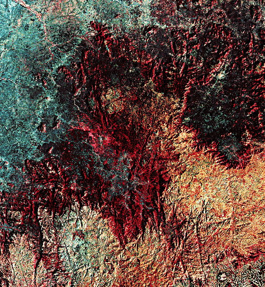
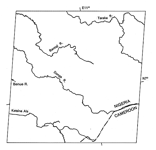
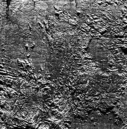
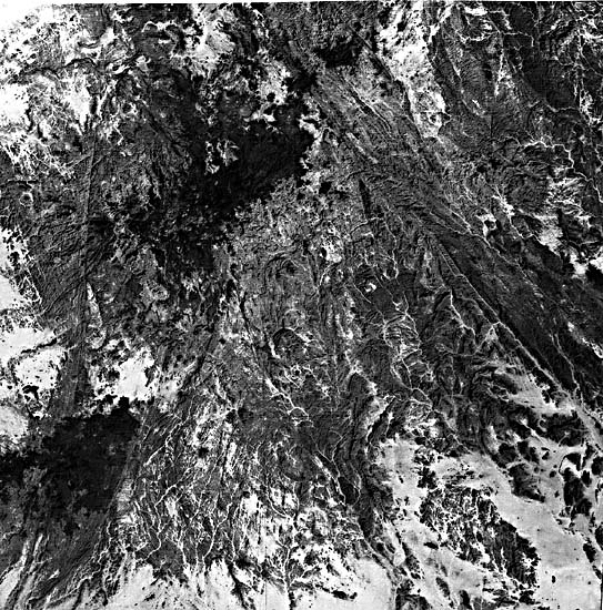
The Plate image brings out the bold fracture patterns visible in the Nigerian shield lying astride the Nigeria/Cameroon border. These are well-developed near the scarp bounding, an old erosion surface covered in places with younger basalts, At least six systems of joints are expressed in the basalt plateau; some of these fractures are inherited (carry upward from the shield surface). In this semiarid environment, vegetation grows more profusely in the fractures, which act as conduits for ground-water movement, making them stand in strong contrast to the heavily cultivated plateau and surrounding lowlands. Close examination of the fractures reveals that several of the sets are rather strongly curved, whereas fractures of other sets are straight over considerable distances. This condition is common to most shields. (Fracture sets in younger terrain tend to be straight.) Curved fractures may reflect inherently curved strain trajectories of the initial stress field, postfracturing deformation, or fracture associated with domal uplifts or intrusive bodies. Compare the Landsat image with a Side-looking Airborne Radar (SLAR) image of the same area (Figure T-59.1). The latter reveals substantially more detail of actual relief in the area by virtue of shadowing and the sensitivity of SLAR to changes in slope angle. Both the upland and lowland have more relief than the Landsat image suggests.
| Figure T-59.3 | Figure T-59.4 |
|---|---|
 |
 |
In southern Brazil, west of São Paulo (Figure T-59.2) Late Precambrian crystalline rocks, part of the Atlantic Shield, are being exhumed (along the right side of the Landsat image), as the Paleozoic cover is stripped away. Note the scarp with re-entrants along the arcuate eastern edge of this unconformable cover, erosion surfaces of low relief to the west, and a prominent northwest pattern of fractures (some dike-filled) in the shield rocks that passes through the cover terrain to the west.
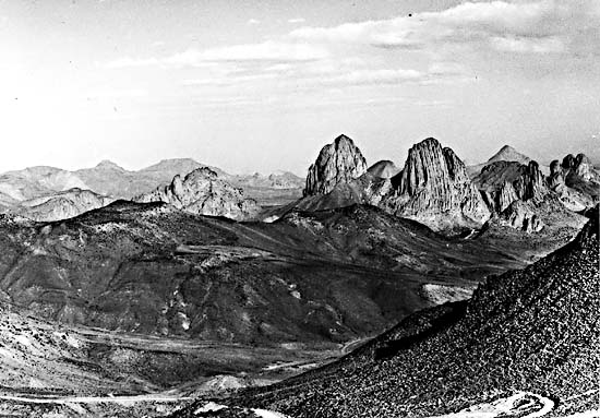
The Ahaggar (Hoggar) Mountains show many of the features of shields, complex fracture patterns, juxtaposition of different trends, equidimensional posttectonic intrusions, and complex foliation patterns (Figure T-59.3). Most of the scene is underlain by Precambrian rocks of the Suggarian Zone (note faults trending northwest; rocks of the Pharusian Zone occupy the western margin. Here, only a few remnants of younger lava flows (dark splotches) mask the older rocks. Jointed volcanic necks and associated flows add to the ruggedness of the terrain (Figure T-59.4). Many joints are strongly etched. Not only has faulting determined the path of several linear valleys, but many streams also show the effect of jointing in the rectangular patterns (including right angle bends) in their channels. (JRE) References: Burke and Dewey (1973), Furon (1963), Pritchard (1979). Landsat 21395-08373, November 17, 1978.
Continue to Plate T-60| Chapter 2 table of Contents| Return to Home Page| Complete Table of Contents