 |
 |
|---|---|
| Plate V-20 | Map |
|
|
|---|---|
| Plate V-20 | Map |
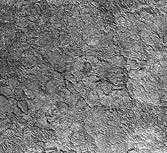
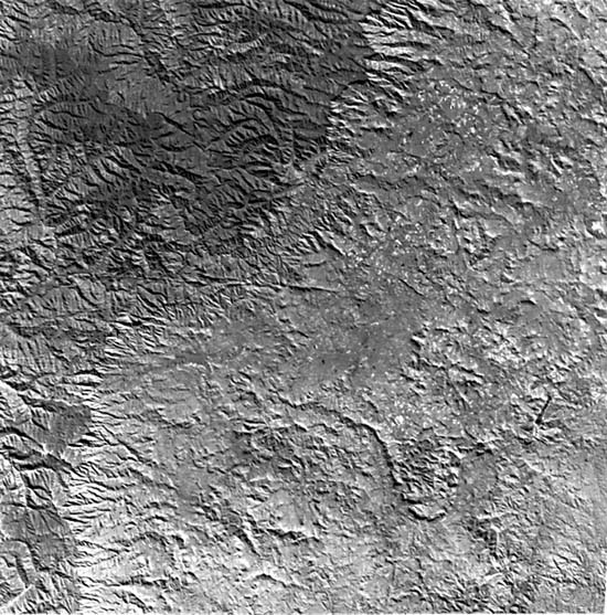
This Plate encompasses part of the southeastern Great Karroo Basin in the Cape Province of South Africa (Furon, 1963) to the southwest of Lesotho. The Great Kei River, visible near the lower right corner, has formed conspicuous entrenched meanders.
Southwest of the image are the east-west-trending Cape Ranges, a Paleozoic fold belt deformed in the Permian. Unexposed basement within the scene is part of the Precambrian Namaqua-Natal mobile belt (gneisses-granulites) peripheral to also-covered much older Kaapvaal Craton block. This ancient terrane lies at the base of a northwest-trending basin that received up to 8000 m of sediment between Late Carboniferous and Early Jurassic times. Four divisions of the basin infilling sediments of the Karroo System comprise a supergroup of depositional units. The older Dwyka and Ecca units do not outcrop in the scene. Most of the southern two-thirds of the image is occupied here by the Beaufort Series, a stratigraphic succession of arenaceous and argillaceous fluvial channel sands laid down during the Middle Permian/Early Triassic. The Beaufort Series is noted for its fine assemblage of amphibian and reptilian remains and land plants, indicating a depositional environment of low marsh surfaces periodically affected by shallow seas (Kitching, 1978). Parts of the northern third of the scene are topped by sediments of the Stormberg Series (type locality at the Stormberg (2168 m)), including white and red sandstones and grayish shales, that contain distinctive dinosaur remains. The youngest part of the Karroo succession is represented by the Drakensberg Volcanics (Early Jurassic), basalt flow lavas over basal tuffs and agglomerate. In the top right of the image, a mountainous plateau (elevation to 2700 m), with its fringing escarpment, is capped by this unit. A second escarpment, cut into the Stormberg Series, crosses the image (see index map); a lower cliff (dashed line) bounds rugged terrain below the Great Kei River.
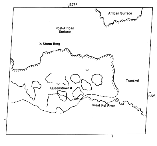
| Figure V-20.1 | Figure V-20.2 |
|---|---|
 |
 |
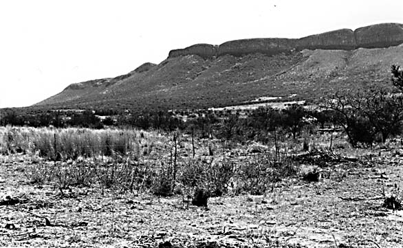
Roughly coeval with the Drakensberg plateau basalts are the Karroo dolerites, lavas with calcic plagioclase laths, pyroxene, and sometimes olivine. These lavas were intruded at hypabyssal depths into the Beaufort Series. They inserted first through steep dikes and then concordantly along bedding planes (usually in shales or at shale contacts) as sills. Many sills are a few meters thick at most, but thicknesses up to 300 m are reported. More than 570 000 km2 in this part of the Karroo basin were affected by this intrusion, which actually covers much larger areas in various parts of southern Africa. In the image, the sills are more abundant in a lowlands between two major scarps.
Distinctive landforms (called "koppies" by the South Africans) have developed from these sills. On the ground, the sills usually appear as cappings for the mesa- like hills (Figure V- 20.1).In the satellite image, the koppies tend to stand out as curved (crudely circular to irregular but usually closed) dissected ridges with both outward- and inward-facing scarps. They ring Beaufort Series sedimentary units exposed within the curved ridges and beyond. These units have been gently folded with the curvature of the caprock contributing to the present interior "basins" tapping some koppies. Although this folding postdates the close of the deformation that produced the Cape Ranges, it may relate to continuing compression. Intrusion during subsequent regional tension may have been under post- orogenic conditions similar to those leading to injection of Triassic trap lavas in the eastern Appalachians. The dolerites were probably emplaced within the time interval in which the supercontinent of Gondwana began to break apart. Their mobilization from depth into shallow sills and surface outpourings appears to be consistent with comparable lava extrusions during early stages of rifting and consequent spreading (Bristow and Saggerson, 1983).
| Figure V-20.3 |
|---|
 |
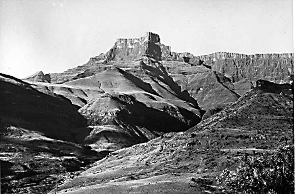
At the time of the Gondwanaland split, a general erosion surface-describable both as a pediplain and a peneplain-had been imposed on this part of the supercontinent (King, 1951) A remnant of this surface may be preserved in terrain seen at the top of this image. The next cycle of erosion, the post-Gondwana, continued into the Cretaceous. Subsequent cycles, named the African (Early Cenozoic) and post-African (Late Cenozoic), affected areas around this scene. Especially prominent is the south- facing Great Escarpment (near bottom of image), which overlooks the Cape Ranges. This escarpment takes on a dramatic face in eastern Lesotho and neighboring Natal, where its front displays relief up to 1500 m or more (Figure V-20.2). The appearance from space of this volcanic terrain is presented in Figure V-20.3. The upper or African surface was developed on Karroo volcanics. The lower but younger post-African surface that extends almost to the coast below Durban was produced by erosion following regional uplift. Landsat 1049-07315-6, September 10, 1972.
Continue to Plate V-21| Chapter 3 Table of Contents.| Return to Home Page| Complete Table of Contents