 |
 |
|---|---|
| Plate V-26 | Map |
|
|
|---|---|
| Plate V-26 | Map |
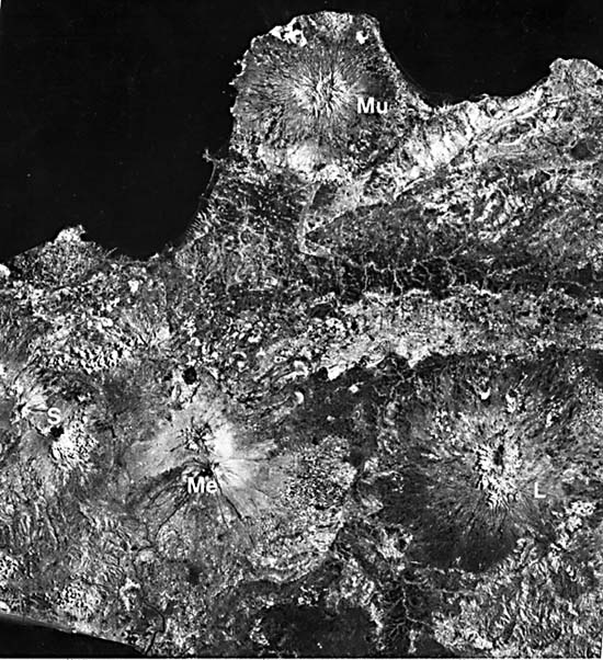
Java, the main island of the Indonesian archipelago, is a prime example of an island arc terrane that is still in process of evolution (Hamilton, 1979). The Indonesian landmass, convex to the southwest, lies next to the northward- dipping subduction zone along the line of convergence between two colliding oceanic plates. Behind the outer arc rises a line of active and Quaternary (dormant/extinct) andesitic volcanoes extending some 4200 km from Sumatra on the west through the Sunda Islands and those in the Banda Sea to the east. The main islands, including Java, are relatively recent uplifts of geosynclinal sediments, deposited on older terrane, that continue to emerge on the Asian mainland side of the southernmost segment of the Eurasian Plate now being underthrust by the Indian/Australian plate. The volcanoes, mostly composite stratocones, run along a narrow axis through the island center.
| Figure V-26.1 | Figure V-26.2 |
|---|---|
 |
 |
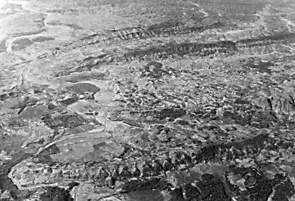
In more detail, this part of the Indonesian arc system, typical of the islands as a whole, consists of the following segments from north to south (Hamilton, 1979):
From the above, the general pattern of sedimentation and structural deformation with age shows a progressive northward shift toward younger events. Volcanism likewise shifts to the north from more basic to more silicic. Along the main volcanic belt, most volcanic rocks are pyroxene andesites and high- Al basalts. Off the main belt, Volcano Muria, now inactive, has produced leucite-bearing eruptive rocks of potassic alkalic composition. The explosivity index (ratio of pyroclastic tephra to total expelled materials) for the Indonesian volcanoes ranges up to 99, the highest values along the Pacific Ring of Fire (Macdonald, 1972).
| Figure V-26.3 |
|---|
 |
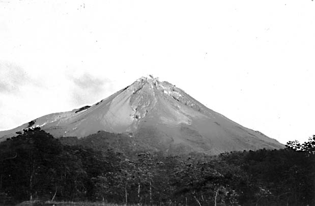
In the volcanic landforms classification devised by van Bemmelen (1949) for Indonesia, several of the volcanoes (Merapi, Merbabu, Lawu, Ungaran) in this scene have experienced eruptions involving partial collapses triggered by sideward sliding along crescentic rifts or "barrancos" Volcano Ungaran also has developed a small central caldera developed after loss of support following magma extrusion. Some of these volcanoes have proved to be especially dangerous to life and property. Merapi (Figure V-26.2) erupts frequently, with lava flows, nuées ardentes, and mudflows providing hazards to the nearby densely populated region.
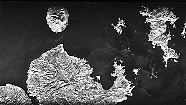
Eastward, the same geologic terranes extend through the Lesser Sunda Islands. Figure V-26.3 is a SIR-A radar image of parts of the Sunda Islands. Mt. Maria on Sumbawa (south) is now extinct and is much dissected. Mt. Api on Sangeang is still active. A remnant of a caldera (similar to the present appearance of Krakatoa) is visible along the north shore of the small Banta Island. Landsat 1067-02145-7, September 28, 1972.
Continue to Plate V-27| Chapter 3 Table of Contents.| Return to Home Page| Complete Table of Contents