 |
 |
|---|---|
| Plate F-10 | Map |
|
|
|---|---|
| Plate F-10 | Map |
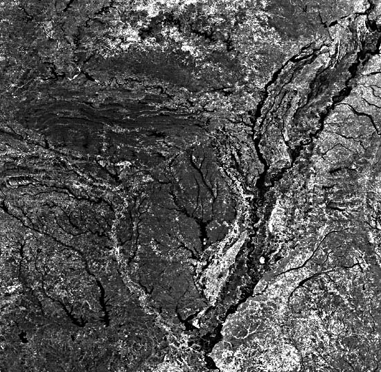
This scene covers most of the Mississippi River valley from just above the delta in Louisiana (bottom) to Cairo, Illinois, at the junction with the Ohio River (upper right). The image was produced by the Heat Capacity Mapping Mission (HCMM) flown by NASA in 1978-1980. It is a visible-near-infrared picture that corresponds roughly to the panchromatic rendition of familiar black-and-white aerial infrared photographs. The image is especially interesting for comparison to the daytime image in the thermal infrared band (Day- IR) (Figure F-10.1). On the latter, relatively cooler temperatures are indicated by dark tones. The thermal contrasts highlight some important rock and soil types that reflect the fluvial evolution of the Mississippi valley.
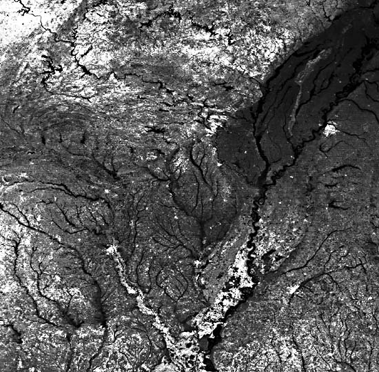
Macon Ridge, near Monroe, Louisiana, appears as a prominent bright area on the visible-near-infrared (VIS) HCMM scene, but it is dark (cool) on the daytime thermal-infrared (Day-IR) scene (Figure F-10.1). This may result from evapotranspiration of crops on the rich soils of this alluvial surface. Similarly, Crowley's Ridge in the northeast part of the scene is almost invisible on the VIS scene, but it stands out prominently on the Day-IR picture. The ridge is underlain by Tertiary sedimentary rocks. Note that several cities also stand out prominently because of their warm thermal signatures on the Day-IR picture (Figure F-10.1).
| Figure F-10.1 | Figure -10.2 |
|---|---|
 |
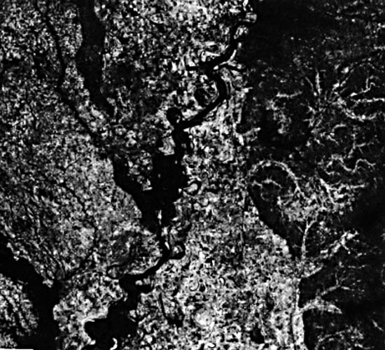 |
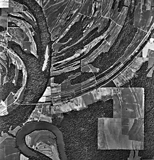
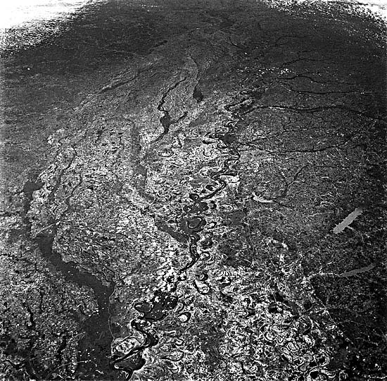
A Landsat TM scene of the Yazoo Basin is shown in Figure F-10.2. A cross section through the floodplain would show the highest elevations at the crests of natural levees flanking the river channel. The levee backslopes flatten away from the channels toward backswamp basins, as in the Yazoo area. These basins receive the fine-grained overbank deposits of floods. High water tables in the basins promote irregular lakes and swamps. Oxbow lakes, produced by neck cutoffs on meander bends, and the scroll topography of meander migration mark the main channelway of the active Mississippi River through a basin area (Figure F-10.3). Oxbows filled with clay can form resistant plugs that hold the river to its general course across the floodplain.
The buildup of levee crests may reach 10 m or more above adjacent backswamps along certain portions of the Mississippi. Because of this, less energetic tributaries such as the Yazoo River (center of Figure F-10.2) may flow great distances parallel to the main river before they breach the levee to join it. During floods, the main river may breach its own levee, spilling bedload through the gap to form a crevasse splay of sandy deposits in the back-swamp area. Occasionally, the main river may completely abandon an entire channel trend by breaking into the backswamp and initiating a new course in the lower elevation portions of its floodplain. Such avulsions occur after several centuries have resulted in immense disparities between the levee heights and the adjacent backswamps.
| Figure F-10.3 | Figure F-10.4 |
|---|---|
 |
 |
A regional view from Apollo 9 of the central Mississippi valley (Figure F-10.4) illustrates the major elements of Late Quaternary fluvial events in the region (Baker, 1983). At the onset of the Wisconsin glacial stage, about 80 000 years ago, the sea level began to fall in the Gulf of Mexico. This induced incision in the lower Mississippi valley, while simultaneously the continental glaciation of the northern headwaters induced aggradation in the upper Mississippi. Prominent braided stream surfaces show that the Mississippi then flowed through the Western Lowlands region west of Crowley's Ridge (Saucier, 1974). Part of the same aggradation cone is also preserved as Macon Ridge. The latter actually dammed the lower Ouachita River, forming a Late Pleistocene lacustrine plain near Monroe, Louisiana (Saucier and Fleetwood, 1970).
About 17 000 years ago, the central Mississippi valley experienced a major diversion. The river abandoned its valley train in the Western Lowlands and cut a gap across the northern end of Crowley's Ridge. The zone of outwash deposition then shifted eastward to the present alluvial valley. Also at this time, the sea level began to rise because of globally melting ice sheets. The lower Mississippi valley aggraded, filling the irregular trench created by its earlier incision. Coarse-:grained braided stream deposits were gradually buried by fine-grained sand, silt, and clay as the glacial influence waned and the river assumed its modern meandering character. HCMM 344-19040-1, April 5, 1979.
Continue to Plate F-11| Chapter 4 Table of Contents.| Return to Home Page| Complete Table of Contents|