 |
 |
|---|---|
| Plate F-11 | Map |
|
|
|---|---|
| Plate F-11 | Map |
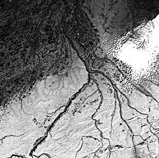
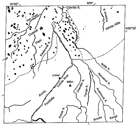
This scene is centered on the Colville River near Umiat, Alaska. The Colville is the largest of the rivers draining from the Brooks Range to the Arctic Ocean. It assumes an east-trending course for 360 km along the northern Brooks Range before turning north downstream of Umiat, at the center of the picture. This early summer scene shows active streamflow across its prominent braided course. During the winter, when the mean daily minimum temperature here is -29°C (-20°F), the gravel flats of the river become covered with sheets of anchor ice that freeze to the riverbed.
The Colville River crosses the Arctic Coastal Plain at the top center of this scene, changing from a braided pattern to a meandering one. Typical scroll topography and oxbow lakes can be seen in the downstream reaches. At the very top of the picture, the first distributary channels of the Colville delta are visible.
| Figure F-11.1 | Figure F-11.2 |
|---|---|
 |
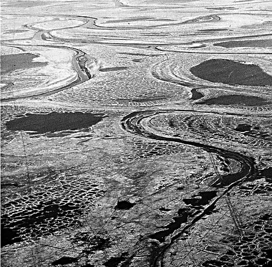 |
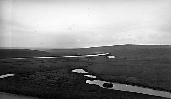
The coastal plain is a relatively smooth plain separated from the Arctic Foothills by an abrupt scarp 15 to 60 m high (Wahrhaftig, 1965). Drainage is extremely poor, with marshy conditions prevailing in summer, as shown here. The small streams west of the Colville, such as Fish Creek, display exceptionally high sinuosity and have valleys shallowly incised into the coastal plain. Elongated thaw lakes are prominent at the upper right of the scene. Permafrost underlying the coastal plain exceeds 300 m in thickness. Higher resolution pictures would reveal a network of ice-wedge polygons on the coastal plain surfaces.
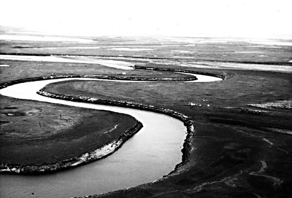
Figure F-11.1 shows a typical Arctic coastal plain river with tortuous meanders. The polygonal pattern of ice wedges in the permafrost shows the influence of ground ice in this area. Subsidence over melting ground ice contributes to slope adjustments by these rivers.
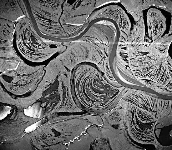
Figure F-11.2 shows a larger river in the area with prominent scroll topography and degraded ice-wedge polygons. River meandering in permafrost may produce steep calving banks by thermal erosion of ground ice. Steep banks may occur on both the inside and outside of meander bends (Figure F-11.3).
East of the Colville River, the coastal plain is dominated by scattered groups of low hills (Figure F-11.4). This area, known as the White Hills, is largely obscured by cloud cover at the upper right of the image. A reduced number of thaw lakes also characterizes this region.
| Figure F-11.3 | Figure F-11.4 |
|---|---|
 |
 |
The Arctic Foothills are shown in the lower half of this scene. The northern foothills rise from an altitude of about 100 m at the Coastal Plain margin to 200 m at the Brooks Range foothills. The latter display local relief of 600 m or more, with buttes, knobs, mesas, and strike-oriented rivers. Diverse sedimentary rocks of Devonian to Cretaceous age underlie this terrain. Tight folding and overthrusting to the north produce the east-west grain in the topography. The folds are locally truncated by regional erosion surfaces. Eolian silt overlies much of the foothill topography.
Much of the Colville River basin would be classified as polar desert. Mean annual precipitation is between 200 and 100 mm, predominantly as snow. Despite elevation of 2500 m in the Brooks Range, modern active glaciers are rare.
Alaskan rivers that drain active glaciers have much larger sediment loads than those that do not. Thus, the Colville River delivers a load of only 5 to 10 million metric tons per year to the Arctic Ocean. In contrast, the Copper River, which drains the numerous glaciers of the Wrangell Mountains and Chugach Mountains, yields 70 million metric tons from a similar-sized drainage basin. Even more impressive is the fact that the Copper River, with a drainage area of 60000 km2, yields more sediment than the Yukon River, with a drainage area of 840000 km2. Landsat 1344-21290-7, July 2, 1973.
Continue to Plate F-12| Chapter 4 Table of Contents.| Return to Home Page| Complete Table of Contents|