 |
 |
|---|---|
| Plate F-13 | Map |
|
|
|---|---|
| Plate F-13 | Map |
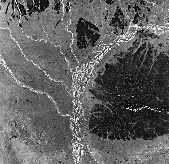
The Brahmaputra is one of the world's great rivers. During its 1962 flood, it achieved a discharge of 72460 m3/s (2560420 cfs). However, its minimum recorded dry-season flow was only 3280 m3/s (116000 cfs) in 1960. Draining an immense region of the Himalaya Mountains (see Plate T-46), the Brahmaputra flows in a great arc before reaching the head of the Bay of Bengal. There, just to the south of this Landsat scene, it combines with the Ganges and the Meghna to form the world's largest delta (Plate D-00), which covers an area of 60000 km2 (23000 mi2). The mean water surface slope of the Brahmaputra is 0.07 m/km (0.35 ft/mi).
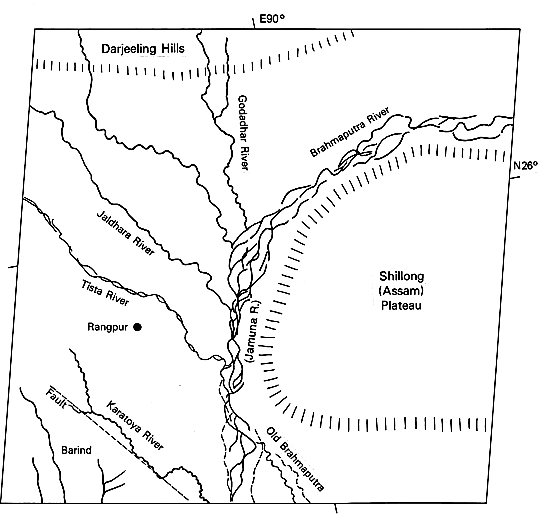
This scene shows the curve of the Brahmaputra around the Shillong Plateau, also known as the Assam Plateau, which consists of horizontal Eocene sandstone and limestone overlying Precambrian crystalline basement. The plateau rises to elevations of 1400 to 1800 m. South and west of the plateau is the Bengal Basin, which is floored with Quaternary sediments contributed by the Brahmaputra and Ganges Rivers.
This picture shows river conditions approximately 1 month after the end of the monsoon season. The Darjeeling Hills at the foot of the Himalaya Mountains, which serve as the headwaters for the Tista, Jaldhara, Godadhar, and other major Brahmaputra tributaries, receive up to 3000 mm of rain during the summer monsoon. The rains begin in May or early June, and the wet season lasts to October. From June to September, the rains occur nearly daily. The river responds by a rapid increase in discharge that peaks in mid-June. A period of fluctuating high flow follows, usually with peaks in July and September. The last peak is followed by a long recession into December and January.
| Figure F-13.1 | Figure F-13.2 |
|---|---|
 |
 |
The highest discharges for the smaller rivers in this region occur following tropical storms. One such storm in the headwaters of the Tista River yielded local totals in excess of 1000 mm for October 2-5, 1968 (Starkel, 1972). Throughout the Darjeeling Hills, intensities of 50 mm/hr were achieved for prolonged periods. The discharge of the Tista River rose to exceed 20000 m3/s in the vicinity of Jalpuiguri following these rains.
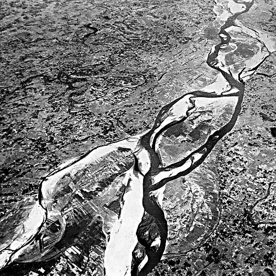
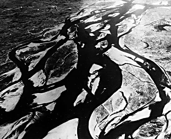
The rises and falls of the river lead to a dynamic sequence of channel adjustment throughout the year. Several varieties of bank failure occur during these flow changes, resulting in channel movement as great as 800 m (2600 ft) per year (Coleman, 1969). The most significant bankline modifications occur during falling river stage, when excess bedload (predominantly fine sand) is deposited as channel bars, inducing changes in local flow direction and migration of the thalweg in a classic braided pattern (Figure F-13.1 and Figure F-13.2). These sandbars, which are called "chars" in Bangladesh, are diamond-shaped and appear as dark islands on the Landsat scene. The dark tones result from vegetation growth induced by the local inhabitants (Figure F-13.3). Once exposed following a flood, the arable land of a char is quickly occupied and put under cultivation.
| Figure F-13.3 |
|---|
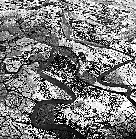 |
The sandbars of the Brahmaputra shift even at moderate flow. The relatively fine bedload (mean size 0.172 mm) can be entrained at relatively low velocity. Large floods are capable of inducing spectacular changes in the river cross section and in channel configuration. Major shifts of channel course can occur by avulsion, as one whole channel route is abandoned in the Bengal Basin. The "Old Brahmaputra," seen at the bottom center of the image, is a pre-1800 course of the river that was so abandoned. During major floods of the modern river, some flow is still directed down this older course, producing its visible meandering pattern.
The southwest corner of the scene shows a region known as the Barind. It consists of relatively old Pleistocene alluvium, which has a bright tonal response on the imagery because of its oxidized state and its distinctive vegetative cover. This older alluvium has been elevated by a Quaternary normal fault upthrown to the southwest. The fault partially controls the course of the Karatoya River. Drainage south of the fault is southwestward, consistent with the tilting action by the fault. Relatively high seismic activity and the deformation of Quaternary alluvial units indicate an unusually active neotectonic influence on the rivers of this region. Landsat 1123-04010-5, November 23, 1972.
Continue to Plate F-14| Chapter 4 Table of Contents.| Return to Home Page| Complete Table of Contents|