 |
 |
|---|---|
| Plate F-25 | Map |
|
|
|---|---|
| Plate F-25 | Map |
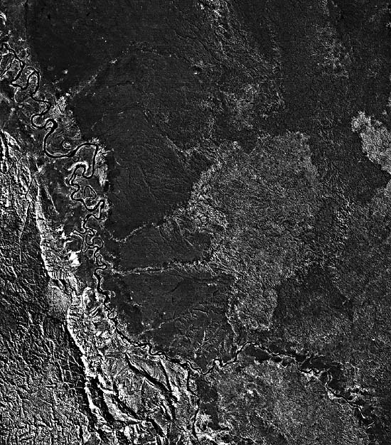
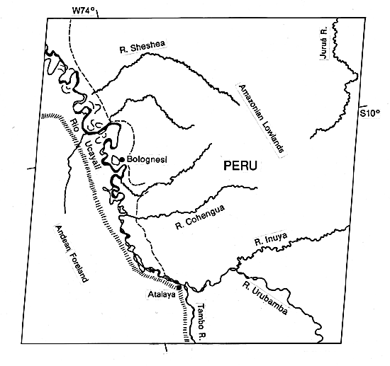
This specially processed Landsat scene shows the Ucayali River in central Peru, immediately east of the high Andes at Cerro de Pasco. The Ucayali originates at the confluence of the Tambo and Urubamba Rivers. The latter both have low to moderately sinuous channels. The Urubamba contains several vegetated islands and some nonvegetated channel deposits, but point bars are not apparent. The river drains the folded and faulted Andean Foreland in the vicinity of the famous Inca sites of Machu Picchu and Cusco.
Downstream of the confluence, the Ucayali displays a progressive change in channel pattern. For the first 50 km, it has a complex of anastomosing channels, meanders, abundant nonvegetated islands, and elongate vegetated islands. Downstream of that point, islands become far less abundant, and meandering dominates. Bright spots on the image along the river show that nonvegetated channel deposits are less abundant and occur primarily as point bars. Since no major tributaries enter this reach, the change in channel pattern for the Ucayali probably results from downstream decreases in channel slope and sediment size. The river may experience the threshold change from braiding to meandering that was postulated by S. A. Schumm (1977) on the basis of flume experiments.
| Figure F-25.1 |
|---|
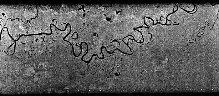 |
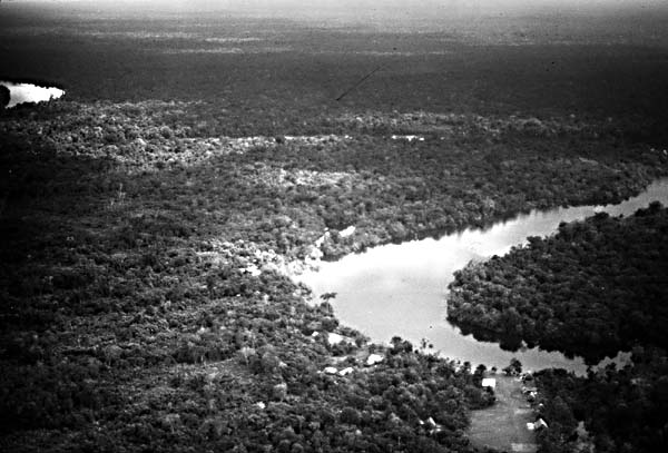
A change in floodplain character accompanies the change in channel pattern for the Rio Ucayali. The upper low-sinuosity anastomosing reach does not have a clearly developed floodplain. Where meandering begins, there is evidence of lateral migration. Abandoned meanders, scroll topography, and backswamp features all appear. The general tone of vegetation on the floodplain becomes distinctly lighter than that of the surrounding forest. Moreover, the floodplain and the meander tract both widen in a downstream direction. Figure F-25.1 is a SIR-A radar image of the lower Ucayali River (350 km north of Atalaya) showing how the pattern of meander migration continues downstream. Figure F-25.2, taken of a tributary to the Ucayali River near Iquitos, Peru, shows dense vegetation of the rainforest and its relationship to channel geometry.
| Figure F-25.2 |
|---|
 |
Because the Ucayali parallels the Andean foreland, it separates the Amazon lowlands of the north and east from mountainous terrains to the west and south. The transitional tropical-to-mountain environments of the foreland are prolific sources of sediment. Note that the small tributaries that descend from the highlands are closely spaced and display relatively low sinuosity until they join the Ucayali in the lowlands. In contrast, the tributaries flowing from the tropical lowlands are widely spaced and highly sinuous. The predominant sediment loads are entering from the west.
The Ucayali derives its enormous sediment load from the Andean foreland and feeds it to the Solimões River. However, it is clear from studies of ancient sediments that both the Juruá (upper right of image) and Purus Rivers formerly drained the same sections of the Andean Foreland. It is likely that the Ucayali has captured the mountainous headwaters of these rivers, resulting in a profound change in their sedimentation histories.
Professor Jean Tricart (1977) attributes the numerous cutoffs on Amazon basin streams to the throughput of suspended load. The sand that settles out on concave banks is easily eroded, especially through undermining at rising flood stages. However, deposition of suspended load on convex banks is minimal. Meanders migrate and distort until they fail through neck cutoffs. Landsat 78224-14193-7, August 12, 1978.
Continue to Plate F-26| Chapter 4 Table of Contents.| Return to Home Page| Complete Table of Contents|