 |
 |
|---|---|
| Plate F-8 | Map |
|
|
|---|---|
| Plate F-8 | Map |
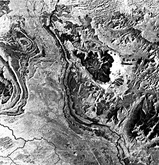
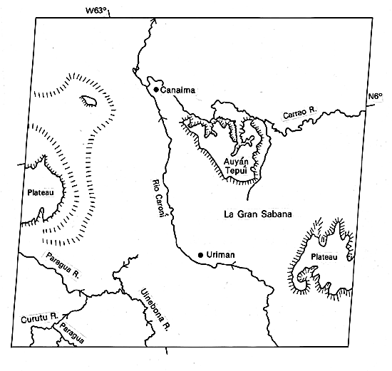
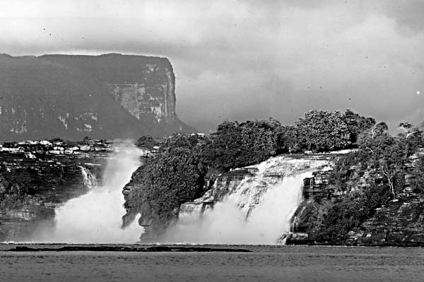
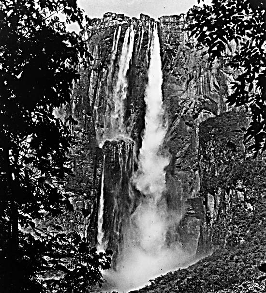
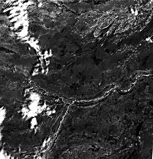
This scene shows portions of the Rio Caroní drainage in the Guiana Highlands of southeastern Venezuela. The Caroní flows northward, joining the Orinoco 250 km north of this image. The bedrock in this region consists predominantly of Precambrian crystalline rocks comprising the Guiana Shield. These are unconformably overlain by a thick section of generally flat-lying Mesozoic sedimentary rocks, known as the Roraima Series. The latter comprise striking flat-topped mesas and small plateaus in this region, known as La Gran Sabana. One of these mesas is Auyán-Tepuí, which rises to an elevation of 2950 m (Figure F-8.1). Local relief exceeds 1200 m, and from the edge of this mesa, Angel Falls (A) drops nearly 1000 m to a tributary of the Rio Caroní (Figure F-8.2). This is the highest single-drop waterfall on the Earth.
| Figure F-8.1 | Figure F-8.2 |
|---|---|
 |
 |
The Guiana Shield is characterized by dense tropical rainforest cover, but structural control of topography is pronounced and extremely important to geologic interpretation. The SIR-A radar image of Siapa River headwaters in the Casiquiare drainage (Figure F-8.3) illustrates this quite well. This area is located in southern Venezuela, 600 km southwest of Angel Falls. However, it is similarly characterized by rugged uplands of Roraima Group sediments overlying the Precambrian shield complex. Slope effects locally modulate the radar backscatter to produce bright tones on foreslopes and dark tones at backslopes. Radar imagery is especially useful in tropical rainforest areas because of its ability to penetrate the cloud cover that so commonly obscures Landsat images of the same regions.
| Figure F-8.3 |
|---|
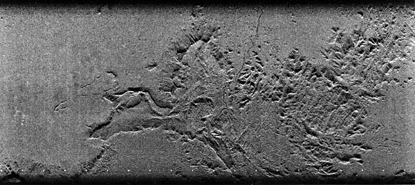 |
Some tributary junctions of the Paragua River system (lower left of image) are barbed (i.e., they join at a sharp angle that points upstream). Such junctions are not unusual in tropical rivers, which may reverse directions over their geologic history, even crossing divides from one basin to another. One of the most famous of such complexities occurs in the upper reaches of the Orinoco, about 450 km southwest of Angel Falls. The Orinoco splits into two downstream branches, the major one continuing northward through Venezuela and the other giving rise to the Casiquiare River, which flows to the Rio Negro and Amazon in Brazil.
| Figure F-8.4 |
|---|
 |
One theory for the channel patterns in this region holds that the rivers are carving trunk channels through relict arid landscapes. This concept, developed by H. F. Garner (1966), considers the Caroní and similar streams to be "rivers in the making." During past arid climates, presumably corresponding to full-glacial conditions, this tropical region was much drier than it is at present. Modern evidence for this is suggested by the occurrence of relict parabolic dunes north of the Meta River in Southwestern Venezuela (Figure F-8.4), in a region now shown on maps as swampy and heavily vegetated. Drainage was directed into local depressions, and considerable derangement characterized the landscape. The subsequent shift to tropical conditions has allowed the rivers to integrate these former deranged patterns, but relicts persist in the overall drainage. Landsat, 21446-13324-7, January 7, 1979.
Continue to Plate F-9| Chapter 4 Table of Contents.| Return to Home Page| Complete Table of Contents|