 |  |
|---|---|
| Plate F-9 | Map |
| |
|---|---|
| Plate F-9 | Map |
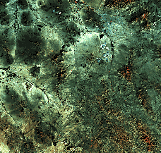
The Tucson area of southern Arizona illustrates the erosional landforms developed on the remnants of block-fault mountains that evolved approximately 10 to 30 million years ago. The area is typical of the Basin and Range physiographic province. Coincident with uplift of the ranges, intervening basins subsided as they accumulated the debris shed from the eroding mountains. Volcanism immediately preceded, and was coincident with, this Late Tertiary tectonism.
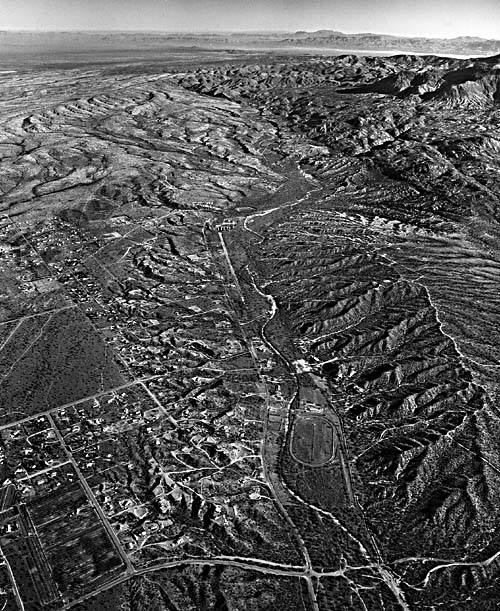
Many of the mountain fronts are no longer tectonically active. The piedmonts that surround them are erosional, formed by the headward retreat of the mountain front itself and by continued planation of rock and sediment downslope of the mountain front (Bull, 1984). Such erosional surfaces are termed "pediments." The northeastern front of the Tucson Mountains (Figure F-9.1) is an excellent example.
The Tucson Mountains consist of Tertiary volcanic rocks overlying Mesozoic sediments. Basin- and range-faulting produced a mountain front that retreated during subsequent pedimentation. Note on Figure F-9.1 that the pediment is characterized by a dense pattern of shallow drainageways. During rare intense rainstorms, these drainages are filled, and water moves slowly by sheetflooding on the pediment surface. Under present climatic conditions, only relatively fine sediment is conveyed across the pediment to the trunk drainageway, which is the Santa Cruz River at the bottom of Figure F-9.1.
| Figure F-9.1 | Figure F-9.2 |
|---|---|
 |  |
Note also on Figure F-9.1 that the retreat of the mountain front may leave isolated hills surrounded by pediment surface. These hills are erosional residuals, or inselbergs. Their presence can be useful in mapping the extent of pedimentation.
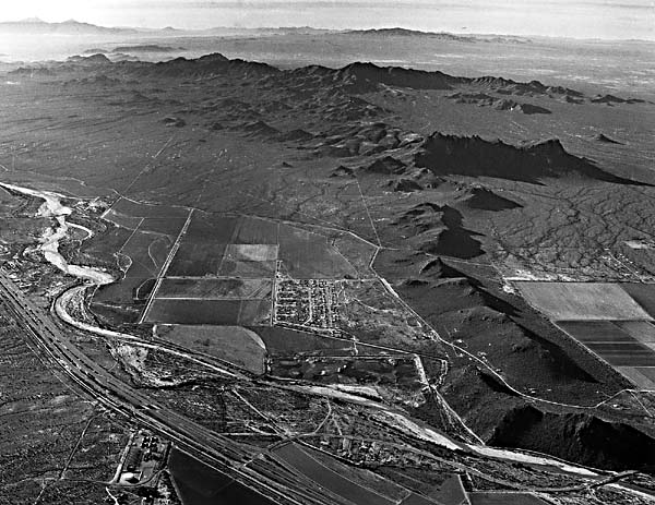
Where mountain fronts have been active tectonically and/or where climatic change has resulted in sufficient sediment loads, alluvial fans may develop. Figure F-9.2 shows the Madera Canyon Fan at the western front of the Santa Rita Mountains. The fan is composed of coarse debris shed from the quartz monzonite core of the mountains. Most of the fan is relict from the Early Pleistocene, as indicated by its pronounced dissection (Figure F-9.2) and by the strongly developed soil profile beneath its surface.
The relatively active tectonism of the Santa Rita Mountain front is indicated by the two fault scarps visible at the left center of Figure F-9.2. These are Quaternary faults, since they cut the Pleistocene fan surface. Detailed study of trenches across these faults indicates that the youngest movement was Late Pleistocene in age (Pearthree and Calvo, 1982).
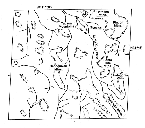
In the northern part of the study area, the great mountain massifs of the Catalina and Rincon Mountains dominate the topography. These are metamorphic core complexes that formed in a compressional phase that preceded basin- and range-faulting. Uplift of these mountains occurred in domal fashion, with covering sediments sliding off along low-angle faults to expose cores of gneiss and granitic rocks. As streams incised from the covering sediments, they cut deep canyons along prominent fractures.
| Figure F-9.3 |
|---|
 |
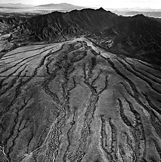
Along the Canada del Oro Valley (CDO on the index map), a stream has incised into a graben northwest of the Catalina Mountains. The result was the exhumation of a pediment at the north end of the mountains (top of Figure F-9.3). Downcutting was episodic. During periods of stability, the stream was able to shift laterally, producing strath terraces. Filling during periods of high sediment yield produced phases of aggradation. Continued downcutting then led to the abandonment of the former strath and aggravation surfaces (McFadden, 1978). The result was a series of terraces (Figure F-9.3). The higher, older terraces in the valley are dissected, whereas the lower, younger terraces preserve much of their original morphology.
During the initial phases of basin- and range-faulting, many of the basins in the study area were closed. Deep wells have penetrated evaporites and lake sediments beneath the basin fills (Pierce, 1984). As the basins filled with sediment, they were also integrated by drainage systems such as the Santa Cruz River (Figure F-9.1). The modern streams are ephemeral, flowing after desert rainstorms. Major flow events are associated with summer convective storms, winter frontal systems, and occasional tropical disturbances that migrate from the Sea of Cortez in late summer or early fall. Although the lowland climate is arid, the mountain areas receive appreciable rainfall. Higher ranges, such as the Catalina and Santa Rita Mountains, support dense coniferous forests and have appreciable winter snowpacks. Landsat 40176-17270, January 8, 1983.
Continue to Plate F-10| Chapter 4 Table of Contents.| Return to Home Page| Complete Table of Contents|