 |
 |
|---|---|
| Plate C-11 | Map |
|
|
|---|---|
| Plate C-11 | Map |
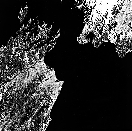
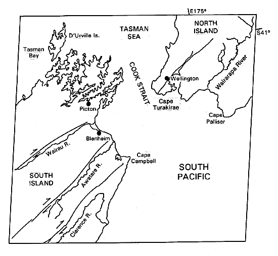
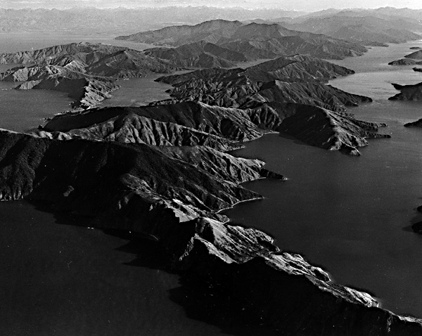
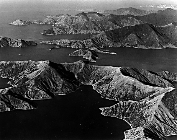
Cook Strait separates the North Island from the South Island of New Zealand. An aerial oblique view (Figure C-11.1) of the Strait shows Wellington on North Island in the foreground and the Marlborough Sounds on South Island near the top of the photograph. It is probably a very old geologic feature that predates the series of right lateral strike-slip faults that are followed by the valleys of the Wairau, Awatere, and Clarence Rivers. The Wairau Fault is a major northern segment of the great Alpine Fault of the South Island. The intricately dissected and drowned Marlborough Sounds region around Picton (Figure C-11.2) is estimated to be creeping northeastward along the Wairau Fault toward Wellington on the North Island at a rate of 6.3 mm per year (Stevens, 1974, p. 198). Cook Strait is thus gradually becoming Z-shaped.
| Figure C-11.1 | Figure C-11.3 |
|---|---|
 |
 |
The area around Wellington is actively rising, especially during earthquakes. Cape Turakirae maybe rising at an average long-term rate of as much as 4 m per 1000 years (Wellman, 1967). It rose about 2.4 m during an earthquake in 1855, enabling farmers in the Wairarapa Valley to the east to thereafter drive cattle around the Cape to market in Wellington. The swampy tombolos that connect several peninsulas within the city of Wellington were also uplifted 1 to 2 m in 1855, creating much better sites for future city expansion and establishing the route for the present Marine Drive around the harbor (Stevens, 1974, p. 228).
| Figure C-11.2 |
|---|
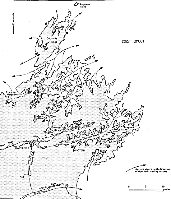 |
The Marlborough Sounds region has submerged after it developed an intricate fluvial drainage pattern. According to one interpretation, much of the drainage was toward the southwest, so that the drowned northeastern heads of former valleys are now below their former southwestern mouths (Figure C-11.3). Note that there are relatively few islands in the Marlborough Sounds region. Most of the landscape is an intricate series of peninsulas, because the relatively steep gradient along the former subaerial ridge crests carries them completely below sea level in a short distance (Figure C-11.4). If the divides were more uniform in height, numerous small high areas on them would appear above sea level as chains of islands.
| Figure C-11.4 |
|---|
 |
The rocks of Marlborough Sounds are schists and graywacke sandstones, relatively resistant to erosion but highly fractured so that they crumble in freezing climates. The region may have been subjected to periglacial conditions during the ice ages, and perhaps intense weathering during times of lowered sea level helped to shape the landscape prior to drowning. The resulting skeleton islands and peninsulas are similar to those in the Falkland Islands (Plate C-6). If the former river valleys had flat longitudinal gradients, smooth sides between relatively sharp ridge crests, and semicircular "theater" heads, all typical of periglacial valleys, tilting and drowning could produce the observed landscape (Cotton, 1957, 1969). Landsat-2335-21190-6, December 23, 1975.
Continue to Plate C-12| Chapter 6 Table of Contents.| Return to Home Page| Complete Table of Contents|