 |
 |
|---|---|
| Plate C-20 | Map |
|
|
|---|---|
| Plate C-20 | Map |
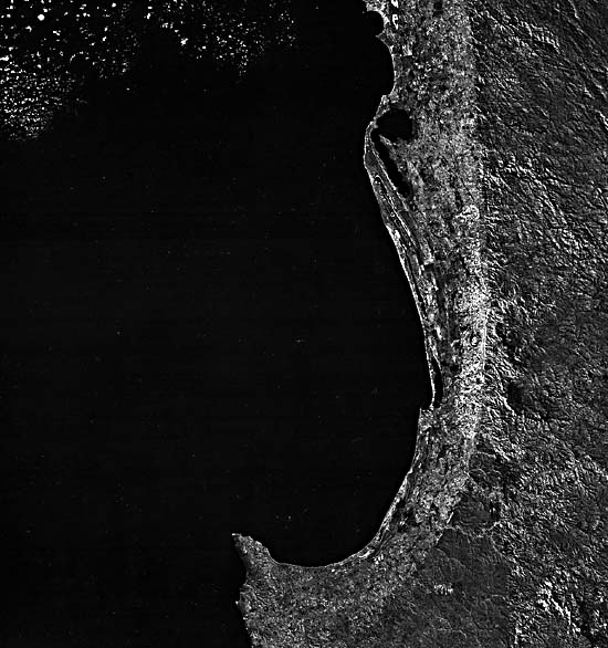
The Swan coastal plain around Perth in western Australia (Wilde and Low, 1975, 1980) illustrates one way in which faulting can influence a coastline. As is strikingly displayed in the Plate, the inner edge of a 20- to 30-km wide coastal zone stands out as a remarkably regular line; the present shore roughly follows the curvature of this line but shows cuspate indentations, promontories, a series of beach ridges, and lagoonal lakes developed in Late Pleistocene and Holocene times. The inner line is actually a scarp eroded back from several major fault planes. The longest of these is the Darling Fault, whose trace over 400 km is accentuated by the abrupt drop in heavy vegetation cover (Jarrah: Eucalyptus sp.) on the western edge of the plateau to the east, readily perceived in a Landsat mosaic (Figure C-20.1) of the region.
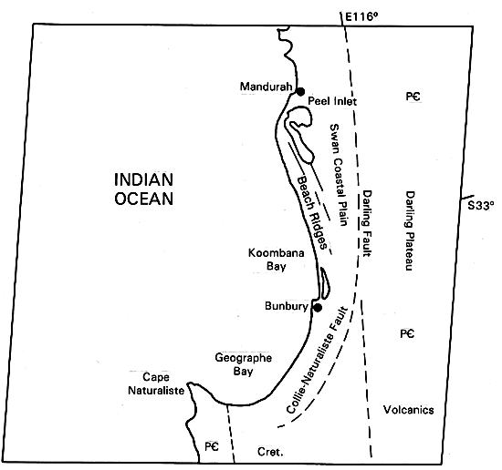
The physiography of southwestern Australia (Jutson, 1950) is dominated by the Darling Fault. This normal fault was initiated in the Early Paleozoic; geophysical work suggests that it has a cumulative displacement of about 10 km. The fault runs meridionally from well north of Perth to the southern coast. A second rupture-the Collie-Naturaliste Fault-arcs southwestward inland from Geographe Bay. Movement along this fault system in the Tertiary has been postulated, but no modern earthquakes can be traced to its subsurface extension. Uplift of the Yilgarn structural block is to the east of the fault, where the present surface attains altitudes averaging 300 m (maximum of 582 m at Mt. Cooke, one of many higher monadnocks). The ranges within the Darling Plateau are underlain by Precambrian crystalline rocks- mostly granites, migmatites, and banded gneisses-and basic volcanics are exposed in the south. The Darling Ranges today comprise an uplifted and dissected peneplain beneath which deep and intense weathering during the Late Mesozoic/Early Tertiary has led to lateritic and bauxitic regolith, together with some sands and conglomerates, that hardened on uplift and dessication. These duricrusts have since been strongly stripped away in the southern region, exposing fresh crystalline rock.
| Figure C-20.1 | Figure C-20.2 |
|---|---|
 |
 |
The Darling scarp varies in height from about 90 to 200 m. Streams to its east (controlled on the plateau by northwest- southeast jointing) incise through the scarp enroute to the Indian Ocean. The scarp itself, stepped in places, appears to be a faultline surface eroded back perhaps 1 to 2 km from the present fault trace to the west.
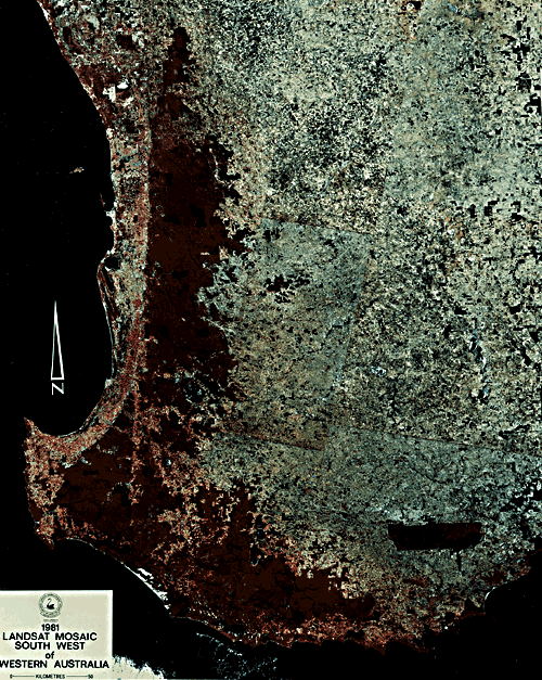
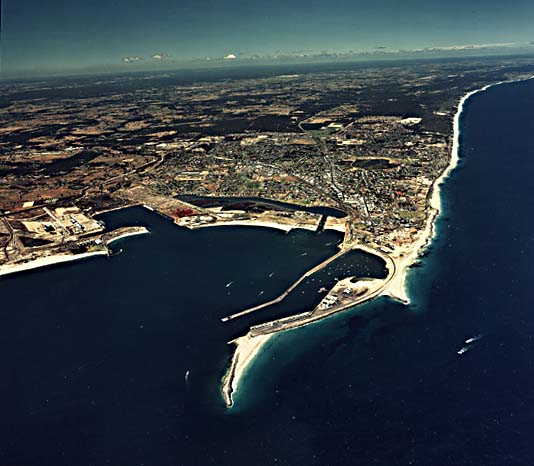
The coastal plain (Figure C-20.2) tops the Perth Basin, which extends oceanward to the continental shelf. The major basin fill consists of sedimentary rocks, possibly exceeding 15 km in depth, that are sparsely exposed amid otherwise continuous Late Cenozoic (mainly Pleistocene) deposits (Playford et al., 1976). Elevations in the Swan coastal plain are generally below 75 m. Highest points are near the scarp, where alluvial fans have built up a piedmont zone. Moving westward, one encounters the Pinjarra Plain, an alluvial tract, then the Bassendean Dunes- low vegetated hills of quartzose sands-and finally the Coastal Belt- dominated by calcareous and siliceous dunes or ridges that can attain heights of 60 m above associated swales (Figure C-20.3). Offshore islands are sand dunes built during lower sea level some 5000 years ago. The subsequent rise in this level has cut low cliffs and beaches along the present coast and produced drowned estuaries and lagoons.
| Figure C-20.3 |
|---|
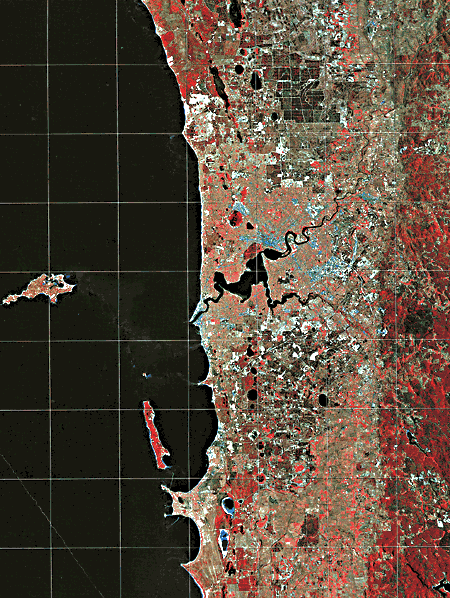 |
Isolated strandlines close to the Darling scarp indicate nearly complete inundations of the Swan plain during Pleistocene interglacial times (Churchill, 1959). The scarp itself thus served as a barrier to further inland invasion, but its erosion has been influenced more by fluvial processes than by marine action. (GCW: N. M. Short) Landsat 21189-01004-7, April 25, 1978.
Continue to Plate C-21| Chapter 6 Table of Contents.| Return to Home Page| Complete Table of Contents|