 |
 |
|---|---|
| Plate C-21 | Map |
|
|
|---|---|
| Plate C-21 | Map |
Water incursions into semi-enclosed basins on the landward side of marine coasts contain salts in varying concentrations ranging from supersaturated to slightly brackish. The concentration depends on the degree of interchange (replenishment) between the open ocean and the land- locked waters, on evaporation rates, and on past history. This Plate treats three prominent examples as seen from space.
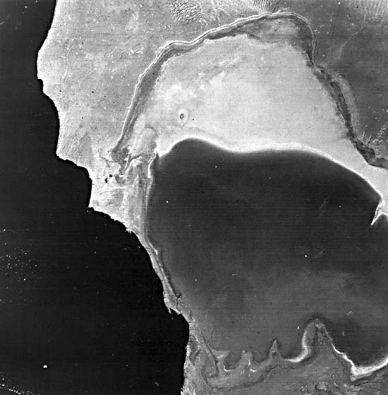
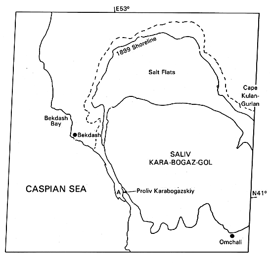
The Plate image shows most of the Gulf (Gol) of Kara- Bogaz along the east-central side of the Caspian Sea, itself a huge landlocked "lake" of slight salinity, but once a part of the Mediterranean system (Garbell, 1963). The Kara-Bogaz is the classic modern counterpart, although somewhat smaller, to some typical evaporite basins responsible for ancient salt deposits in the stratigraphic record. Its current dimensions cover an area of about 10 000 km with a maximum depth of 3.5 m (Fairbridge, 1968), but the distribution of saline deposition beyond its periphery indicates a former area of more than 18 000 km. Recent salinity determinations show an excess of 300% in the Gulf of Kara-Bogaz waters (compared with an average of 13% for the Caspian Sea and 35% for seawater), approximately the same as that of the Great Salt Lake (Plate KL- 12). Deposition of salts is prodigious, with gypsum, epsomite, and halite being most common. In earlier times, mirabilite (a hydrous sodium sulphate) formed under conditions suggesting the cooler temperatures found in periglacial environments.
| Figure C-21.1 | Figure C-21.2 |
|---|---|
 |
 |
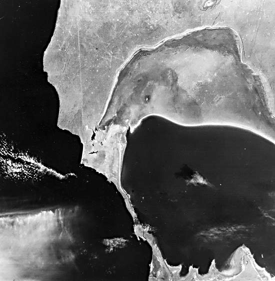
Sand spits developed by longshore currents in the Caspian Sea are responsible for the nearly complete oceanward enclosure of the embayment of the Gulf onto desert lowlands. Waters now enter the Kara-Bogaz through a narrow (300 m wide) and shallow inlet (A on the index map), but there is no reverse circulation. The arid climate in this part of the Turkmen Republic S.S.R. favors precipitation of salts. In the long term, the Kara-Bogaz is likely to vanish as an active sediment basin, but no significant change can be detected from comparing the 1972 image with a later one in 1977 (Figure C-21.1). Visual differences may be attributed to both the differences in MSS bands (5 for 1972; 6 for 1977 image) and seasonal variability (December versus March).
Figure C-21.2 is a mosaic of parts of two images that focus on the southern Gulf of Venezuela (indented from the Caribbean Sea) and northern Lake Maracaibo in western Venezuela. These water bodies lie within a structural basin that localized extensive sedimentation throughout the Cenozoic (Sutton, 1946). Marine waters driven by tides invade the narrow strait of Maracaibo from the nearly sealed Tablazo Bay at the south end of the Gulf. This strait was probably the course of a river during times of lower sea level. Then, Maracaibo was a true freshwater lake, as revealed by samples from drilling into and around the lake in search of abundant oil in subsurface fields. The lake now supports low but variable salinity (typically less than 1% at the surface and 3% at depth), depending on influx of seasonably fluctuating rainwaters from land drainage. Outflow from the lake to the Bay and Gulf predominates during the wet season, but this usually reverses in dry times (Redfield, 1961).
| Figure C-21.3 |
|---|
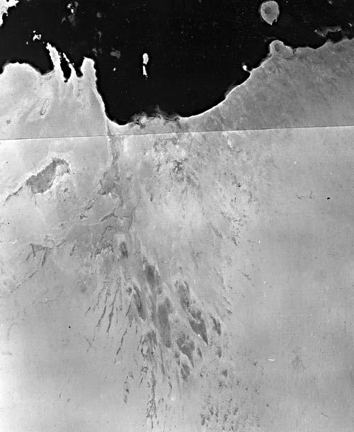 |
In Figure C-21.3 (another Landsat two-image mosaic), a much different situation exists along the Arabian (Trucial) coast on the Persian Gulf (Evans et al., 1964). Adjoining this coast, in land near sea level, are several salt-encrusted depressions termed sabkhas (or sebkhas). These may receive fluids from tidal action, if near shore, from rainwater, or from shallow, often saline ground water. Two types of sabkhas are distinguishable: one coastal and the other inland (including playas of the southwestern United States, the kevirs of Iran, and shotts of northwest Africa). High evaporation rates are required to maintain sabkhas, and capillary action above shallow water tables resupplies saline inputs. Sabkhas along the Persian Gulf can result from residual waters introduced from higher sea levels during Holocene sea level changes. This may apply to the very large interior sabkha- Sabkhat Matti-seen in Figure C-21.3 to extend inland for more than 150 km from the Persian Gulf (just east of Qatar) into the Empty Quarter of Saudi Arabia. (GCW: N. M. Short) Landsat 1134-06425-5, December 4, 1972.
Continue to Plate C-22| Chapter 6 Table of Contents.| Return to Home Page| Complete Table of Contents|