 |
 |
|---|---|
| Plate C-4 | Map |
|
|
|---|---|
| Plate C-4 | Map |
The coast of the large southernmost Brazilian state of Rio Grande do Sul is another example of the sea reaching onto the margin of old eroded continental crust. Inland, the relief rises to 1000 meters. River valleys are not prominent. Offshore, the continental shelf is narrow, and a sharp submarine scarp marks the scar where South America rifted from Africa.
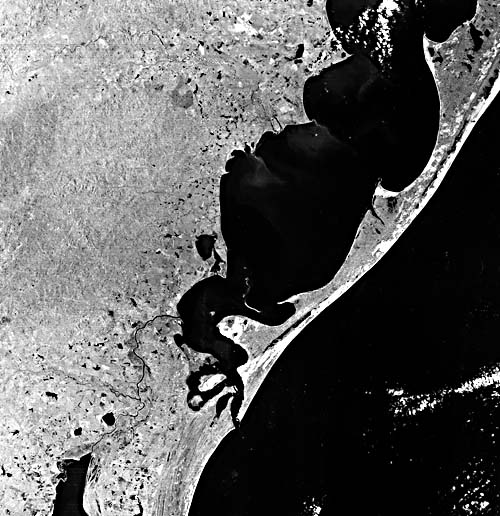
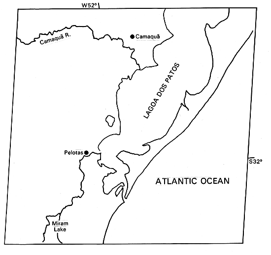
On the narrow coastal plain of Rio Grande do Sul, a very large, complex sand barrier spit has built southward for about 240 kilometers, enclosing a large lagoon called Lagoa dos Pates. Eighty kilometers north of the image margin is the southern Brazilian seaport of Porto Alegre, approached by a long voyage up the lagoon from the inlet at its southern end. The barrier, in places 100 km wide and extending 640 km from the city of Torres southward to the Uruguay border, is part of one of the world's longest sandy beaches. Another long barrier beach, approximately 500 km in length but much narrower, lines the Texas coast along the Gulf of Mexico (Figure C-4.1, a Landsat image showing Padre Island). Unlike the Brazilian Coastal Region, the Texas barrier has developed along a coastal plains of low relief.
| Figure C-4.1 | Figure C-4.2 |
|---|---|
 |
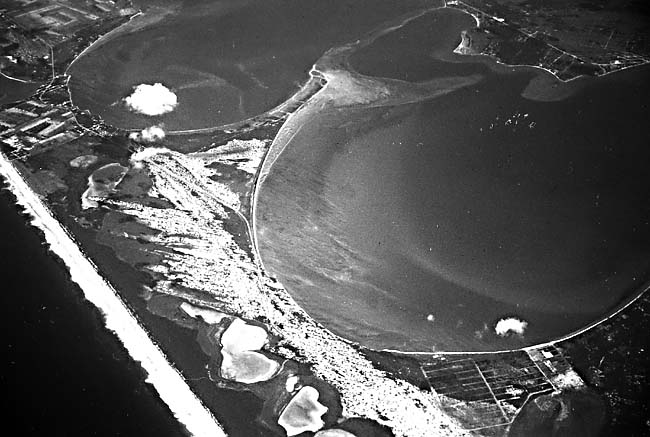 |
The most striking features of the Lagoa dos Pates are the cuspate spits that segment it (Figure C-4.2). The image clearly shows plumes of sediment carried southeast from the cuspate headlands on the inland shore of the lagoon as the surface currents are deflected into the lagoon from each point. On the southeast shore of the lagoon, along the barrier spit, the current is generally northeastward, creating even more sharply defined asymmetric cusps.
The sediment-transporting circulation system of the lagoon seems to develop as a series of counterclockwise rotating ellipses with north-south long axes. A combination of winds and tidal currents maintain the alternating cuspate spits in a north-south orientation in spite of the generally northeast trend of the outer coast. A similar pattern has been noted in Laguna Madre, behind the Padre Island barrier of Texas (Figure C-4.1), and in southeastern Australia (Bird, 1971).
| Figure C-4.3 | Figure C-4.4 |
|---|---|
 |
 |
The great outer barrier of Lagoa dos Pates shows a complex growth history. The crystalline rocks of the shield and their overlying Mesozoic basalt lava flows were eroded to low relief, and buried under a thin cover of Tertiary sediments. These sediments are known only from subsurface borings through a thin cover of Pleistocene sand and gravel that forms the floor of the lagoon. More than one cycle of Pleistocene sea-level fluctuations may be recorded in the Pleistocene sediments. At some time in the Late Pleistocene, interglacial sea level rose to 5 m above its present level and built a barrier system similar to the present one (Delaney, 1962, 1966). About 10 000 km2 of the present barrier belongs to this Pleistocene system. The barrier and dune sands are now weathered to red and yellow colors, are lightly indurated, and form a low plain with low fixed sand dunes and shallow ponds. A good working hypothesis is that this barrier formed about 125 000 years ago, during the last interglacial episode, as has been verified on the coast of New South Wales, Australia (Plate C-2). Subsequently, sea level fell during the most recent ice age, and the old beach ridges and dunes were weathered and eroded. When sea level rose again in the Holocene Epoch, a straight cliff was cut in the Pleistocene barrier, and the red sands were mixed with fresher sand to build the modern barrier, which in itself covers an area of 7000 km2 and is up to 15 km wide in places. The straight low scarp that separates the Pleistocene and Holocene barrier is easily visible on Plate C-4 because of the line of ponds and lagoons along it.
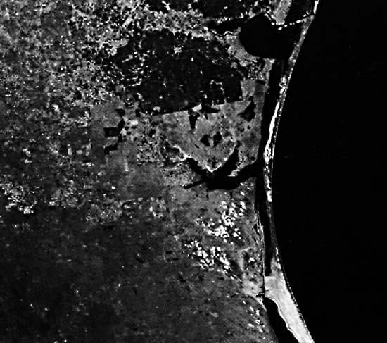
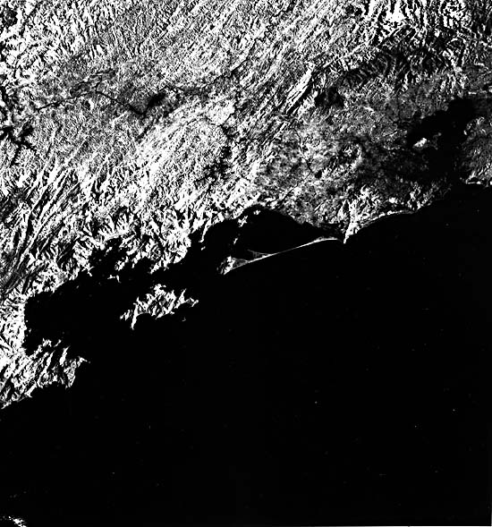
Up the coast some 1000 km to the northeast, near Rio de Janeiro, the rugged irregular coastline reflects the interaction between a rising Holocene sea level and mountainous terrain just inland (Figure C-4.3 and Figure C-4.4). The only major barrier developed in this scene is the elongate spit that has reached an offshore island. Landsat 21468- 12235-6, January 29, 1979.
Continue to Plate C-5| Chapter 6 Table of Contents.| Return to Home Page| Complete Table of Contents|