 |
 |
|---|---|
| Plate KL-10 | Map |
|
|
|---|---|
| Plate KL-10 | Map |
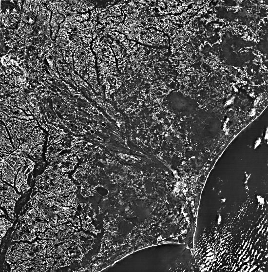
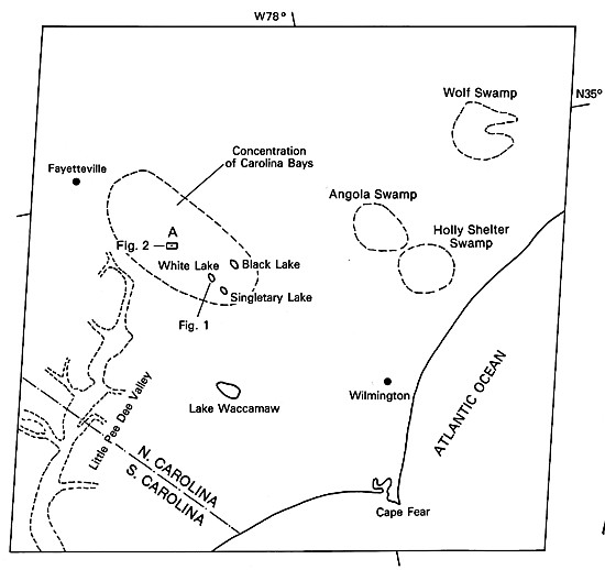
This Landsat image covers a region that encompasses a portion of the Atlantic Coastal Plain in North and South Carolina. The most intriguing geomorphological features within the image are the Carolina Bays. These are shallow ovoid depressions with a northwest- southeast orientation. Most bays are ringed by a sand rim that is best developed on the southeast side. Some bays exhibit multiple rims. Careful examination of this Landsat image reveals more than 200 of these depressions (A on index map). Although they have been studied by geologists and geomorphologists for over a century, there is still no agreement as to their exact origin. These oriented depressions have a striking resemblance to the oriented lakes of Alaska (see Plate KL- 9), but because there is no evidence that permafrost conditions ever existed this far south during the Pleistocene, processes other than permafrost must be considered.
Some of the hypotheses suggested for the formation of the bays are listed by Price (1968a, p. 103):
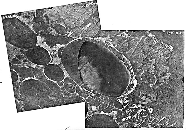
| Figure KL-10.1 | Figure KL-10.2 |
|---|---|
 |
 |
With the exception of the deflation hypothesis (No. 13), the other proposed origins have been shown to be untenable (Kaczorowski, 1976). Thom (1970) in South Carolina was able to classify all bays within his study area into three topographic settings: (1) flat interfluves, (2) dune depressions, and (3) terrace contacts. His study indicates that most of the bays are found to be concentrated on the interfluve plains between entrenched stream valleys (see image; A on index map).
Dates obtained from organic fill within the bays indicate that their formation probably occurred between 7000 and 40000 years ago. Thom believes that the bays developed from shallow lakes during the Pleistocene, which, because of changing vegetation and drainage patterns and a dominant southwest wind, worked collectively to orient the bays normal to the wind direction. Surface wave action generated at right angles to the wind direction is believed to cause elongation in the northwest-southeast directions. Kaczorowski (1976) made a careful comparison of the oriented lakes in Chile and Alaska, and he corroborates Thom´s conclusions.
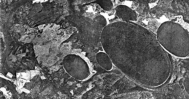
| Figure KL-10.3 |
|---|
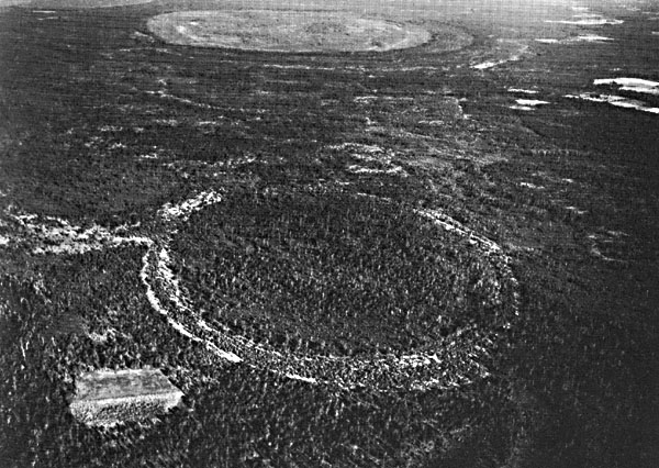 |
No investigator has disputed the influence of eolian processes as an agent in bay formation. The question is whether the wind action is primary or secondary. The high reflectivity of the rim sand dunes outlines many of the bays on the Landsat image and can be clearly seen in the ancillary photos (Figure KL-10.1, Figure KL-10.2, and Figure KL-10.3). Many of the dunes are believed to be former longitudinal dunes that later, under the influence of more humid conditions, transformed into parabolic dunes or blowout crescent- shaped dunes with tails anchored by vegetation (Price, 1968b). Because today´s dominant winds blow from the southwest, a more complex wind regime than that suggested by either Thom or Price must be invoked to account for the buildup of sand on the southeast ends.
Such wide variation exists among the half million lakes that no single hypothesis satisfactorily explains their origin. Landsat 1080-15203-5 October 11, 1972.
Continue to Plate KL-11| Chapter 7 Table of Contents.| Return to Home Page| Complete Table of Contents