 |
 |
|---|---|
| Plate KL-14 | Map |
|
|
|---|---|
| Plate KL-14 | Map |
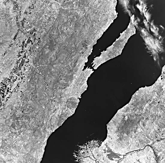
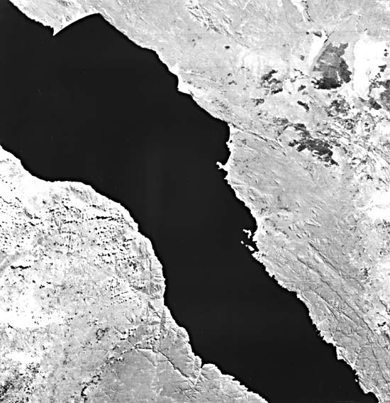
Lake Baikal lies in the southern part of eastern Siberia, U.S.S.R. It is the deepest continental body of water on Earth, having a maximum depth of 1741 m. Its area extends over 31500 km2, being about 636 km in length and averaging 48 km in width. This huge lake embodies one-fifth of the world´s fresh water, which is as much as the five Great Lakes of the United States combined. The lake maintains an elevation of 454 m and is surrounded by mountains that rise to as high as 2900 m above sea level (Encyclopedia Britannica, 1980).
The lake is far enough north in latitude (N52°-N56°) that it is frozen from January through May. Annual precipitation there is 200 to 340 mm/yr, which falls mostly in July and August.
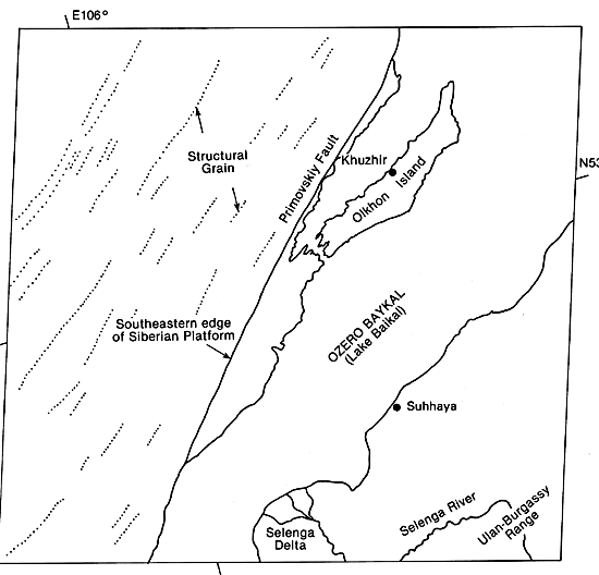
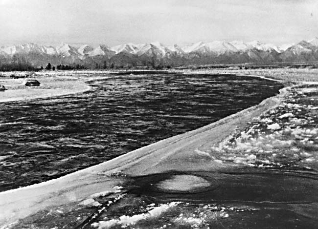
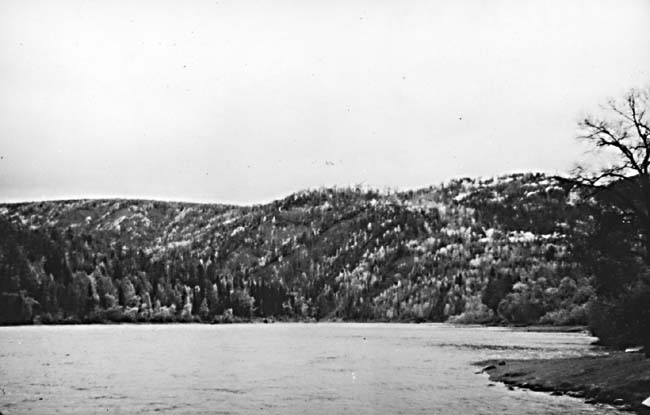
Much of the western edge of the lake is bounded by the Primovskiy Fault, which is clearly displayed on the image (see index map), and marks the boundary between the Siberian Platform to the northwest and the pre-Cenozoic Sayan/Baikal fold belt to the southeast (Zamarayev and Ruzhich, 1978). The shoreline on the west consists of cliffs and hills (Figure KL-14.1 and Figure KL-14.2) that express the influence of this fault on the topography. Lake Baikal is located within a rift 2000 km in length and exhibits many of the same characteristics as the East African rift in Kenya (Logatchev et al., 1983). For example, both have anomalous heat flows, are bounded by major extensional fault systems, are associated with basaltic volcanism and deep-seated dike systems, display a thinning of the crust, and are zones of concentrated seismic activity (Logatchev et al., 1983). Lake Tanganyika (Figure KL-14.3), in the western arm of the African Rift, is in some respects an analog to Lake Baikal.
| Figure KL-14.1 | Figure KL-14.2 |
|---|---|
 |
 |
From the image, it can be seen that the lake boundaries conform to the tectonic fabric of the surrounding terrain (see index map), which, according to Zamarayev and Ruzhich (1978), predates the rift and may have influenced the rift orientation. The Baikal rift is not a simple rift valley, but is a complex system of block-faulted depressions. The lake occupies the southwestern part of the Baikal depression, which consists of three en echelon grabens separated by two topographic highs, one located southwest on the Selenga Delta and the other along the Olkhon Island and Svyatoy Nos Peninsula (Tapponnier and Molnar, 1979).
Lake Baikal began to form at least by Late Oligocene to Early Miocene based on the Oligocene/Miocene sediments recovered from the rift floor (Tapponnier and Molnar, 1979), which would make the lake 20 to 25 million years old and thus, the oldest documented lake on Earth. Continental sediments in the Baikal depressions are subdivided into two series. The lower series consists of Oligocene to Early Pliocene clastics mixed with carbonates and coals. The upper series is Middle Pliocene to Quaternary in age and consists of coarser clastics (Logatchev et al., 1983). In places, the sedimentary rocks within the lake basin may attain thicknesses of up to 6000 m (Encyclopedia Britannica, 1980).
| Figure KL-14.3 | Figure KL-14.4 |
|---|---|
 |
 |
Cenozoic volcanism in the Baikal depression, whose total volume is less than 6000 km3 (20 times less than the volume found in the East African Rift in Kenya), is located principally along the margins or shoulders of the rift. Seismic studies by the Russians indicate that the crustal thickness within the Baikal Rift depression is about 35 km, whereas the shoulders display thicknesses of 42 to 46 km. Logatchev et al. (1983) suggest that plastic extension of as much as 15 km has taken place beneath the rift proper. The Baikal rift is believed to be the surface expression of a deep-seated asthenospheric upwelling and, because of its similarities to the Kenya rift, is believed to be an example of an active rift system.
Baikal is one of three large lake systems in the Soviet Union. A second, the Aral Sea (Plate D-15), is the fourth largest lake in the world, but is quite shallow. A third, Lake Balkhash (Figure KL-14.4), is elongate (600 by 30 to 50 km) like Baikal, but is shallow (maximum depth 12 m) like Aral. Lake Balkhash occupies a shallow structural trough (graben?) backfilled with sediments carried in by the Ili River from the high Tian Shan along the Russian border. Despite lack of outlet drainage, the Balkhash waters have a low saline content (but high potassium), yet have led to conditions favoring precipitation of dolomite in modern times. Landsat 2150-03123-5, June 21, 1975.
Continue to Plate KL-15| Chapter 7 Table of Contents.| Return to Home Page| Complete Table of Contents