 |
 |
|---|---|
| Plate KL-9 | Map |
|
|
|---|---|
| Plate KL-9 | Map |
This Landsat scene covers a small portion of the Arctic Coastal Plain of Alaska. The Arctic Coastal Plain is underlain by flat-lying Late Cretaceous to Early Tertiary sandstones and shales with interbedded conglomerates and coal seams. This sedimentary pile has a thickness greater than 1000 m and is overlain by as much as 45 m of Late Tertiary to Quaternary unconsolidated clays, silts, gravel, and peat.
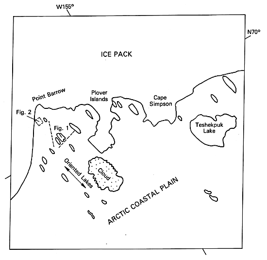
The most significant physiographic characteristic of this region of Alaska is the abundance of oriented thermokarst lakes that are associated with permafrost in northern Alaska. The Arctic Coastal Plain is included within the continuous permafrost region as defined by Péwé (1983). Within the Landsat scene, perennially frozen unconsolidated sediments are found only a few decimeters below the surface. This has the marked effect of limiting water flow to either surface runoff or within upper soil horizons. The permafrost zone extends to 680 m in depth in parts of northern Alaska (Péwé, 1984, written communication). Topographic relief in this region is generally less than 3 m, but along coastal bluffs, it can average 5 m.
| Figure KL-9.1 | Figure KL-9.2 |
|---|---|
 |
 |
Black and Barksdale (1949) estimated that from 50 to 70 percent of the coastal plain is dominated by lakes and marshy ponds. Between the lakes, the gently rolling surface is blanketed with a thick mat of vegetation consisting of lichens, mosses, grasses, sedges, shrubs, and occasional willows (Black and Barksdale, 1949), and there is a conspicuous absence of trees. The permafrost conditions exist because the annual mean temperature at Barrow is -12°C and subzero temperatures are recorded 320 days of the year. The prevailing winds are from the northeast for 11 months of the year, and in July, they blow from the southwest.
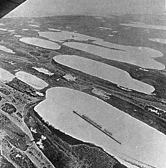
The oriented lakes of Alaska (Figure KL-9.1 and Figure KL-9.2) are primarily confined to the Arctic Coastal Plain, although other oriented lakes are known to occur under similar environmental conditions such as in the vicinity of Old Crow in Yukon Territory. The shapes of the lakes have been described as elliptical, cigar-shaped, rectangular, ovoid, triangular, and compound (Black and Barksdale, 1949). The length-to- width ratios of the lakes vary from 1:1 to 5:1, but 2:1 to 3:1 dominates in the Barrow Region. Most lakes are 6 m deep or less, but some attain depths exceeding 20 m. The abundance of drained lake basins and former extensions of existing lakes suggests that many lakes have been larger some time in the recent past.
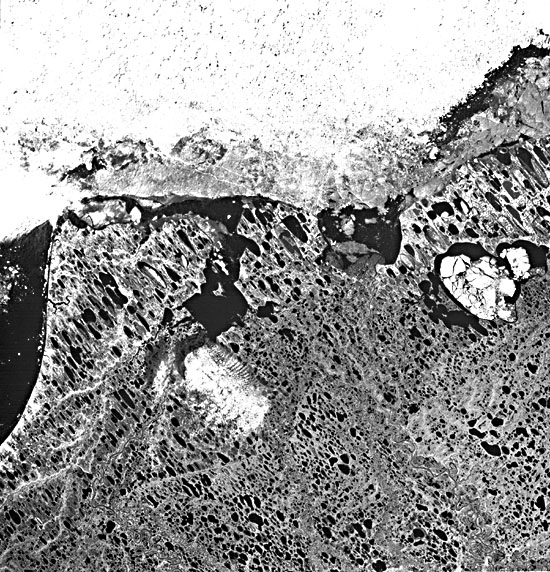
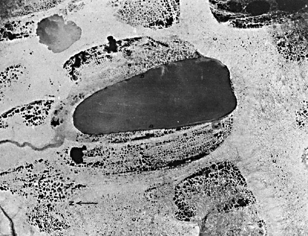
Summer thawing affects the stability of the lake shore by causing collapse, slumping, caving, and erosion of the banks (Figure KL-9.3). A lake can enlarge through thawing and wave action at its banks and may be drained if the banks expand into a drainage system or topographic depression. The origin of the lakes is related to the frozen, fine-grained sediments that generally contain a volume of ice that exceeds the normal porosity of ice-free sediments. When thawing of the surface occurs, a depression results and a thaw lake has formed (Carson and Hussey, 1962).
| Figure KL-9.3 |
|---|
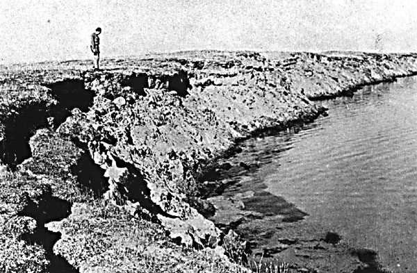 |
Controversy still exists over the origin of the predominant N10°-15°W orientation of the lakes. Black and Barksdale (1949) suggest that lake elongation may be due to a dominant north by northwest paleowind that has since shifted to the present- day northeast wind. The relatively recent age of several thousand years from radiocarbon dating and the fact that no lakes seem to be forming parallel to the existing wind direction support some other origin. Carson and Hussey (1962), after considerable field work, conclude that the northeast-southwest winds develop sublittoral shelves and bars along the major or longest axis (normal to wind direction) that insulate the banks from further thaw and subdue wave erosion. Deeper and warmer water has been found to be present near the ends of some of the elongated lakes, indicating that continued thaw and collapse will tend to accentuate or at least maintain the elliptical shape.
Furbringer and Naydn (Washburn, 1979) propose bedrock fracture control for lake orientation. Ice wedges oriented in a north by northwest direction (the same as bedrock fractures) have been observed, which upon thawing give rise to elongated lakes. The influence of maximum insolation at noon along a north- south axis may also aid in maintaining the elongation of lakes.
The final solution must take into account some of the observations seen from the Landsat image (namely, that the size and elongation of lakes tend to increase toward the coastline). The interior lakes are rounder and smaller. Some of the lakes to the eastern lower edge of the image are even elongated in a northwest-southwest direction. Landsat 20182-21394-7, July 23, 1975.
Continue to Plate KL-10| Chapter 7 Table of Contents.| Return to Home Page| Complete Table of Contents