 |
 |
|---|---|
| Plate E-12 | Map |
|
|
|---|---|
| Plate E-12 | Map |
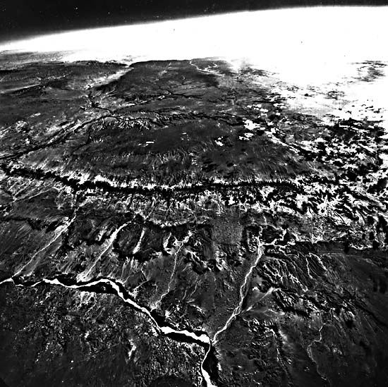
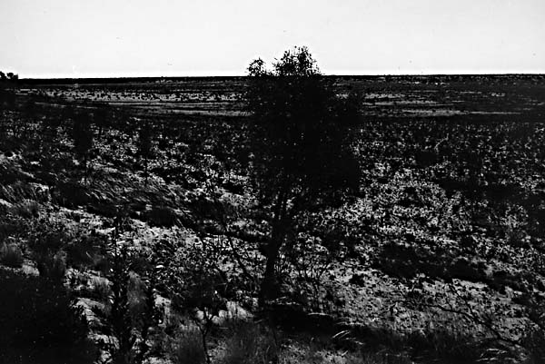
Deserts outside of North America generally form on stratified structural plains with horizontal bedrock or ancient alluvial plains that stretch for hundreds of kilometers (Petrov, 1976). The desert lands of western North America differ from most other deserts of the world in that they often contain closed depressions that hold well-preserved lacustrine terraces or pluvial lakes; many are within or adjacent to eroded structural plains or plateaus. Deep canyons, such as the Grand Canyon, and mountain ranges are associated with these deserts. Figure E-12.1 is a high-altitude oblique aerial photograph of a typical plateau desert of the U.S. Southwest-here the Moenkopi Plateau about 600 km north of the Plate. The Little Colorado River is on the front left. Small crescentic dunes are in most of the washes above the river. Their crests indicate that the dominant wind direction is from the bottom left in this figure. Red Rock Cliff is across the center of this picture, and linear dunes are on the plateau above the cliff. Dunes are rare in North American deserts, and fluvial processes dominate much of the landscapes. Compare the mountains and basins in this Plate and in Plate E-13, the Great Basin Desert, with Plates of other deserts throughout the world.
| Figure E-12.1 | Figure E-12.2 |
|---|---|
 |
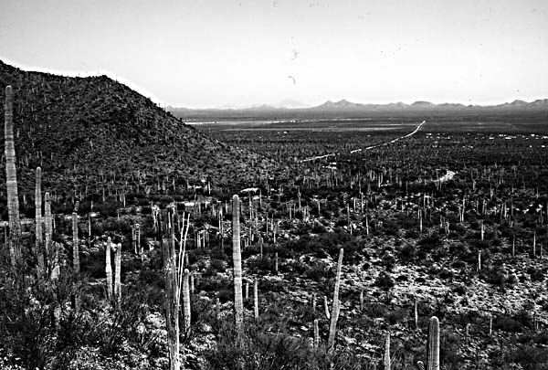 |
The Sonoran Desert is a subtropical desert and is the most complex of the North American deserts. Based on vegetation, Crosswhite and Crosswhite (1982) divide the Sonoran into seven region divisions and suggest that the Mojave Desert be considered an eighth division of the Sonoran Desert. Because of its biseasonal rainfall, short duration of cold weather, and topographic and geologic diversity, the Sonoran Desert has the greatest variety of plants of any deserts on the Earth. Figure E-12.2 shows the giant saguaro, which is sometimes more than 15 m tall. This plant dots the Sonoran and reinforces a general concept of deserts as cacti-rich land.
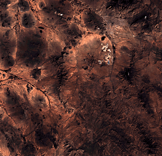
Tucson, Arizona, is in the northeastern Sonoran Desert, in a province generally referred to as the Arizona Uplands. As is evident in the Plate image, no perennial streams flow near Tucson. Inasmuch as irrigable acreage in the Santa Cruz Valley is limited to the narrow floodplain, the average annual rainfall in the upper Santa Cruz basin is presently capable of recharging underground water supplies (Dunbar, 1968). Dunbar points out that Tucson is the largest city in the United States that is wholly dependent on ground water.
| Figure E-12.3 |
|---|
 |
The Arizona Uplands is the most diverse province of the Sonoran because of an abundance of moisture and a 600-m variation in elevation. The effects of this elevation range and the moisture differences that together determine the complex vegetation are best seen in the compound alluvial fans next to the mountains in the province. These fans, sometimes called bajadas in North America, are gently inclined surfaces of deposition (Figure E- 12.3). In this province, Hastings and Turner (1972) find that 40 percent or more of the higher reaches of bajada may be covered by woody and succulent perennials. Small plants grow beneath the low shrubs, and saguaros top them. Landsat TM 40176-17270, January 8, 1983.
Continue to Plate E-13| Chapter 8 Table of Contents.| Return to Home Page| Complete Table of Contents