 |
 |
|---|---|
| Plate E-7 | Map |
|
|
|---|---|
| Plate E-7 | Map |
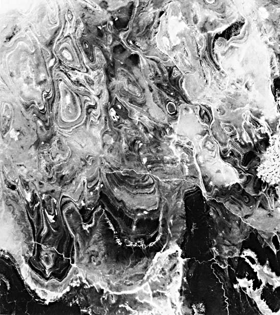
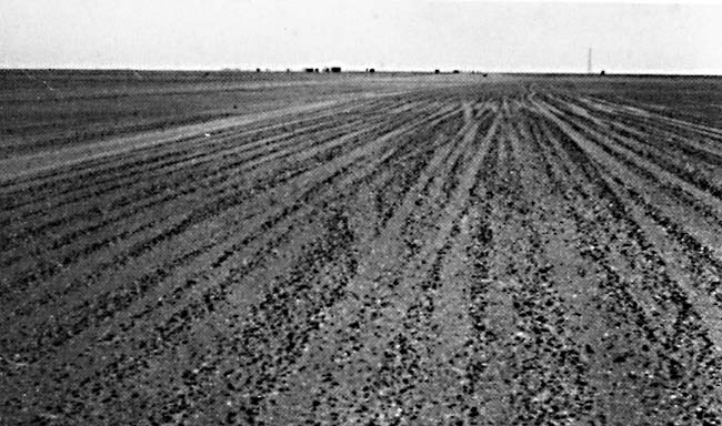
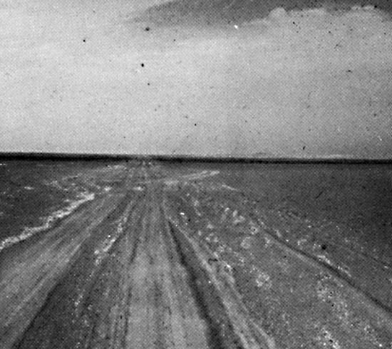
The Tanezrouft Basin is a geographical region in southern Algeria known as the "Land of Terror" because of its desolate landscape. The Tanezrouft is located in the south- central Sahara a few hundred kilometers southeast of Yetti Eglab Massif. The eastern border of Erg Chech, depicted in Plates E-3 and E-5, is near the basin. Reg, or gravel desert, dominates this Plate as it does about 70 percent of the Sahara. Reg stripes on the basin surface are illustrated in Figure E-7.1; note the oil rigs and trucks in the background. The hills at the bottom and right of the Plate are the foothills of the Plateau.
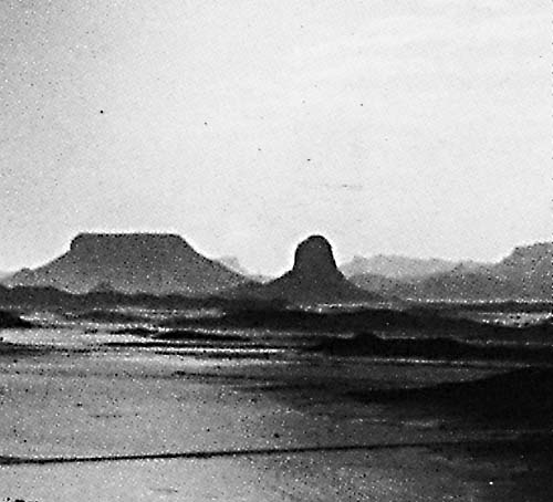
As reported by Cooke and Warren (1973), areas near this Plate record many climate extremes. Tamanrasset, Algeria, a few hundred kilometers to the east, has a range of annual precipitation between 6.4 and 159 mm; once, 44 mm of rain fell within 3 hours. Figure E-7.2 shows the terrain in the Ahaggar west of Tamanrasset. Tanezrouft, a small town a few kilometers west of this Plate, holds the regional record for the greatest daily variation of relative humidity, between 12 percent in July and 29 percent in November-December (Cooke and Warren, 1973, p. 12).
| Figure E-7.1 | Figure E-7.2 |
|---|---|
 |
 |
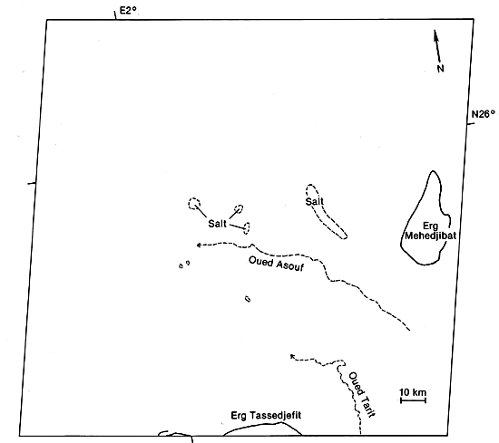
Two small ergs occur within this region. Erg Mehedjibat is made up of a cluster of small star dunes. Just the tip of Erg Tassegefit appears at the bottom. These ergs probably occupy the lowest elevations on the Plate. In addition, numerous small salt flats are scattered throughout the scene.
| Figure E-7.3 | Figure E-7.4 |
|---|---|
 |
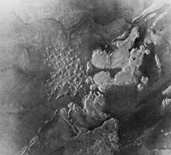 |
The concentric patterns that stand out in this Plate are deflation hollows scoured by eolian activity in slightly Paleozoic sedimentary rocks. Note the effects of differential deflation on the structures. Deflation basins are created wherever variations in lithology or cementation result in differing rates of rock-weathering and wind-aided removal of fines (Glennie, 1970). Considerable local relief develops even though fluvial activity is minimum. Cuestas, known in this part of the world as "tassilis," that formed from north-dipping rocks appear along margins of the darker rocks in the lower fourth of the Plate. In places, the erosion surface has beveled the strata to produce a banded floor pattern that corresponds to small segments of the concentric patterns of the deflation basins (Figure E-7.3). Figure E-7.4 is a hand-held Shuttle picture of a small dune field northeast of this Plate. The photograph covers an area of 120 km and shows star dunes west of Hagar Massif.
| Figure E-7.5 |
|---|
|
This Plate image was digitally processed to emphasize the contrast between the rock units. Figure E-7.5 is part of the same Plate image that was processed in the standard way by the EROS Data Center. Compare the equivalent areas of the two images. The digital data used to make the Plate image have been filtered and stretched to enhance certain features in the basin by changing the gray-scale step values. As a result, the rock exposed at the bottom of the Plate is extremely dark, and subtle features on the outcrop visible on Figure E-7.4 are not evident in the Plate. Similarly, the dunes in Erg Mehedjibat are better highlighted in the figure than in the Plate, where they are more saturated. Sometimes special processing done to improve information extraction and to bring out certain features causes loss of details not always recoverable by careful printing. Landsat 1112-09505, November 12, 1972.
Continue to Plate E-8| Chapter 8 Table of Contents.| Return to Home Page| Complete Table of Contents