 |
 |
|---|---|
| Plate G-21 | Map |
|
|
|---|---|
| Plate G-21 | Map |
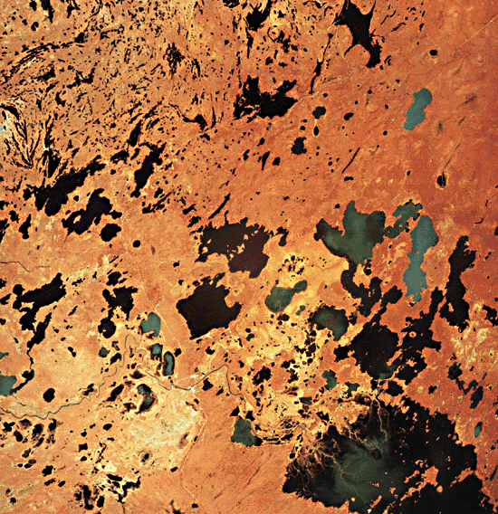
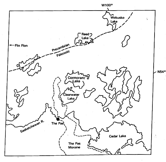
The entire area of northwest Manitoba was glaciated during the last Wisconsinan stage and represents a typical region of continental glaciation. The latest movement was generally from a northeasterly direction and formed the Pas Moraine (4) approximately 10 800 years B.P. Following a local readvance beyond the Pas Moraine, the ice melted and proglacial Lake Agassiz covered the ice-free portion of the area.
The scene can be subdivided into four broad areas based on surface deposits, bedrock geology, and vegetation:.
1. This area is dominated by Precambrian volcanic, gneissic and granitic bedrock. Volcanic and gneissic rocks are characterized by linear and curvilinear ridges (A) representing fold systems that form a strongly rolling to hilly topography. Granitic rock types (B) usually form a more gentle topography or rounded hills. These bedrocks are covered by a mixed conifer and deciduous vegetation. Glacial erosion of the more resistant granitic and gneissic rocks of the Precambrian Shield produce a landscape of rounded knobs and hollows, streamlined roches moutonnées and crag and tail, and numerous ice-gouged lakes and valleys. Shallow sand till covers most of the area, with small lacustrine clay pockets occurring in valleys. Peat deposits, usually small in size, are found in depressions and are composed mainly of forest and sphagnum peat. Mining and forestry are the main economic activities. The bluish-green area at Flin Flon represents the toxic effects of the sulphurous fumes from the base metal smelter that has been in operation for several decades.
| Fig G-21.1 | Figure G-21.2 |
|---|---|
 |
 |
2. This area forms part of the Manitoba and Saskatchewan lowlands, which are underlain by glacial drift and flat bedded Ordovician dolomitic limestone. Unlike the bouldery, sandy till of the Precambrian Shield, the softer Paleozoic rocks in this region produce a silty clay till. Here, the lakes are larger and rounder, and the shorelines are more regular. Peatlands are extensive and occur as string bogs (C) and ribbed fens (D). Discontinuous permafrost occurs in peat plateaus and wooded palsen.
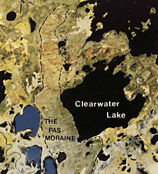
3. The Pasquia and Cedar Lake lowlands form an extensive alluvial and lacustrine plain that is divided by the Pas Moraine. The entire area was submerged by Lake Agassiz and has been modified by lacustrine and fluvial action. It includes part of the Saskatchewan River delta. Distributaries, channels, and natural levees (E) are evident from the image. In the Pasquia Basin, the alluvial floodplain is used as an area of improved pasture. The light blue at Cedar Lake represents suspended sediments stirred from the lake bottom, as well as sediment from erosion by the Saskatchewan River.
| Fig G-21.3 |
|---|
 |
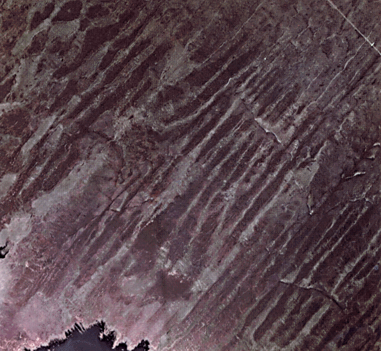
4. The Pas Moraine is a topographic high, arcuate in plan, and extends from Lake Winnipeg to 50 km north of the town of The Pas. This terminal moraine is the largest in Canada with a total length of approximately 225 km and a width varying from 6 to 30 km. The moraine is delineated on the Landsat scene and on the TM image (Figure G-21.1). The moraine front forms a south-to-west escarpment some 225 m high. It comprises an accumulation of till along the front of a bedrock escarpment. The subparallel lines indicated by (F) are glacial flutings on the Pas Moraine. These parallel grooves, with intervening ridges of glacial drift (Figure G-21.2) form fluted surfaces with gentle slopes and a relief of only a few meters. The drift-covered ridges support black spruce vegetation (dark tone), and the parallel grooves are peat-covered and support sedges, which produce a light tone on the color-infrared photographs and the Plate image. Several theories have been set forth to explain formation of these fluted terrains. These include (a) the erosion of the subglacial material by basal sliding in the submarginal zone where the bed is thawed; (b) the erosion of the underlying material by sliding on the sole of thrust blocks beneath the frozen bed zone; (c) the streamlining of subglacial blocks of material that were thrust up from below at the up-glacier edge of the frozen bed zone; and (d) the distribution of debris that is transported by the ice. Portions of the western edge of the Pas Moraine are flanked by Agassiz beach ridges that are mined for construction aggregates. The sand and gravel pits are shown as white spots (G) on the Plate image.
An unsupervised classification of a portion of the Pas Moraine (Figure G-21.3) shows the major spectral classes that correspond to landcover. Class (1) represents the open black spruce vegetation covering the Moraine; (2) the Saskatchewan river floodplain and delta; (3) areas of low black spruce bogs; (4) open fens; (5) algae-rich lakes; (6) muddy and turbid waters of the Saskatchewan River. (GCW: V. R. Singhroy) Landsat E-1335-17153-3, June 23, 1973.
Continue to Plate G-22| Chapter 9 Table of Contents.| Return to Home Page| Complete Table of Contents|